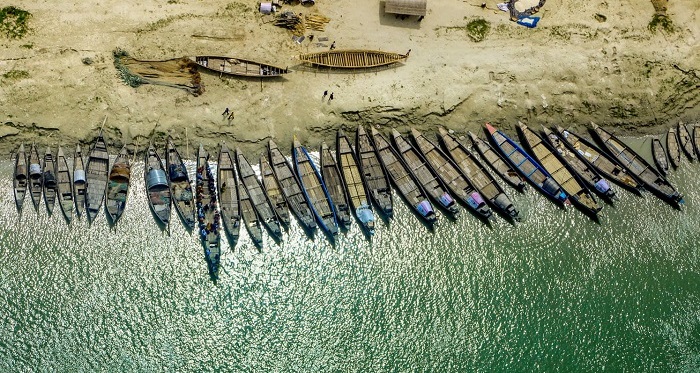
River Systems

The Blood Vessels of Bangladesh

A Story Map by Geospatial Bangladesh

The pride of Bangladesh is its rivers with one of the largest networks in the world with a total number of about 700 rivers including tributaries, which have a total length of about 24,140 km. They consist of tiny hilly streams, winding seasonal creeks, muddy canals (khals), some truly magnificent rivers and their tributaries and distributaries. In some places, such as Patuakhali, Barisal and the Sundarbans area the watercourses are so plentiful that they form a veritable maze. The watercourses of the country are obviously not evenly distributed. They increase in numbers and size from the northwest of the northern region to the southeast of southern region. The rivers of Bangladesh has been categorized into six regions depending on their locations in the country.

North West

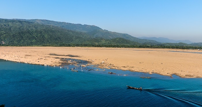
The North West Region consists of 8 districts of Rajshahi Division and 9 districts of Rangpur Division. The region is bounded by the Brahmaputra-Jamuna in the east and the Padma in the south. There are 115 rivers including 19 transboundary rivers in this region (BWDB, 2011). Along with the Brahmaputra-Jamuna and the Padma rivers, Atrai, Dharla, Teesta, Dudhkumar, Karatoya, Mahananda, Bangali Rivers are significant.

North West Rivers

The river rises from Lowland in Mithapukur, Rangpur and is meandering through Mithapukur, Pirganj of Rangpur; Sadullapur, Palashbari of Gaibandha; Ghoraghat of Dinajpur. It empties into Karatoya-Nilphamari River in Ghoraghat, Dinajpur.

The length of the river is 84 km and has lowest: 14 m, highest: 68 m, average: 26 m of width.

This is a seasonal river. The high flow months are July-September - Approx. Flow: 168 cumec. The river bank overflows due to normal flood.. Flood slope of the river is 5 cm/km.

Akhira-Maccha is a non-tidal river.

Tributaries of the river: None. Distributaries: None and Branches: None.

The river rises from Lowland in Bogra Sadar, Bogra and is meandering through Bogra Sadar, Gabtali, Sariakandi of Bogra. It empties into Bangali River in Gabtali, Bogra.

The length of the river is 37 km and has lowest: 30 m, highest: 50 m, average: 45 m of width.

This is a seasonal river. The high flow months are July-September. The river bank overflows due to normal flood.. Flood slope of the river is 0 cm/km.

Ichamati-Bogra is a non-tidal river.

Tributaries of the river: None. Distributaries: Garaiya Khal and Branches: None.

The river rises from India in Panchagarh Sadar, Panchagarh and is meandering through Panchagarh Sadar of Panchagarh. It empties into Kurum River in Panchagarh Sadar, Panchagarh.

The length of the river is 8 km and has lowest: 28 m, highest: 78 m, average: 48 m of width.

This is a seasonal river. The high flow months are July-September. The river bank does not overflow due to normal flood.. Flood slope of the river is 0 cm/km.

Jamuna-Panchagarh is a non-tidal river.

Tributaries of the river: None. Distributaries: None and Branches: None.

The river rises from Maldaha River in Lalmonirhat Sadar, Lalmonirhat and is meandering through Lalmonirhat Sadar of Lalmonirhat; Phulbari of Kurigram. It empties into Dharla River in Phulbari, Kurigram.

The length of the river is 24 km and has lowest: 19 m, highest: 27 m, average: 22 m of width.

This is a seasonal river. The high flow months are July-September. The river bank overflows due to normal flood.. Flood slope of the river is 0 cm/km.

Ratnai-Lalmonirhat is a non-tidal river.

Tributaries of the river: None. Distributaries: None and Branches: None.

The river rises from Lowland in Tetulia, Panchagarh and is straight through Tetulia of Panchagarh. It empties into Mahananda Upper Panchagarh River in Tetulia, Panchagarh.

The length of the river is 3 km and has lowest: 7 m, highest: 11 m, average: 8 m of width.

This is a seasonal river. The high flow months are July-September. The river bank overflows due to normal flood.. Flood slope of the river is 0 cm/km.

Ramchandi is a non-tidal river.

Tributaries of the river: None. Distributaries: None and Branches: None.

The river rises from India-Lowland in Bochaganj, Dinajpur and is meandering through Biral, Bochaganj of Dinajpur; Pirganj of Thakurgaon . It empties into India in Biral, Dinajpur.

The length of the river is 67 km and has lowest: 20 m, highest: 60 m, average: 30 m of width.

This is a seasonal river. The high flow months are July-September. The river bank overflows due to normal flood.. Flood slope of the river is 0 cm/km.

Rakhasini-Tetulia-Tulai is a non-tidal river.

Tributaries of the river: None. Distributaries: None and Branches: None.

The river rises from Lowland-Bamundanga Beel in Sundarganj, Gaibandha and is meandering through Sundarganj, Gaibandha Sadar of Gaibandha. It empties into Ghaghot River in Gaibandha Sadar, Gaibandha.

The length of the river is 38 km and has lowest: 9 m, highest: 40 m, average: 25 m of width.

This is a seasonal river. The high flow months are July-September. The river bank overflows due to normal flood.. Flood slope of the river is 0 cm/km.

Lenga is a non-tidal river.

Tributaries of the river: None. Distributaries: None and Branches: None.

The river rises from Atrai River in Manda, Naogaon and is meandering through Manda, Niamatpur of Naogaon; Tanore, Bagmara, Mohanpur, Paba of Rajshahi. It empties into Barnai River in Paba, Rajshahi.

The length of the river is 71 km and has lowest: 28 m, highest: 45 m, average: 37 m of width.

This is a seasonal river. The high flow months are July-September. The river bank overflows due to normal flood.. Flood slope of the river is 3 cm/km.

Shib is a non-tidal river.

Tributaries of the river: None. Distributaries: None and Branches: None.

The river rises from Teesta River in Hatibandha, Lalmonirhat and is meandering through Hatibandha, Kaliganj, Aditmari, Lalmonirhat Sadar of Lalmonirhat. It empties into Teesta River in Lalmonirhat Sadar, Lalmonirhat.

The length of the river is 35 km and has lowest: 90 m, highest: 230 m, average: 150 m of width.

This is a seasonal river. The high flow months are July-September. The river bank overflows due to normal flood.. Flood slope of the river is 0 cm/km.

Sati-Sarnamati-Bhateshwari is a non-tidal river.

Tributaries of the river: None. Distributaries: None and Branches: None.

The river rises from India in Patgram, Lalmonirhat and is meandering through Patgram, Dimla, Hatibandha of Lalmonirhat. It empties into Teesta River in Patgram, Lalmonirhat.

The length of the river is 44 km and has lowest: 30 m, highest: 130 m, average: 90 m of width.

This is a seasonal river. The high flow months are July-September. The river bank overflows due to normal flood.. Flood slope of the river is 0 cm/km.

Shemlajan is a non-tidal river.

Tributaries of the river: Singimari. Distributaries: None and Branches: None.

The river rises from Atrai River in Manda, Naogaon and is meandering through Manda, Naogaon Sadar, Raninagar, Atrai of Naogaon. It empties into Atrai River in Atrai, Naogaon.

The length of the river is 23 km and has lowest: 25 m, highest: 28 m, average: 27 m of width.

This is a seasonal river. The high flow months are July-September. The river bank overflows due to normal flood.. Flood slope of the river is 0 cm/km.

Shirmakhali Khal is a non-tidal river.

Tributaries of the river: None. Distributaries: None and Branches: None.

The river rises from Bangali River in Sariakandi, Bogra and is meandering through Sariakandi, Dhunat of Bogra; Kazipur, Raiganj, Sirajganj Sadar, Kamarkhanda of Sirajganj. It empties into Bangali River in Raiganj, Sirajganj.

The length of the river is 74 km and has lowest: 35 m, highest: 140 m, average: 66 m of width.

This is a seasonal river. The high flow months are July-September. The river bank overflows due to normal flood.. Flood slope of the river is 4 cm/km.

Ichamati-Bogra-Sirajganj is a non-tidal river.

Tributaries of the river: Monas. Distributaries: None and Branches: None.

The river rises from Lowland in Patgram, Lalmonirhat and is meandering through Patgram of Lalmonirhat. It empties into Shemlajan River in Patgram, Lalmonirhat.

The length of the river is 21 km and has lowest: 15 m, highest: 40 m, average: 25 m of width.

This is a seasonal river. The high flow months are July-September. The river bank overflows due to normal flood.. Flood slope of the river is 0 cm/km.

Singimari is a non-tidal river.

Tributaries of the river: None. Distributaries: None and Branches: None.

The river rises from Lowland in Panchagarh Sadar, Panchagarh and is meandering through Panchagarh Sadar, Boda of Panchagarh. It empties into Ghoramara River in Boda, Panchagarh.

The length of the river is 11 km and has lowest: 16 m, highest: 44 m, average: 32 m of width.

This is a seasonal river. The high flow months are July-September. The river bank overflows due to normal flood.. Flood slope of the river is 0 cm/km.

Sui is a non-tidal river.

Tributaries of the river: None. Distributaries: None and Branches: None.

The river rises from Lowland in Thakurgaon Sadar, Thakurgaon and is meandering through Thakurgaon Sadar of Thakurgaon. It empties into Tangon River in Thakurgaon Sadar, Thakurgaon.

The length of the river is 21 km and has lowest: 12 m, highest: 48 m, average: 23 m of width.

This is a seasonal river. The high flow months are July-September. The river bank overflows due to normal flood.. Flood slope of the river is 0 cm/km.

Sinua is a non-tidal river.

Tributaries of the river: Choto Sinua. Distributaries: None and Branches: None.

The river rises from Lowland in Thakurgaon Sadar, Thakurgaon and is meandering through Thakurgaon Sadar of Thakurgaon. It empties into Tangon River in Thakurgaon Sadar, Thakurgaon.

The length of the river is 21 km and has lowest: 14 m, highest: 47 m, average: 35 m of width.

This is a seasonal river. The high flow months are July-September. The river bank overflows due to normal flood.. Flood slope of the river is 0 cm/km.

Shoz is a non-tidal river.

Tributaries of the river: None. Distributaries: None and Branches: None.

The river rises from Lowland in Ghoraghat, Dinajpur and is meandering through Ghoraghat of Dinajpur; Panchbibi, Joypurhat Sadar, Khetlalpur of Joypurhat. It empties into Tulshi Ganga River in Khetlalpur, Joypurhat.

The length of the river is 42 km and has lowest: 19 m, highest: 34 m, average: 23 m of width.

This is a seasonal river. The high flow months are July-September. The river bank overflows due to normal flood.. Flood slope of the river is 0 cm/km.

Harabati is a non-tidal river.

Tributaries of the river: None. Distributaries: None and Branches: None.

The river rises from Brahmaputra-Jamuna River in Sirajganj Sadar, Sirajganj and is meandering through Sirajganj Sadar, Kamarkhanda, Belkuchi, Shahjadpur of Sirajganj; Santhia, Bera of Pabna. It empties into Brahmaputra-Jamuna River in Bera, Pabna.

The length of the river is 55 km and has lowest: 40 m, highest: 90 m, average: 70 m of width.

This is a seasonal river. The high flow months are July-September. The river bank overflows due to normal flood.. Flood slope of the river is 4 cm/km.

Hura Sagor is a non-tidal river.

Tributaries of the river: Bangali, Gohala, Atrai, Ichamati-Pabna. Distributaries: None and Branches: None.

The river rises from Lowland in Dhupchanchia, Bogra and is meandering through Dhupchanchia, Adamdighi of Bogra; Raninagar, Atrai of Naogaon. It empties into Atrai-Naogaon-Natore River in Atrai, Naogaon.

The length of the river is 58 km and has lowest: 8 m, highest: 51 m, average: 26 m of width.

This is a seasonal river. The high flow months are July-September. The river bank overflows due to normal flood.. Flood slope of the river is 0 cm/km.

Iramati is a non-tidal river.

Tributaries of the river: None. Distributaries: None and Branches: None.

The river rises from India in Tetulia, Panchagarh and is meandering through Tetulia, Panchagarh Sadar, Boda, Debiganj of Panchagarh; Birganj, Khansama, Kaharole, Dinajpur Sadar, Chirirbandar of Dinajpur. It empties into Atrai River in Dinajpur Sadar, Dinajpur.

The length of the river is 187 km and has lowest: 55 m, highest: 293 m, average: 135 m of width.

This is a perennial river. The low flow months are February-April - Approx. flow: 2.36 cumec and flows high in July-September - Approx. flow: 4570 cumec. The river bank overflows due to normal flood.. Flood slope of the river is 0 cm/km.

Korotoya is a non-tidal river.

Tributaries of the river: Chawai, Talma, Satnai, Ghoramara, Teesta-Panchagarh, Pathraj, Belan. Distributaries: Gaveshwari, Dhepa and Branches: Atrai-Dinajpur.

The river rises from Deonai-Charalkata-Jamuneshwari River in Mithapukur, Rangpur and is meandering through Mithapukur, Pirganj of Rangpur; Nawabganj, Ghoraghat of Dinajpur; Palashbari, Gobindaganj of Gaibandha; Shibganj, Bogra Sadar, Shajahanpur, Sherpur of Bogra. It empties into Bangali River in Sherpur, Bogra.

The length of the river is 122 km and has lowest: 75 m, highest: 249 m, average: 144 m of width.

This is a perennial river. The low flow months are February-April and flows high in July-September - Approx. flow: 1630 cumec. The river bank overflows due to normal flood.. Flood slope of the river is 10 cm/km.

Karatoya-Nilphamari is a non-tidal river.

Tributaries of the river: Ghirnai, Nalshisa, Akhira-Maccha, Gangnai. Distributaries: Katakhali-Gaibandha, Nagar Lower-Bogra- Natore, Bhadai-Bogra and Branches: Maila.

The river rises from Lowland-Gangbhanga Beel in Santhia, Pabna and is meandering through Santhia, Bera of Pabna. It empties into Brahmaputra-Jamuna River in Bera, Pabna.

The length of the river is 17 km and has lowest: 30 m, highest: 55 m, average: 40 m of width.

This is a seasonal river. The high flow months are July-September. The river bank overflows due to normal flood.. Flood slope of the river is 0 cm/km.

Kageshwari is a non-tidal river.

Tributaries of the river: None. Distributaries: None and Branches: None.

The river rises from Karatoya-Nilphamari River in Gobindaganj, Gaibandha and is meandering through Gobindaganj, Sughatta of Gaibandha. It empties into Bangali River in Gobindaganj, Gaibandha.

The length of the river is 28 km and has lowest: 90 m, highest: 320 m, average: 175 m of width.

This is a perennial river. The low flow months are February-April - Approx. flow: 0.78 cumec and flows high in July-September - Approx. flow: 1150 cumec. The river bank overflows due to normal flood.. Flood slope of the river is 0 cm/km.

Katakhali-Gaibandha is a non-tidal river.

Tributaries of the river: Alai, Naleya. Distributaries: None and Branches: None.

The river rises from Ghirnai River in Parbatipur, Dinajpur and is meandering through Badarganj of Rangpur; Nawabganj, Parbatipur of Dinajpur. It empties into Ghirnai River in Nawabganj, Dinajpur.

The length of the river is 21 km and has lowest: 25 m, highest: 85 m, average: 50 m of width.

This is a seasonal river. The high flow months are July-September - Approx. Flow: 60 cumec. The river bank does not overflow due to normal flood.. Flood slope of the river is 0 cm/km.

Kala is a non-tidal river.

Tributaries of the river: None. Distributaries: None and Branches: None.

The river rises from Lowland-Telian Beel in Sughatta, Gaibandha and is meandering through Sughatta of Gaibandha. It empties into Bangali River in Sughatta, Gaibandha.

The length of the river is 33 km and has lowest: 40 m, highest: 51 m, average: 44 m of width.

This is a seasonal river. The high flow months are July-September. The river bank does not overflow due to normal flood.. Flood slope of the river is 0 cm/km.

Kalapani is a non-tidal river.

Tributaries of the river: None. Distributaries: None and Branches: None.

The river rises from Bangali River in Raiganj, Sirajganj and is meandering through Raiganj, Ullahpara of Sirajganj. It empties into Gohala River in Ullahpara, Sirajganj.

The length of the river is 24 km and has lowest: 40 m, highest: 50 m, average: 46 m of width.

This is a seasonal river. The high flow months are July-September. The river bank overflows due to normal flood.. Flood slope of the river is 0 cm/km.

Kaludaha is a non-tidal river.

Tributaries of the river: Banni. Distributaries: None and Branches: None.

The river rises from Karatoya River in Dinajpur Sadar, Dinajpur and is meandering through Dinajpur Sadar of Dinajpur; Dhamoirhat, Patnitala, Mohadevpur, Manda, Atrai of Naogaon; Natore Sadar, Singra, Gurudaspur of Natore; Chatmohar, Bhangura, Faridpur, Santhia of Pabna; Shahjadpur of Sirajganj. It empties into Hura Sagor River in Shahjadpur, Sirajganj.

The length of the river is 269 km and has lowest: 127 m, highest: 285 m, average: 177 m of width.

This is a perennial river. The low flow months are February-April - Approx. flow: 3.59 cumec and flows high in July-September - Approx. flow: 3110 cumec. The river bank overflows due to normal flood.. Flood slope of the river is 5 cm/km.

Atrai is a non-tidal river.

Tributaries of the river: Gadai, Chiknai, Choto Jamuna, Barnai, Baral Upper-Baral-Nandakuja. Distributaries: Fakirni, Shib and Branches: Shirmakhali Khal, Atrai-Naogaon-Natore, Baral Lower-Pabna, Besani.

The river rises from Lowland in Dimla, Nilphamari and is meandering through Dimla, Jaldhaka of Nilphamari. It empties into Buri Teesta River in Dimla, Nilphamari.

The length of the river is 25 km and has lowest: 13 m, highest: 51 m, average: 27 m of width.

This is a seasonal river. The high flow months are July-September - Approx. Flow: 60.50 cumec. The river bank does not overflow due to normal flood.. Flood slope of the river is 0 cm/km.

Kumlal-Nautara is a non-tidal river.

Tributaries of the river: None. Distributaries: None and Branches: None.

The river rises from India in Panchagarh Sadar, Panchagarh and is meandering through Panchagarh Sadar, Boda of Panchagarh. It empties into Ghoramara River in Boda, Panchagarh.

The length of the river is 30 km and has lowest: 15 m, highest: 75 m, average: 45 m of width.

This is a seasonal river. The low flow months are January-April - Approx. Flow: 2 cumec and flows high in July-September - Approx. Flow: 70 cumec. The river bank does not overflow due to normal flood.. Flood slope of the river is 0 cm/km.

Kurum is a non-tidal river.

Tributaries of the river: Jamuna-Panchagarh. Distributaries: None and Branches: None.

The river rises from India-Lowland in Baliadangi, Thakurgaon and is meandering through Baliadangi, Thakurgaon Sadar, Ranisankail, Haripur of Thakurgaon. It empties into India in Haripur, Thakurgaon.

The length of the river is 58 km and has lowest: 20 m, highest: 150 m, average: 60 m of width.

This is a perennial river. The low flow months are December-March - Approx. Flow: 1.60 cumec and flows high in July-September - Approx. Flow: 115 cumec. The river bank overflows due to normal flood.. Flood slope of the river is 0 cm/km.

Kulik is a non-tidal river.

Tributaries of the river: None. Distributaries: None and Branches: None.

The river rises from Lowland-Chaora Beel in Nilphamari Sadar, Nilphamari and is meandering through Nilphamari Sadar, Saidpur of Nilphamari; Parbatipur, Phulbari of Dinajpur. It empties into Choto Jamuna River in Phulbari, Dinajpur.

The length of the river is 70 km and has lowest: 14 m, highest: 26 m, average: 18 m of width.

This is a seasonal river. The high flow months are July-September - Approx. Flow: 75 cumec. The river bank overflows due to normal flood.. Flood slope of the river is 0 cm/km.

Khar Kharia-Tilai is a non-tidal river.

Tributaries of the river: None. Distributaries: None and Branches: None.

The river rises from Lowland in Bagha, Sunamganj and is meandering through Bagha of Sunamganj; Lalpur, Baraigram of Natore. It empties into Chiknai River in Baraigram, Natore.

The length of the river is 51 km and has lowest: 21 m, highest: 41 m, average: 30 m of width.

This is a seasonal river. The high flow months are July-September. The river bank does not overflow due to normal flood.. Flood slope of the river is 0 cm/km.

Khalsadingi is a non-tidal river.

Tributaries of the river: None. Distributaries: None and Branches: None.

The river rises from Musakhan River in Natore Sadar, Natore and is meandering through Natore Sadar, Singra of Natore. It empties into Atrai River in Singra, Natore.

The length of the river is 26 km and has lowest: 13 m, highest: 21 m, average: 17 m of width.

This is a seasonal river. The high flow months are July-September. The river bank overflows due to normal flood.. Flood slope of the river is 0 cm/km.

Gadai is a non-tidal river.

Tributaries of the river: None. Distributaries: None and Branches: None.

The river rises from Karatoya River in Dinajpur Sadar, Dinajpur and is meandering through Dinajpur Sadar, Kaharole of Dinajpur. It empties into Atrai-Dinajpur River in Dinajpur Sadar, Dinajpur.

The length of the river is 25 km and has lowest: 15 m, highest: 38 m, average: 27 m of width.

This is a seasonal river. The high flow months are July-September - Approx. Flow: 24 cumec. The river bank overflows due to normal flood.. Flood slope of the river is 0 cm/km.

Gaveshwari is a non-tidal river.

Tributaries of the river: None. Distributaries: None and Branches: None.

The river rises from India in Shibganj, Chapainawabganj and is braided through Shibganj, Nawabganj Sadar of Chapainawabganj; Godagari, Paba, Charghat, Bagha of Rajshahi; Kushtia; Lalpur of Natore; Ishwardi, Pabna Sadar, Sujanagar of Pabna; Pangsha, Rajbari Sadar, Goalandaghat of Rajbari. It empties into Padma River in Goalandaghat, Rajbari.

The length of the river is 230 km and has lowest: 1300 m, highest: 14000 m, average: 5000 m of width.

This is a perennial river. The low flow months are February-April - Approx. flow: 530 cumec and flows high in July-September - Approx. flow: 70868 cumec. The river bank overflows due to normal flood.. Flood slope of the river is 0 cm/km.

Ganges-Padma is a non-tidal river.

Tributaries of the river: Mahananda Lower-Nawabganj. Distributaries: Baral Upper-Baral- Nandakuja, Mathabhanga, Garai, Ichamati-Pabna, Badai, Chandana-Barasia and Branches: None.

The river rises from Lowland in Gobindaganj, Gaibandha and is meandering through Gobindaganj of Gaibandha; Shibganj of Bogra. It empties into Karatoya-Nilphamari River in Shibganj, Bogra.

The length of the river is 31 km and has lowest: 10 m, highest: 40 m, average: 35 m of width.

This is a seasonal river. The high flow months are July-September - Approx. Flow: 15 cumec. The river bank overflows due to normal flood.. Flood slope of the river is 0 cm/km.

Gangnai is a non-tidal river.

Tributaries of the river: None. Distributaries: None and Branches: None.

The river rises from India in Aditmari, Lalmonirhat and is meandering through Aditmari, Lalmonirhat Sadar of Lalmonirhat. It empties into Dharla River in Lalmonirhat Sadar, Lalmonirhat.

The length of the river is 10 km and has lowest: 29 m, highest: 85 m, average: 58 m of width.

This is a seasonal river. The high flow months are July-September. The river bank overflows due to normal flood.. Flood slope of the river is 0 cm/km.

Gidari is a non-tidal river.

Tributaries of the river: None. Distributaries: None and Branches: None.

The river rises from Korotoya River in Dinajpur Sadar, Dinajpur and is meandering through Dinajpur Sadar, Chirirbandar of Dinajpur. It empties into Korotoya River in Dinajpur Sadar, Dinajpur.

The length of the river is 30 km and has lowest: 0 m, highest: 193 m, average: 96 m of width.

This is a seasonal river. The high flow months are July-September. The river bank overflows due to normal flood.. Flood slope of the river is 0 cm/km.

Atrai-Dinajpur is a non-tidal river.

Tributaries of the river: Gaveshwari. Distributaries: None and Branches: None.

The river rises from Lowland-Borodam Beel in Nageshwari, Kurigram and is meandering through Nageshwari, Kurigram Sadar of Kurigram. It empties into Brahmaputra-Jamuna River in Kurigram Sadar, Kurigram.

The length of the river is 56 km and has lowest: 50 m, highest: 80 m, average: 60 m of width.

This is a seasonal river. The high flow months are July-September. The river bank does not overflow due to normal flood.. Flood slope of the river is 0 cm/km.

Girai is a non-tidal river.

Tributaries of the river: None. Distributaries: None and Branches: None.

The river rises from India in Dhamoirhat, Naogaon and is meandering through Dhamoirhat, Patnitala of Naogaon. It empties into Choto Jamuna River in Patnitala, Naogaon.

The length of the river is 36 km and has lowest: 8 m, highest: 18 m, average: 13 m of width.

This is a seasonal river. The high flow months are July-September. The river bank overflows due to normal flood.. Flood slope of the river is 0 cm/km.

Guksi is a non-tidal river.

Tributaries of the river: None. Distributaries: None and Branches: None.

The river rises from Lowland in Tetulia, Panchagarh and is meandering through Tetulia of Panchagarh. It empties into Berong River in Tetulia, Panchagarh.

The length of the river is 8 km and has lowest: 20 m, highest: 90 m, average: 50 m of width.

This is a seasonal river. The high flow months are July-September. The river bank does not overflow due to normal flood.. Flood slope of the river is 0 cm/km.

Gobra is a non-tidal river.

Tributaries of the river: None. Distributaries: None and Branches: None.

The river rises from Banni River in Ullahpara, Sirajganj and is meandering through Faridpur of Pabna; Ullahpara, Shahjadpur of Sirajganj. It empties into Hura Sagor River in Shahjadpur, Sirajganj.

The length of the river is 28 km and has lowest: 44 m, highest: 181 m, average: 93 m of width.

This is a seasonal river. The high flow months are July-September. The river bank does not overflow due to normal flood.. Flood slope of the river is 0 cm/km.

Gohala is a non-tidal river.

Tributaries of the river: Kaludaha. Distributaries: None and Branches: None.

The river rises from Ichamati-Bogra River in Gabtali, Bogra and is meandering through Gabtali, Bogra Sadar, Dhunat of Bogra. It empties into Bangali River in Dhunat, Bogra.

The length of the river is 29 km and has lowest: 30 m, highest: 60 m, average: 50 m of width.

This is a perennial river. The low flow months are February-April and flows high in July-September. The river bank does not overflow due to normal flood.. Flood slope of the river is 0 cm/km.

Garaiya Khal is a non-tidal river.

Tributaries of the river: None. Distributaries: None and Branches: None.

The river rises from Teesta River in Jaldhaka, Nilphamari and is meandering through Jaldhaka of Nilphamari; Gangachhara, Rangpur Sadar, Mithapukur, Pirgachha of Rangpur; Sadullapur, Gaibandha Sadar, Phulchhari of Gaibandha. It empties into Brahmaputra-Jamuna River in Phulchhari, Gaibandha.

The length of the river is 192 km and has lowest: 20 m, highest: 100 m, average: 65 m of width.

This is a seasonal river. The low flow months are February-April - Approx. Flow: 0.99 cumec and flows high in July-September - Approx. Flow: 241 cumec. The river bank overflows due to normal flood.. Flood slope of the river is 8 cm/km.

Ghaghat is a non-tidal river.

Tributaries of the river: Alai Kumari-Burail, Lenga. Distributaries: Alai and Branches: None.

The river rises from Lowland in Saidpur, Nilphamari and is meandering through Saidpur of Nilphamari; Badarganj, Mithapukur of Rangpur; Parbatipur, Nawabganj of Dinajpur. It empties into Karatoya-Nilphamari River in Nawabganj, Dinajpur.

The length of the river is 76 km and has lowest: 5 m, highest: 50 m, average: 30 m of width.

This is a seasonal river. The high flow months are July-September. The river bank overflows due to normal flood.. Flood slope of the river is 20 cm/km.

Ghirnai is a non-tidal river.

Tributaries of the river: None. Distributaries: None and Branches: Kala.

The river rises from India in Panchagarh Sadar, Panchagarh and is meandering through Panchagarh Sadar, Boda of Panchagarh. It empties into Karatoya River in Boda, Panchagarh.

The length of the river is 23 km and has lowest: 32 m, highest: 122 m, average: 65 m of width.

This is a seasonal river. The high flow months are July-September. The river bank does not overflow due to normal flood.. Flood slope of the river is 0 cm/km.

Ghoramara is a non-tidal river.

Tributaries of the river: Kurum, Sui. Distributaries: None and Branches: None.

The river rises from India in Panchagarh Sadar, Panchagarh and is meandering through Panchagarh Sadar of Panchagarh. It empties into Karatoya River in Panchagarh Sadar, Panchagarh.

The length of the river is 27 km and has lowest: 50 m, highest: 110 m, average: 70 m of width.

This is a perennial river. The low flow months are February-April and flows high in July-September. The river bank does not overflow due to normal flood.. Flood slope of the river is 0 cm/km.

Chawai is a non-tidal river.

Tributaries of the river: Borka. Distributaries: None and Branches: None.

The river rises from Khalsadingi River in Baraigram, Natore and is meandering through Baraigram of Natore; Chatmohar, Atgharia, Santhia, Faridpur of Pabna. It empties into Atrai River in Faridpur, Pabna.

The length of the river is 57 km and has lowest: 30 m, highest: 94 m, average: 51 m of width.

This is a seasonal river. The high flow months are July-September. The river bank does not overflow due to normal flood.. Flood slope of the river is 0 cm/km.

Chiknai is a non-tidal river.

Tributaries of the river: None. Distributaries: None and Branches: None.

The river rises from Atrai River in Atrai, Naogaon and is meandering through Atrai of Naogaon, Singra of Natore. It empties into Atrai River in Singra, Natore.

The length of the river is 35 km and has lowest: 50 m, highest: 138 m, average: 92 m of width.

This is a seasonal river. The high flow months are July-September - Approx. Flow: 673 cumec. The river bank overflows due to normal flood.. Flood slope of the river is 0 cm/km.

Atrai-Naogaon-Natore is a non-tidal river.

Tributaries of the river: Iramati, Nagar Lower-Bogra-Natore. Distributaries: None and Branches: None.

The river rises from Burikhora River in Nilphamari Sadar, Nilphamari and is meandering through Nilphamari Sadar, Saidpur, of Nilphamari; Taraganj, Badarganj of Rangpur. It empties into Deonai-Charalkata-Jamuneshwari River in Badarganj, Rangpur.

The length of the river is 43 km and has lowest: 40 m, highest: 170 m, average: 120 m of width.

This is a seasonal river. The high flow months are July-September. The river bank overflows due to normal flood.. Flood slope of the river is 27 cm/km.

Chikli is a non-tidal river.

Tributaries of the river: None. Distributaries: None and Branches: None.

The river rises from Lowland in Birampur, Dinajpur and is meandering through Birampur of Dinajpur; Joypurhat Sadar of Joypurhat; Dhamoirhat of Naogaon. It empties into Choto Jamuna River in Dhamoirhat, Naogaon.

The length of the river is 38 km and has lowest: 30 m, highest: 70 m, average: 50 m of width.

This is a seasonal river. The high flow months are July-September. The river bank overflows due to normal flood.. Flood slope of the river is 0 cm/km.

Ciri is a non-tidal river.

Tributaries of the river: None. Distributaries: None and Branches: None.

The river rises from Choto Jamuna River in Joypurhat Sadar, Joypurhat and is meandering through Joypurhat Sadar, Akkelpur of Joypurhat. It empties into Tulshi Ganga River in Akkelpur, Joypurhat.

The length of the river is 22 km and has lowest: 13 m, highest: 41 m, average: 25 m of width.

This is a seasonal river. The high flow months are July-September. The river bank overflows due to normal flood.. Flood slope of the river is 0 cm/km.

Chhiri is a non-tidal river.

Tributaries of the river: None. Distributaries: None and Branches: None.

The river rises from Lowland in Domar, Nilphamari and is meandering through Domar of Nilphamari. It empties into Deonai-Charalkata-Jamuneshwari River in Domar, Nilphamari.

The length of the river is 12 km and has lowest: 12 m, highest: 26 m, average: 19 m of width.

This is a seasonal river. The high flow months are July-September. The river bank overflows due to normal flood.. Flood slope of the river is 0 cm/km.

Chungabhanga is a non-tidal river.

Tributaries of the river: None. Distributaries: None and Branches: None.

The river rises from Lowland-Magura Beel in Debiganj, Panchagarh and is meandering through Debiganj of Panchagarh. It empties into Karatoya River in Debiganj, Panchagarh.

The length of the river is 12 km and has lowest: 15 m, highest: 50 m, average: 25 m of width.

This is a seasonal river. The high flow months are July-September. The river bank does not overflow due to normal flood.. Flood slope of the river is 0 cm/km.

Satnai is a non-tidal river.

Tributaries of the river: None. Distributaries: None and Branches: None.

The river rises from Lowland in Thakurgaon Sadar, Thakurgaon and is meandering through Thakurgaon Sadar of Thakurgaon; Birganj of Dinajpur. It empties into Dhepa River in Birganj, Dinajpur.

The length of the river is 48 km and has lowest: 30 m, highest: 65 m, average: 50 m of width.

This is a seasonal river. The high flow months are July-September. The river bank does not overflow due to normal flood.. Flood slope of the river is 0 cm/km.

Choto Dhepa is a non-tidal river.

Tributaries of the river: Patharghata, Bhulli. Distributaries: None and Branches: None.

The river rises from Ichamati-Dinajpur River in Parbatipur, Dinajpur and is meandering through Chirirbandar, Parbatipur, Phulbari, Birampur, Hakimpur Of Dinajpur; Joypurhat Sadar, Panchbibi Of Joypurhat; Dhamoirhat, Badalgachhi, Patnitala, Naogaon Sadar, Raninagar, Atrai of Naogaon. It empties into Atrai River in Atrai, Naogaon.

The length of the river is 195 km and has lowest: 30 m, highest: 130 m, average: 85 m of width.

This is a seasonal river. The high flow months are July-September. The river bank does not overflow due to normal flood.. Flood slope of the river is 15 cm/km.

Choto Jamuna is a non-tidal river.

Tributaries of the river: Khar Kharia-Tilai, Ciri, Guksi, Tulshi Ganga. Distributaries: Chhiri and Branches: None.

The river rises from Lowland in Thakurgaon Sadar, Thakurgaon and is meandering through Thakurgaon Sadar of Thakurgaon. It empties into Sinua River in Thakurgaon Sadar, Thakurgaon.

The length of the river is 9 km and has lowest: 8 m, highest: 10 m, average: 9 m of width.

This is a seasonal river. The high flow months are July-September. The river bank does not overflow due to normal flood.. Flood slope of the river is 0 cm/km.

Choto Sinua is a non-tidal river.

Tributaries of the river: None. Distributaries: None and Branches: None.

The river rises from India-Lowland in Panchagarh Sadar, Panchagarh and is meandering through Panchagarh Sadar, Atwari, Boda of Panchagarh; Thakurgaon Sadar, Pirganj of Thakurgaon; Bochaganj of Dinajpur. It empties into India in Pirganj, Thakurgaon.

The length of the river is 123 km and has lowest: 72 m, highest: 232 m, average: 120 m of width.

This is a seasonal river. The high flow months are July-September. The river bank overflows due to normal flood.. Flood slope of the river is 58 cm/km.

Tangon is a non-tidal river.

Tributaries of the river: Shoz, Sinua. Distributaries: None and Branches: None.

The river rises from India in Tetulia, Panchagarh and is meandering through Tetulia of Panchagarh. It empties into India in Tetulia, Panchagarh.

The length of the river is 14 km and has lowest: 20 m, highest: 139 m, average: 80 m of width.

This is a perennial river. The low flow months are February-April - Approx. Flow: 0.08 cumec and flows high in July-September - Approx. Flow: 48.6 cumec. The river bank does not overflow due to normal flood.. Flood slope of the river is 0 cm/km.

Dahuk is a non-tidal river.

Tributaries of the river: None. Distributaries: None and Branches: None.

The river rises from Ichamati-Pabna River in Santhia, Pabna and is meandering through Bera, Santhia, Sujanagar of Pabna. It empties into Badai River in Bera, Pabna.

The length of the river is 47 km and has lowest: 28 m, highest: 58 m, average: 41 m of width.

This is a seasonal river. The high flow months are July-September. The river bank does not overflow due to normal flood.. Flood slope of the river is 0 cm/km.

Atrai-Pabna is a non-tidal river.

Tributaries of the river: None. Distributaries: None and Branches: None.

The river rises from Karatoya River in Birganj, Dinajpur and is meandering through Birganj, Kaharole, Biral, Dinajpur Sadar of Dinajpur. It empties into Punarbhaba River in Biral, Dinajpur.

The length of the river is 5 km and has lowest: 100 m, highest: 240 m, average: 175 m of width.

This is a seasonal river. The high flow months are July-September. The river bank overflows due to normal flood.. Flood slope of the river is 24 cm/km.

Dhepa is a non-tidal river.

Tributaries of the river: Choto Dhepa. Distributaries: None and Branches: None.

The river rises from India in Panchagarh Sadar, Panchagarh and is meandering through Panchagarh Sadar of Panchagarh. It empties into Karatoya River in Panchagarh Sadar, Panchagarh.

The length of the river is 28 km and has lowest: 30 m, highest: 70 m, average: 60 m of width.

This is a perennial river. The low flow months are February-April and flows high in July-September. The river bank does not overflow due to normal flood.. Flood slope of the river is 34 cm/km.

Talma is a non-tidal river.

Tributaries of the river: None. Distributaries: None and Branches: None.

The river rises from India in Dimla, Nilphamari and is braided through Hatibandha, Kaliganj, Lalmonirhat Sadar, Aditmari of Lalmonirhat; Dimla, Jaldhaka of Nilphamari; Gangachhara, Kaunia, Pirgachha of Rangpur; Ulipur, Rajarhat of Kurigram; Sundarganj of Gaibandha. It empties into Brahmaputra-Jamuna River in Sundarganj, Gaibandha.

The length of the river is 113 km and has lowest: 700 m, highest: 5500 m, average: 3000 m of width.

This is a perennial river. The low flow months are February-April - Approx. Flow: 8 cumec and flows high in July-September - Approx. Flow: 4494 cumec. The river bank does not overflow due to normal flood.. Flood slope of the river is 0 cm/km.

Teesta is a non-tidal river.

Tributaries of the river: Burail, Buri Teesta, Shemlajan. Distributaries: Ghaghat and Branches: Sati-Sarnamati- Bhateshwari.

The river rises from India in Debiganj, Panchagarh and is meandering through Debiganj, Boda of Panchagarh; Domar of Nilphamari. It empties into Karatoya River in Debiganj, Panchagarh.

The length of the river is 24 km and has lowest: 15 m, highest: 65 m, average: 47 m of width.

This is a perennial river. The low flow months are February-April and flows high in July-September. The river bank does not overflow due to normal flood.. Flood slope of the river is 0 cm/km.

Teesta-Panchagarh is a non-tidal river.

Tributaries of the river: None. Distributaries: None and Branches: None.

The river rises from Lowland in Atwari, Panchagarh and is meandering through Atwari of Panchagarh; Thakurgaon Sadar, Baliadangi, Ranisankail of Thakurgaon. It empties into Nagar Upper River in Ranisankail, Thakurgaon.

The length of the river is 44 km and has lowest: 15 m, highest: 45 m, average: 35 m of width.

This is a perennial river. The low flow months are February-April and flows high in July-September. The river bank does not overflow due to normal flood.. Flood slope of the river is 0 cm/km.

Tirnai-Thakurgaon is a non-tidal river.

Tributaries of the river: None. Distributaries: None and Branches: None.

The river rises from Lowland in Tentulia, Panchagarh and is meandering through Tentulia of Panchagarh. It empties into Mahananda Upper River in Tentulia, Panchagarh.

The length of the river is 4 km and has lowest: 15 m, highest: 20 m, average: 15 m of width.

This is a perennial river. The low flow months are January-April and flows high in July-September. The river bank overflows due to normal flood.. Flood slope of the river is 0 cm/km.

Tirnai-Panchagarh is a non-tidal river.

Tributaries of the river: None. Distributaries: None and Branches: None.

The river rises from Lowland in Nawabganj, Dinajpur and is meandering through Nawabganj, Hakimpur of Dinajpur; Joypurhat Sadar, Akkelpur, Khetlal of Joypurhat; Adamdighi of Bogra; Badalgachhi, Naogaon Sadar of Naogaon. It empties into Choto Jamuna River in Naogaon Sadar, Naogaon.

The length of the river is 100 km and has lowest: 50 m, highest: 110 m, average: 70 m of width.

This is a seasonal river. The high flow months are July-September. The river bank overflows due to normal flood.. Flood slope of the river is 0 cm/km.

Tulshi Ganga is a non-tidal river.

Tributaries of the river: Chhiri, Harabati. Distributaries: None and Branches: None.

The river rises from India in Bhurungamari of Kurigram and is meandering through Bhurungamari, Nageshwari of Kurigram. It empties into Brahmaputra-Jamuna River in Nageshwari of Kurigram.

The length of the river is 65 km and has lowest: 290 m, highest: 640 m, average: 460 m of width.

This is a perennial river. The low flow months are February-March - Approx. flow: 52 cumec and flows high in July-September - Approx. flow: 1800 cumec. The river bank overflows due to normal flood.. Flood slope of the river is 1 cm/km.

Dudhkumar is a non-tidal river.

Tributaries of the river: Phulkumar. Distributaries: None and Branches: None.

The river rises from India-Lowland in Domar, Nilphamari and is meandering through Domar, Jaldhaka, Nilphamari Sadar, Kishoreganj of Nilphamari; Taraganj, Badarganj, Mithapukur of Rangpur. It empties into Karatoya-Nilphamari River in Nawabganj, Dinajpur.

The length of the river is 116 km and has lowest: 40 m, highest: 75 m, average: 50 m of width.

This is a perennial river. The low flow months are February-April and flows high in July-September - Approx. Flow: 1850 cumec. The river bank overflows due to normal flood.. Flood slope of the river is 20 cm/km.

Deonai-Charalkata-Jamuneshwari is a non-tidal river.

Tributaries of the river: Chungabhanga, Dhaijan, Bullai, Chikli, Palimari. Distributaries: None and Branches: None.

The river rises from India in Lalmonirhat Sadar of Lalmonirhat and is braided through Lalmonirhat Sadar, Patgram, Aditmari, of Lalmonirhat; Phulbari, Kurigram Sadar, Ulipur of Kurigram. It empties into Brahmaputra-Jamuna River in Ulipur of Kurigram.

The length of the river is 55 km and has lowest: 500 m, highest: 3500 m, average: 1200 m of width.

This is a perennial river. The low flow months are February-April - Approx. flow: 11.25 cumec and flows high in July-September - Approx. flow: 6405 cumec. The river bank overflows due to normal flood.. Flood slope of the river is 13 cm/km.

Dharla is a non-tidal river.

Tributaries of the river: Maldaha, Gidari, Ratnai-Lalmonirhat. Distributaries: None and Branches: None.

The river rises from Ghaghat River in Gaibandha Sadar, Gaibandha and is meandering through Gaibandha Sadar, Palashbari, Sughatta, Gobindaganj of Gaibandha. It empties into Katakhali-Gaibandha River in Gobindaganj, Gaibandha.

The length of the river is 44 km and has lowest: 30 m, highest: 50 m, average: 39 m of width.

This is a seasonal river. The high flow months are July-September. The river bank overflows due to normal flood.. Flood slope of the river is 1 cm/km.

Alai is a non-tidal river.

Tributaries of the river: None. Distributaries: None and Branches: None.

The river rises from Lowland-Daribhija Beel in Jaldhaka, Nilphamari and is meandering through Jaldhaka, Kishoreganj of Nilphamari. It empties into Deonai-Charalkata- Jamuneshwari River in Kishoreganj, Nilphamari.

The length of the river is 26 km and has lowest: 15 m, highest: 60 m, average: 50 m of width.

This is a perennial river. The low flow months are February-April and flows high in July-September. The river bank overflows due to normal flood.. Flood slope of the river is 0 cm/km.

Dhaijan is a non-tidal river.

Tributaries of the river: None. Distributaries: None and Branches: None.

The river rises from Lowland in Dimla, Nilphamari and is meandering through Dimla, Jaldhaka of Nilphamari. It empties into Buri Teesta River in Jaldhaka, Nilphamari.

The length of the river is 19 km and has lowest: 10 m, highest: 80 m, average: 50 m of width.

This is a seasonal river. The high flow months are July-September. The river bank does not overflow due to normal flood.. Flood slope of the river is 0 cm/km.

Dhum is a non-tidal river.

Tributaries of the river: None. Distributaries: None and Branches: None.

The river rises from Lowland in Birganj, Dinajpur and is meandering through Birganj of Dinajpur. It empties into Punarbhaba River in Birganj, Dinajpur.

The length of the river is 7 km and has lowest: 11 m, highest: 19 m, average: 15 m of width.

This is a seasonal river. The high flow months are July-September. The river bank overflows due to normal flood.. Flood slope of the river is 0 cm/km.

Narth is a non-tidal river.

Tributaries of the river: None. Distributaries: None and Branches: None.

The river rises from Lowland in Parbatipur, Dinajpur and is meandering through Parbatipur, Nawabganj of Dinajpur; Pirganj of Rangpur. It empties into Karatoya-Nilphamari River in Pirganj, Rangpur.

The length of the river is 36 km and has lowest: 15 m, highest: 50 m, average: 40 m of width.

This is a seasonal river. The high flow months are July-September. The river bank does not overflow due to normal flood.. Flood slope of the river is 0 cm/km.

Nalshisa is a non-tidal river.

Tributaries of the river: None. Distributaries: None and Branches: None.

The river rises from Lowland-Boro Pailar Beel in Pirganj, Rangpur and is meandering through Pirganj of Rangpur; Gobindaganj, Palashbari, Sadullapur of Gaibandha. It empties into Katakhali-Gaibandha River in Gobindaganj, Gaibandha.

The length of the river is 66 km and has lowest: 10 m, highest: 50 m, average: 35 m of width.

This is a seasonal river. The high flow months are July-September. The river bank overflows due to normal flood.. Flood slope of the river is 0 cm/km.

Naleya is a non-tidal river.

Tributaries of the river: None. Distributaries: None and Branches: None.

The river rises from India in Atwari, Panchagarh and is meandering through Atwari of Panchagarh; Baliadangi, Ranisankail, Haripur of Thakurgaon. It empties into India in Haripur, Thakurgaon.

The length of the river is 130 km and has lowest: 15 m, highest: 190 m, average: 110 m of width.

This is a perennial river. The low flow months are February-April and flows high in July-September. The river bank overflows due to normal flood.. Flood slope of the river is 0 cm/km.

Nagar Upper is a non-tidal river.

Tributaries of the river: Tirnai-Thakurgaon, Petki. Distributaries: None and Branches: None.

The river rises from Karatoya-Nilphamari River in Shibganj, Bogra and is meandering through Shibganj, Dhupchanchia, Bogra Sadar, Adamdighi, Kahaloo, Nandigram of Bogra; Atrai, Raninagar of Naogaon; Singra of Natore. It empties into Atrai-Naogaon-Natore River in Singra, Natore.

The length of the river is 112 km and has lowest: 30 m, highest: 180 m, average: 90 m of width.

This is a seasonal river. The high flow months are July-September. The river bank overflows due to normal flood.. Flood slope of the river is 0 cm/km.

Nagar Lower-Bogra-Natore is a non-tidal river.

Tributaries of the river: None. Distributaries: None and Branches: None.

The river rises from Musakhan River in Natore Sadar, Natore and is meandering through Natore Sadar, Singra, Gurudaspur of Natore. It empties into Baral Upper-Baral-Nandakuja River in Gurudaspur, Natore.

The length of the river is 16 km and has lowest: 10 m, highest: 40 m, average: 24 m of width.

This is a seasonal river. The high flow months are July-September. The river bank does not overflow due to normal flood.. Flood slope of the river is 0 cm/km.

Narode is a non-tidal river.

Tributaries of the river: None. Distributaries: None and Branches: None.

The river rises from Lowland in Badarganj, Rangpur and is meandering through Badarganj of Rangpur. It empties into Deonai-Charalkata-Jamuneshwari River in Badarganj, Rangpur.

The length of the river is 17 km and has lowest: 25 m, highest: 80 m, average: 41 m of width.

This is a seasonal river. The high flow months are July-September. The river bank does not overflow due to normal flood.. Flood slope of the river is 0 cm/km.

Palimari is a non-tidal river.

Tributaries of the river: None. Distributaries: None and Branches: None.

The river rises from India in Shibganj, Chapainawabganj and is meandering through Shibganj, Chapainawabganj Sadar of Chapainawabganj. It empties into Mahananda Lower-Nawabganj River in Chapainawabganj Sadar, Chapainawabganj.

The length of the river is 43 km and has lowest: 110 m, highest: 190 m, average: 170 m of width.

This is a seasonal river. The high flow months are July-September. The river bank overflows due to normal flood.. Flood slope of the river is 0 cm/km.

Pagla is a non-tidal river.

Tributaries of the river: None. Distributaries: None and Branches: None.

The river rises from Lowland in Pirgachha, Rangpur and is meandering through Kaunia, Pirgachha, Mithapukur of Rangpur. It empties into Ghaghat River in Mithapukur, Rangpur.

The length of the river is 26 km and has lowest: 30 m, highest: 60 m, average: 45 m of width.

This is a seasonal river. The high flow months are July-September - Approx. Flow: 54.10 cumec. The river bank overflows due to normal flood.. Flood slope of the river is 0 cm/km.

Alai Kumari-Burail is a non-tidal river.

Tributaries of the river: None. Distributaries: None and Branches: None.

The river rises from Lowland in Birganj, Dinajpur and is meandering through Birganj of Dinajpur. It empties into Choto Dhepa River in Birganj, Dinajpur.

The length of the river is 14 km and has lowest: 5 m, highest: 20 m, average: 15 m of width.

This is a seasonal river. The high flow months are July-September. The river bank overflows due to normal flood.. Flood slope of the river is 0 cm/km.

Patharghata is a non-tidal river.

Tributaries of the river: None. Distributaries: None and Branches: None.

The river rises from Lowland-Maidan Dighi Beel in Boda, Panchagarh and is meandering through Boda, Atwari, Debiganj of Panchagarh; Thakurgaon Sadar of Thakurgaon. It empties into Karatoya River in Debiganj, Panchagarh.

The length of the river is 45 km and has lowest: 30 m, highest: 85 m, average: 70 m of width.

This is a perennial river. The low flow months are February-April and flows high in July-September. The river bank does not overflow due to normal flood.. Flood slope of the river is 0 cm/km.

Pathraj is a non-tidal river.

Tributaries of the river: None. Distributaries: None and Branches: None.

The river rises from India-Lowland in Birganj, Dinajpur and is meandering through Birganj, Kaharole, Biral, Dinajpur Sadar of Dinajpur; Sapahar, Porsha of Naogaon; Gomastapur of Chapainawabganj. It empties into Mahananda Lower-Nawabganj River in Gomastapur, Chapainawabganj.

The length of the river is 223 km and has lowest: 30 m, highest: 240 m, average: 102 m of width.

This is a seasonal river. The high flow months are July-September. The river bank overflows due to normal flood.. Flood slope of the river is 8 cm/km.

Punarbhaba is a non-tidal river.

Tributaries of the river: Dhepa, Narth. Distributaries: None and Branches: None.

The river rises from Lowland in Atwari, Panchagarh and is meandering through Atwari of Panchagarh. It empties into Nagar Upper River in Atwari, Panchagarh.

The length of the river is 6 km and has lowest: 10 m, highest: 13 m, average: 11 m of width.

This is a seasonal river. The high flow months are July-September. The river bank overflows due to normal flood.. Flood slope of the river is 0 cm/km.

Petki is a non-tidal river.

Tributaries of the river: None. Distributaries: None and Branches: None.

The river rises from Atrai River in Manda, Naogaon and is meandering through Manda, Atrai of Naogaon; Bagmara of Rajshahi. It empties into Barnai River in Bagmara, Rajshahi.

The length of the river is 31 km and has lowest: 37 m, highest: 79 m, average: 51 m of width.

This is a perennial river. The low flow months are February-April - Approx. Flow: 0.75 cumec and flows high in July-September - Approx. Flow: 208 cumec. The river bank overflows due to normal flood.. Flood slope of the river is 8 cm/km.

Fakirni is a non-tidal river.

Tributaries of the river: Shib. Distributaries: None and Branches: None.

The river rises from India in Bhurungamari, Kurigram and is meandering through Bhurungamari, Nageshwari of Kurigram. It empties into Dudhkumar River in Nageshwari, Kurigram.

The length of the river is 38 km and has lowest: 20 m, highest: 70 m, average: 55 m of width.

This is a seasonal river. The high flow months are July-September. The river bank does not overflow due to normal flood.. Flood slope of the river is 0 cm/km.

Phulkumar is a non-tidal river.

Tributaries of the river: None. Distributaries: None and Branches: None.

The river rises from Himalaya in Birganj, Dinajpur and is braided through Belkuchi, Chauhali of Sirajganj; Bera of Pabna; Bhuapur of Tangail; Char Rajibpur, Chilmari of Kurigram; Daulatpur of Manikganj; Dewanganj of Jamalpur; Dhunat of Bogra; Phulchhari, Gaibandha Sadar of Gaibandha. It empties into Padma River in Goalanda Ghat, Rajbari.

The length of the river is 230 km and has lowest: 9000 m, highest: 16000 m, average: 12000 m of width.

This is a perennial river. The low flow months are February-April - Approx. flow: 3430 cumec and flows high in July-September - Approx. flow: 102535 cumec. The river bank overflows due to normal flood.. Flood slope of the river is 0 cm/km.

Brahmaputra-Jamuna is a non-tidal river.

Tributaries of the river: Ghaghat, Teesta, Dudhkumar, Dharla, Badai, Kageshwari, Girai. Distributaries: Monas and Branches: Hura Sagor.

The river rises from Padma-Ganges River in Char Ghat, Rajshahi and is meandering through Bagha, Char Ghat of Rajshahi; Bagatipara, Gurudaspur, Baraigram, Lalpur, Natore Sadar, Singra of Natore. It empties into Atrai River in Gurudaspur, Natore.

The length of the river is 89 km and has lowest: 27 m, highest: 80 m, average: 63 m of width.

This is a seasonal river. The high flow months are July-September. The river bank overflows due to normal flood.. Flood slope of the river is 7 cm/km.

Baral Upper-Baral-Nandakuja is a non-tidal river.

Tributaries of the river: Narode. Distributaries: Musakhan and Branches: None.

The river rises from Atrai River in Bhangura, Pabna and is meandering through Bhangura, Faridpur of Pabna. It empties into Atrai River in Faridpur, Pabna.

The length of the river is 23 km and has lowest: 50 m, highest: 80 m, average: 65 m of width.

This is a seasonal river. The high flow months are July-September. The river bank overflows due to normal flood.. Flood slope of the river is 0 cm/km.

Baral Lower-Pabna is a non-tidal river.

Tributaries of the river: None. Distributaries: None and Branches: None.

The river rises from Katakhali-Gaibandha River in Gobindaganj of Gaibandha and is meandering through Gobindaganj, Sughatta of Gaibandha; Dhunat, Gabtali, Sariakandi, Shajahanpur Sherpur, Sonatola of Bogra, Kamarkhanda, Raiganj, Shahjadpur of Sirajganj. It empties into Hura Sagor River in Shahjadpur of Sirajganj.

The length of the river is 183 km and has lowest: 80 m, highest: 246 m, average: 143 m of width.

This is a perennial river. The low flow months are February-April and flows high in July-September. The river bank overflows due to normal flood.. Flood slope of the river is 4 cm/km.

Bangali is a non-tidal river.

Tributaries of the river: Kalapani, Ichamati-Bogra, Karatoya-Nilphamari, Katakhali-Gaibandha, Garaiya Khal. Distributaries: Banni, Kaludaha and Branches: Ichamati-Bogra- Sirajganj.

The river rises from Lowland in Khansama, Dinajpur and is meandering through Khansama, Chirirbandar of Dinajpur . It empties into Choto Jamuna River in Chirirbandar, Dinajpur.

The length of the river is 27 km and has lowest: 62 m, highest: 174 m, average: 112 m of width.

This is a seasonal river. The high flow months are July-September - Approx. Flow: 75 cumec. The river bank overflows due to normal flood.. Flood slope of the river is 0 cm/km.

Ichamati-Dinajpur is a non-tidal river.

Tributaries of the river: None. Distributaries: None and Branches: None.

The river rises from Padma-Ganges-River in Sujanagar, Pabna and is meandering through Pabna Sadar, Sujanagar, Bera of Pabna. It empties into Brahmaputra-Jamuna River in Bera, Pabna.

The length of the river is 48 km and has lowest: 15 m, highest: 123 m, average: 47 m of width.

This is a seasonal river. The high flow months are July-September. The river bank overflows due to normal flood.. Flood slope of the river is 0 cm/km.

Badai is a non-tidal river.

Tributaries of the river: Atrai-Pabna. Distributaries: None and Branches: None.

The river rises from Shib River in Paba, Rajshahi and is meandering through Bagmara, Durgapur, Mohanpur, Paba, Puthia of Rajshahi; Natore Sadar, Singra of Natore. It empties into Atrai River in Singra, Natore.

The length of the river is 93 km and has lowest: 27 m, highest: 91 m, average: 51 m of width.

This is a seasonal river. The high flow months are July-September. The river bank overflows due to normal flood.. Flood slope of the river is 0 cm/km.

Barnai is a non-tidal river.

Tributaries of the river: Fakirni. Distributaries: None and Branches: None.

The river rises from Bangali River in Raiganj, Sirajganj and is meandering through Raiganj, Ullapara of Sirajganj. It empties into Kaludaha River in Ullapara, Sirajganj.

The length of the river is 26 km and has lowest: 27 m, highest: 52 m, average: 40 m of width.

This is a seasonal river. The high flow months are July-September. The river bank overflows due to normal flood.. Flood slope of the river is 0 cm/km.

Banni is a non-tidal river.

Tributaries of the river: None. Distributaries: Gohala and Branches: None.

The river rises from Lowland in Kaunia, Rangpur and is meandering through Kaunia, Pirgachha of Rangpur. It empties into Teesta River in Pirgachha, Rangpur.

The length of the river is 54 km and has lowest: 17 m, highest: 58 m, average: 36 m of width.

This is a seasonal river. The high flow months are July-September. The river bank does not overflow due to normal flood.. Flood slope of the river is 0 cm/km.

Burail is a non-tidal river.

Tributaries of the river: None. Distributaries: None and Branches: None.

The river rises from Lowland-Baflur Beel in Jaldhaka, Nilphamari and is meandering through Jaldhaka, Kishoreganj of Nilphamari; Gangachhara, Taraganj, Rangpur Sadar, Badarganj of Rangpur. It empties into Deonai-Charalkata-Jamuneshwari River in Badarganj, Rangpur.

The length of the river is 39 km and has lowest: 15 m, highest: 27 m, average: 21 m of width.

This is a seasonal river. The high flow months are July-September. The river bank overflows due to normal flood.. Flood slope of the river is 30 cm/km.

Bullai is a non-tidal river.

Tributaries of the river: None. Distributaries: None and Branches: None.

The river rises from Lowland-Sonarai Beel in Domar, Nilphamari and is meandering through Domar, Nilphamari Sadar of Nilphamari. It empties into Chikli River in Nilphamari Sadar, Nilphamari.

The length of the river is 32 km and has lowest: 30 m, highest: 50 m, average: 40 m of width.

This is a seasonal river. The high flow months are July-September. The river bank overflows due to normal flood.. Flood slope of the river is 0 cm/km.

Burikhora is a non-tidal river.

Tributaries of the river: None. Distributaries: None and Branches: None.

The river rises from India in Dimla, Nilphamari and is meandering through Dimla, Domar, Jaldhaka of Nilphamari; Hatibandha of Lalmonirhat. It empties into Teesta River in Hatibandha, Lalmonirhat.

The length of the river is 76 km and has lowest: 20 m, highest: 108 m, average: 69 m of width.

This is a seasonal river. The high flow months are July-September. The river bank does not overflow due to normal flood.. Flood slope of the river is 0 cm/km.

Buri Teesta is a non-tidal river.

Tributaries of the river: Dhum, Kumlal-Nautara. Distributaries: None and Branches: None.

The river rises from Lowland in Tetulia, Panchagarh and is meandering through Tetulia of Panchagarh. It empties into Dahuk in Tetulia, Panchagarh.

The length of the river is 9 km and has lowest: 30 m, highest: 70 m, average: 50 m of width.

This is a seasonal river. The high flow months are July-September. The river bank overflows due to normal flood.. Flood slope of the river is 0 cm/km.

Berong is a non-tidal river.

Tributaries of the river: Gobra. Distributaries: None and Branches: None.

The river rises from Lowland in Khanshama, Dinajpur and is meandering through Khanshama, Dinajpur Sadar, Chirirbandar of Dinajpur. It empties into Karatoya River in Chirirbandar, Dinajpur.

The length of the river is 20 km and has lowest: 12 m, highest: 53 m, average: 35 m of width.

This is a seasonal river. The high flow months are July-September. The river bank overflows due to normal flood.. Flood slope of the river is 0 cm/km.

Belan is a non-tidal river.

Tributaries of the river: None. Distributaries: None and Branches: None.

The river rises from Atrai River in Gurudaspur, Natore and is meandering through Gurudaspur of Natore; Tarash of Sirajganj. It empties into Atrai River in Tarash, Sirajganj.

The length of the river is 12 km and has lowest: 24 m, highest: 45 m, average: 37 m of width.

This is a perennial river. The low flow months are February-April and flows high in July-September. The river bank overflows due to normal flood.. Flood slope of the river is 0 cm/km.

Besani is a non-tidal river.

Tributaries of the river: Bhadai-Bogra. Distributaries: None and Branches: None.

The river rises from Ganges-Padma River in Pabna Sadar, Pabna and is meandering through Pabna Sadar, Atgharia, Santhia, Bera of Pabna. It empties into Hura Sagor River in Bera, Pabna.

The length of the river is 44 km and has lowest: 30 m, highest: 140 m, average: 120 m of width.

This is a seasonal river. The high flow months are July-September - Approx. Flow: 40 cumec. The river bank overflows due to normal flood.. Flood slope of the river is 0 cm/km.

Ichamati-Pabna is a non-tidal river.

Tributaries of the river: None. Distributaries: Atrai-Pabna and Branches: None.

The river rises from Lowland in Tetulia, Panchagarh and is meandering through Tetulia, Panchagarh Sadar of Panchagarh. It empties into Chawai River in Panchagarh Sadar, Panchagarh.

The length of the river is 6 km and has lowest: 20 m, highest: 40 m, average: 30 m of width.

This is a seasonal river. The high flow months are July-September. The river bank does not overflow due to normal flood.. Flood slope of the river is 0 cm/km.

Borka is a non-tidal river.

Tributaries of the river: None. Distributaries: None and Branches: None.

The river rises from Karatoya-Nilphamari River in Bogra Sadar, Bogra and is meandering through Bogra Sadar, Sherpur, Nandigram of Bogra; Singra of Natore; Tarash of Sirajganj. It empties into Besani River in Tarash, Sirajganj.

The length of the river is 77 km and has lowest: 15 m, highest: 36 m, average: 24 m of width.

This is a seasonal river. The high flow months are July-September. The river bank overflows due to normal flood.. Flood slope of the river is 0 cm/km.

Bhadai-Bogra is a non-tidal river.

Tributaries of the river: None. Distributaries: None and Branches: None.

The river rises from Lowland in Thakurgaon Sadar, Thakurgaon and is meandering through Thakurgaon Sadar of Thakurgaon; Debiganj of Panchagarh; Birganj of Dinajpur. It empties into Choto Dhepa River in Birganj, Dinajpur.

The length of the river is 38 km and has lowest: 15 m, highest: 40 m, average: 30 m of width.

This is a seasonal river. The high flow months are July-September. The river bank overflows due to normal flood.. Flood slope of the river is 0 cm/km.

Bhulli is a non-tidal river.

Tributaries of the river: None. Distributaries: None and Branches: None.

The river rises from Lowland in Tetulia, Panchagarh and is meandering through Tetulia of Panchagarh. It empties into Dahuk River in Tetulia, Panchagarh.

The length of the river is 11 km and has lowest: 10 m, highest: 30 m, average: 15 m of width.

This is a perennial river. The low flow months are February-April and flows high in July-September. The river bank overflows due to normal flood.. Flood slope of the river is 0 cm/km.

Versha is a non-tidal river.

Tributaries of the river: None. Distributaries: None and Branches: None.

The river rises from India in Tetulia, Panchagarh and is meandering through Tetulia of Panchagarh. It empties into India in Tetulia, Panchagarh.

The length of the river is 28 km and has lowest: 170 m, highest: 440 m, average: 200 m of width.

This is a seasonal river. The high flow months are July-September. The river bank overflows due to normal flood.. Flood slope of the river is 0 cm/km.

Mahananda Upper-Panchagarh is a non-tidal river.

Tributaries of the river: Tirnai -Panchagarh, Ramchandi. Distributaries: None and Branches: None.

The river rises from India in Bholahat, Chapainawabganj and is meandering through Bholahat, Gomastapur, Nachole, Shibganj, Chapainawabganj Sadar of Chapainawabganj; Godagari of Rajshahi. It empties into Ganges-Padma River in Godagari, Rajshahi.

The length of the river is 95 km and has lowest: 110 m, highest: 530 m, average: 460 m of width.

This is a perennial river. The low flow months are February-April - Approx. flow: 8.35 cumec and flows high in July-September - Approx. flow: 3660 cumec. The river bank overflows due to normal flood.. Flood slope of the river is 0 cm/km.

Mahananda Lower-Nawabganj is a non-tidal river.

Tributaries of the river: Punarbhaba, Pagla. Distributaries: None and Branches: None.

The river rises from Karatoya-Nilphamari River in Pirganj, Rangpur and is meandering through Pirganj of Rangpur; Nawabganj, Ghoraghat of Dinajpur. It empties into Karatoya-Nilphamari River in Ghoraghat, Dinajpur.

The length of the river is 35 km and has lowest: 30 m, highest: 65 m, average: 50 m of width.

This is a seasonal river. The high flow months are July-September. The river bank overflows due to normal flood.. Flood slope of the river is 0 cm/km.

Maila is a non-tidal river.

Tributaries of the river: None. Distributaries: None and Branches: None.

The river rises from India in Kaliganj, Lalmonirhat and is meandering through Kaliganj, Aditmari, Lalmonirhat Sadar of Lalmonirhat. It empties into Dharla River in Lalmonirhat Sadar, Lalmonirhat.

The length of the river is 36 km and has lowest: 7 m, highest: 26 m, average: 18 m of width.

This is a seasonal river. The high flow months are July-September. The river bank overflows due to normal flood.. Flood slope of the river is 0 cm/km.

Maldaha is a non-tidal river.

Tributaries of the river: None. Distributaries: Ratnai-Lalmonirhat and Branches: None.

The river rises from Baral Upper-Baral-Nandakuja River in Bagatipara, Natore and is meandering through Bagatipara, Natore Sadar of Natore; Puthia, Charghat of Rajshahi. It empties into Gadai River in Natore Sadar, Natore.

The length of the river is 33 km and has lowest: 14 m, highest: 31 m, average: 22 m of width.

This is a seasonal river. The high flow months are July-September. The river bank overflows due to normal flood.. Flood slope of the river is 0 cm/km.

Musakhan is a non-tidal river.

Tributaries of the river: None. Distributaries: Narode and Branches: None.

The river rises from Brahmaputra-Jamuna River in Dhunat, Bogra and is meandering through Dhunat of Bogra; Kazipur of Sirajganj. It empties into Ichamati-Bogra-Sirajganj River in Dhunat, Bogra.

The length of the river is 17 km and has lowest: 30 m, highest: 60 m, average: 50 m of width.

This is a seasonal river. The high flow months are July-September. The river bank overflows due to normal flood.. Flood slope of the river is 0 cm/km.

Monas is a non-tidal river.

Tributaries of the river: None. Distributaries: None and Branches: None.

North Central

The North Central Region is bounded by the Brahmaputra-Jamuna in the west, the Padma in the south, the Old Brahmaputra in the north-east and the Meghna Upper River in the south-east. The region consists of 8 districts including the Capital Dhaka. The region has 61 rivers including 1 transboundary river. Among these rivers, the rivers Padma, Old Brahmaputra, Sitalakhya, Dhaleswari, Buriganga, Kaliganga, Bangshi, Turag and Balu are important rivers.

North Central Rivers

The river rises from Old Brahmaputra River in Fulbaria, Mymensingh and is meandering through Jamalpur Sadar of Jamalpur; Fulbaria, Muktagachha, Trishal, Mymensingh Sadar of Mymensingh. It empties into Khiro-Trishal River in Fulbaria, Mymensingh.

The length of the river is 61 km and has lowest: 10 m, highest: 91 m,average: 52 m of width.

This is a seasonal river. The high flow months are July-September. The river bank does not overflow due to normal flood.. Flood slope of the river is 6 cm/km.

Aiman-Akhila is a non-tidal river.

Tributaries of the river: None. Distributaries: Aiman-Mobari and Branches: None.

The river rises from Banar Upper River in Gaffargaon, Mymensingh and is meandering through Fulbaria, Gaffargaon, Trishal of Mymensingh. It empties into Sutia River in Gaffargaon, Mymensingh.

The length of the river is 45 km and has lowest: 36 m, highest: 84 m, average: 54 m of width.

This is a seasonal river. The high flow months are July-September. The river bank overflows due to normal flood.. Flood slope of the river is 5 cm/km.

Khiro-Trishal is a non-tidal river.

Tributaries of the river: Mahari, Aiman- Akhila. Distributaries: None and Branches: None.

The river rises from Lowland in Sreepur, Gazipur and is meandering through Bhaluka, Gaffargaon of Mymensingh; Kapasia, Sreepur of Gazipur. It empties into Banar Lower River in Sreepur, Gazipur.

The length of the river is 46 km and has lowest: 42 m, highest: 66 m, average: 53 m of width.

This is a perennial river. The low flow months are February-April and flows high in July-September. The river bank does not overflow due to normal flood.. Flood slope of the river is 0 cm/km.

Khiro-Bhaluka is a non-tidal river.

Tributaries of the river: Baksatra, Bajja- Medhua. Distributaries: None and Branches: None.

The river rises from Old Dhaleswari River in Manikganj Sadar, Manikganj and is meandering through Ghior, Shivalaya, Manikganj Sadar of Manikganj. It empties into Kaliganga-Manikganj River in Manikganj Sadar, Manikganj.

The length of the river is 28 km and has lowest: 24 m, highest: 59 m, average: 45 m of width.

This is a seasonal river. The high flow months are July-September. The river bank does not overflow due to normal flood.. Flood slope of the river is 0 cm/km.

Gangdubi is a non-tidal river.

Tributaries of the river: None. Distributaries: None and Branches: None.

The river rises from Dhaleswari River in Singair, Manikganj and is meandering through Saturia, Singair, Manikganj Sadar of Manikganj; Dhamrai, Savar of Dhaka. It empties into Dhaleswari River in Singair, Manikganj.

The length of the river is 48 km and has lowest: 36 m, highest: 81 m, average: 52 m of width.

This is a seasonal river. The high flow months are July-September. The river bank overflows due to normal flood.. Flood slope of the river is 5 cm/km.

Gazikhali is a non-tidal river.

Tributaries of the river: None. Distributaries: None and Branches: None.

The river rises from Lowland in Kaliakair, Gazipur and is meandering through Mirzapur, Sakhipur of Tangail; Kaliakair of Gazipur. It empties into Turag River in Kaliakair, Gazipur.

The length of the river is 24 km and has lowest: 24 m, highest: 47 m, average: 34 m of width.

This is a seasonal river. The high flow months are June-September. The river bank overflows due to normal flood.. Flood slope of the river is 0 cm/km.

Goallar Khal is a non-tidal river.

Tributaries of the river: None. Distributaries: None and Branches: None.

The river rises from Brahmaputra-Jamuna River in Madarganj, Jamalpur and is meandering through Islampur, Melandaha, Madarganj of Jamalpur. It empties into Jhinai River in Madarganj, Jamalpur.

The length of the river is 34 km and has lowest: 37 m, highest: 133 m,average: 82 m of width.

This is a seasonal river. The high flow months are July-September. The river bank overflows due to normal flood.. Flood slope of the river is 1 cm/km.

Chatal is a non-tidal river.

Tributaries of the river: None. Distributaries: None and Branches: None.

The river rises from Jhinai River in Kalihati, Tangail and is meandering through Kalihati of Tangail. It empties into Hai River in Kalihati, Tangail.

The length of the river is 11 km and has lowest: 22 m, highest: 42 m, average: 32 m of width.

This is a seasonal river. The high flow months are July-September. The river bank overflows due to normal flood.. Flood slope of the river is 0 cm/km.

Chapai is a non-tidal river.

Tributaries of the river: None. Distributaries: None and Branches: None.

The river rises from Lowland in Gazipur Sadar, Gazipur and is meandering through Sreepur, Gazipur Sadar of Gazipur. It empties into Balu River in Gazipur Sadar, Gazipur.

The length of the river is 23 km and has lowest: 16 m, highest: 29 m, average: 23 m of width.

This is a seasonal river. The high flow months are July-September. The river bank overflows due to normal flood.. Flood slope of the river is 0 cm/km.

Chilai is a non-tidal river.

Tributaries of the river: None. Distributaries: None and Branches: None.

The river rises from Padma River in Nawabganj, Dhaka and is meandering through Dohar, Nawabganj of Dhaka. It empties into Ichamati-Manikganj River in Nawabganj, Dhaka.

The length of the river is 14 km and has lowest: 31 m, highest: 56 m, average: 38 m of width.

This is a seasonal river. The high flow months are July-September. The river bank overflows due to normal flood.. Flood slope of the river is 0 cm/km.

Joypara Khal is a non-tidal river.

Tributaries of the river: None. Distributaries: None and Branches: None.

The river rises from Jhinai River in Sarishabari, Jamalpur and is meandering through Sarishabari of Jamalpur. It empties into Brahmaputra-Jamuna River in Sarishabari, Jamalpur.

The length of the river is 20 km and has lowest: 72 m, highest: 235 m, average: 132 m of width.

This is a perennial river. The low flow months are February-April and flows high in July-September. The river bank overflows due to normal flood.. Flood slope of the river is 2 cm/km.

Jharkata is a non-tidal river.

Tributaries of the river: None. Distributaries: None and Branches: None.

The river rises from Aiman-Akhila River in Muktagachha, Mymensingh and is meandering through Jamalpur Sadar of Jamalpur; Muktagachha of Mymensingh. It empties into Banar Upper River in Muktagachha, Mymensingh.

The length of the river is 23 km and has lowest: 22 m, highest: 112 m, average: 59 m of width.

This is a seasonal river. The high flow months are July-September. The river bank overflows due to normal flood.. Flood slope of the river is 0 cm/km.

Aiman-Mobari is a non-tidal river.

Tributaries of the river: None. Distributaries: None and Branches: None.

The river rises from India in Dewanganj, Jamalpur and is meandering through Char Rajibpur, Raomari of Kurigram; Phulchhari of Gaibandha; Dewanganj of Jamalpur. It empties into Old Brahmaputra River in Dewanganj, Jamalpur.

The length of the river is 55 km and has lowest: 87 m, highest: 143 m, average: 107 m of width.

This is a perennial river. The low flow months are February-April and flows high in July-September. The river bank overflows due to normal flood.. Flood slope of the river is 0 cm/km.

Jinjiram is a non-tidal river.

Tributaries of the river: None. Distributaries: Mora Jinjiram and Branches: None.

The river rises from Old Brahmaputra River in Kalihati, Tangail and is meandering through Islampur, Jamalpur Sadar, Melandaha of Jamalpur; Bhuyapur, Ghatail, Kalihati, Dhanbari of Tangail. It empties into Bangshi River in Kalihati, Tangail.

The length of the river is 133 km and has lowest: 35 m, highest: 107 m, average: 76 m of width.

This is a seasonal river. The high flow months are July-September. The river bank overflows due to normal flood.. Flood slope of the river is 7 cm/km.

Jhinai is a non-tidal river.

Tributaries of the river: Chatal. Distributaries: Jharkata, Chapai and Branches: Bairan.

The river rises from Turag River in Savar, Dhaka and is meandering through Savar of Dhaka; Dakshinkhan, Turag, Uttar Khan, Uttara Thana of Dhaka City, Gazipur Sadar of Gazipur. It empties into Balu River in Uttar Khan Thana of Dhaka City.

The length of the river is 15 km and has lowest: 31 m, highest: 70 m, average: 55 m of width.

This is a seasonal river. The high flow months are July-September. The river bank overflows due to normal flood.. Flood slope of the river is 0 cm/km.

Tungi Khal is a tidal river. Height of normal tide of the river is 0 meter.

Tributaries of the river: None. Distributaries: None and Branches: None.

The river rises from Lowland in Sakhipur, Tangail and is meandering through Sakhipur of Tangail. It empties into Bangshi River in Sakhipur, Tangail.

The length of the river is 7 km and has lowest: 32 m, highest: 64 m, average: 43 m of width.

This is a seasonal river. The high flow months are July-September. The river bank overflows due to normal flood.. Flood slope of the river is 0 cm/km.

Tanki Khal is a non-tidal river.

Tributaries of the river: None. Distributaries: None and Branches: None.

The river rises from Padma River in Narayanganj Sadar, Narayanganj and is meandering through Lohajang, Tongibari of Munshiganj; Narayanganj Sadar of Narayanganj. It empties into Ichamati-Serajdikhan River in Narayanganj Sadar, Narayanganj.

The length of the river is 13 km and has lowest: 75 m, highest: 111 m, average: 90 m of width.

This is a perennial river. The low flow months are February-April and flows high in July-September. The river bank overflows due to normal flood.. Flood slope of the river is 0 cm/km.

Taltala Khal is a non-tidal river.

Tributaries of the river: None. Distributaries: None and Branches: None.

The river rises from Bangshi River in Kaliakair, Gazipur and is meandering through Kaliakair, Gazipur Sadar of Gazipur; Savar of Dhaka; Turag Thana of Dhaka City. It empties into Buriganga River in Savar, Dhaka.

The length of the river is 62 km and has lowest: 48 m, highest: 111 m, average: 82 m of width.

This is a perennial river. The low flow months are February-April and flows high in July-September. The river bank overflows due to normal flood.. Flood slope of the river is 2 cm/km.

Turag is a non-tidal river.

Tributaries of the river: Bangshi-Savar, Salda, Labundha, Goallar Khal. Distributaries: Tungi Khal, Buriganga and Branches: None.

The river rises from Ichamati-Manikganj River in Serajdikhan, Munshiganj and is meandering through Serajdikhan of Munshiganj; Nawabganj of Dhaka. It empties into Ichamati-Manikganj River in Serajdikhan, Munshiganj.

The length of the river is 5 km and has lowest: 26 m, highest: 82 m, average: 46 m of width.

This is a seasonal river. The high flow months are July-September. The river bank overflows due to normal flood.. Flood slope of the river is 0 cm/km.

Tulashikhali Khal is a tidal river. Height of normal tide of the river is 0 meter.

Tributaries of the river: None. Distributaries: None and Branches: None.

The river rises from Brahmaputra-Jamuna River in Kalihati, Tangail and is meandering through Kalihati, Tangail Sadar, Delduar of Tangail; Saturia, Singair, Manikganj Sadar of Manikganj; Dhamrai, Keraniganj of Dhaka; Bandar, Narayanganj Sadar of Narayanganj; Munshiganj Sadar, Gazaria of Munshiganj. It empties into Meghna-Upper River in Gazaria, Munshiganj.

The length of the river is 292 km and has lowest: 50 m, highest: 248 m, average: 144 m of width.

This is a perennial river. The low flow months are February-April and flows high in July-September. The river bank overflows due to normal flood.. Flood slope of the river is 4 cm/km.

Dhaleswari is a tidal river. Height of normal tide of the river is 1 meter.

Tributaries of the river: Bangshi, Buriganga, Sitalakhya, Ichamati -Serajdikhan. Distributaries: Pungli, Alongjani, Louhajang, Bangshi-Savar and Branches: Kaliganga-Manikganj, Gazikhali.

The river rises from Sitalakhya River in Gazipur Sadar, Gazipur and is meandering through Palash of Narsingdi; Gazipur Sadar, Kaliganj of Gazipur. It empties into Balu River in Gazipur Sadar, Gazipur.

The length of the river is 21 km and has lowest: 25 m, highest: 52 m, average: 36 m of width.

This is a seasonal river. The high flow months are July-September. The river bank does not overflow due to normal flood.. Flood slope of the river is 0 cm/km.

Nagda Khal is a non-tidal river.

Tributaries of the river: None. Distributaries: None and Branches: None.

The river rises from Lowland in Kalihati, Tangail and is meandering through Ghatail, Kalihati of Tangail. It empties into Hai River in Kalihati, Tangail.

The length of the river is 38 km and has lowest: 41 m, highest: 69 m, average: 51 m of width.

This is a seasonal river. The high flow months are July-September. The river bank overflows due to normal flood.. Flood slope of the river is 0 cm/km.

Nangla is a non-tidal river.

Tributaries of the river: None. Distributaries: None and Branches: None.

The river rises from Old Brahmaputra River in Narsingdi Sadar, Narsingdi and is meandering through Katiadi, Kuliar Char of Kishoreganj; Monohardi, Raipura, Shibpur, Narsingdi Sadar of Narsingdi. It empties into Meghna-Upper River in Narsingdi Sadar, Narsingdi.

The length of the river is 19 km and has lowest: 21 m, highest: 140 m, average: 79 m of width.

This is a perennial river. The low flow months are February-April and flows high in July-September. The river bank does not overflow due to normal flood.. Flood slope of the river is 0 cm/km.

Arial Khan-Narsingdi is a tidal river. Height of normal tide of the river is 0 meter.

Tributaries of the river: None. Distributaries: None and Branches: None.

The river rises from Lowland in Kaliganj, Gazipur and is meandering through Kapasia, Kaliganj of Gazipur. It empties into Nagda Khal in Kaliganj, Gazipur.

The length of the river is 5 km and has lowest: 32 m, highest: 82 m, average: 51 m of width.

This is a seasonal river. The high flow months are July-September. The river bank does not overflow due to normal flood.. Flood slope of the river is 0 cm/km.

Naljuri Khal is a non-tidal river.

Tributaries of the river: None. Distributaries: None and Branches: None.

The river rises from Bangshi River in Mirzapur, Tangail and is meandering through Sakhipur, Basail, Mirzapur of Tangail. It empties into Bangshi River in Mirzapur, Tangail.

The length of the river is 37 km and has lowest: 35 m, highest: 139 m, average: 74 m of width.

This is a seasonal river. The high flow months are July-September. The river bank overflows due to normal flood.. Flood slope of the river is 6 cm/km.

Nangli is a non-tidal river.

Tributaries of the river: Pungli, Hai. Distributaries: None and Branches: None.

The river rises from Ganga River in Goalandaghat, Rajbari and is braided through Goalandaghat of Rajbari; Harirampur of Manikganj; Charbhadrasan, Faridpur Sadar, Sadarpur of Faridpur; Dohar of Dhaka; Lohajang, Tongibari of Munshiganj; Bhederganj, Naria, Zajira of Shariatpur; Chandpur Sadar of Chandpur; Shibchar of Madaripur. It empties into Meghna-Upper River in Chandpur Sadar, Chandpur.

The length of the river is 121 km and has lowest: 3000 m, highest: 20000 m, average: 10000 m of width.

This is a perennial river. The low flow months are February-April - Approx. Flow: 3040 cumec and flows high in July-September - Approx. Flow: 141934.8. The river bank overflows due to normal flood.. Flood slope of the river is 0 cm/km.

Padma is a non-tidal river.

Tributaries of the river: Ichamati-Manikganj, Katakhali. Distributaries: Taltala Khal, Joypara Khal, Ilishmari and Branches: None.

The river rises from Sutia River in Gaffargaon, Mymensingh and is meandering through Mymensingh Sadar, Trishal, Gaffargaon of Mymensingh. It empties into Sutia River in Gaffargaon, Mymensingh.

The length of the river is 95 km and has lowest: 25 m, highest: 61 m, average: 41 m of width.

This is a seasonal river. The high flow months are July-September. The river bank overflows due to normal flood.. Flood slope of the river is 0 cm/km.

Pagaria-Shila is a non-tidal river.

Tributaries of the river: None. Distributaries: None and Branches: None.

The river rises from Lowland in Sreepur, Gazipur and is meandering through Sreepur of Gazipur. It empties into Balu River in Sreepur, Gazipur.

The length of the river is 23 km and has lowest: 41 m, highest: 72 m, average: 52 m of width.

This is a seasonal river. The high flow months are July-September. The river bank does not overflow due to normal flood.. Flood slope of the river is 0 cm/km.

Paruli Khal is a non-tidal river.

Tributaries of the river: None. Distributaries: None and Branches: None.

The river rises from Lowland in Narsingdi Sadar, Narsingdi and is meandering through Belabo, Shibpur, Raipura, Narsingdi Sadar of Narsingdi. It empties into Arial Khan-Narsingdi River in Narsingdi Sadar, Narsingdi.

The length of the river is 28 km and has lowest: 27 m, highest: 129 m, average: 57 m of width.

This is a perennial river. The low flow months are February-April and flows high in July-September. The river bank does not overflow due to normal flood.. Flood slope of the river is 0 cm/km.

Paharia is a tidal river. Height of normal tide of the river is 0 meter.

Tributaries of the river: None. Distributaries: None and Branches: None.

The river rises from Brahmaputra-Jamuna River in Ghior, Manikganj and is meandering through Chauhali of Sirajganj; Nagarpur of Tangail; Daulatpur, Ghior of Manikganj. It empties into Kaliganga-Manikganj River in Ghior, Manikganj.

The length of the river is 63 km and has lowest: 33 m, highest: 122 m, average: 76 m of width.

This is a seasonal river. The high flow months are July-September. The river bank overflows due to normal flood.. Flood slope of the river is 0 cm/km.

Old Dhaleswari is a non-tidal river.

Tributaries of the river: None. Distributaries: Gangdubi and Branches: None.

The river rises from Brahmaputra-Jamuna River in Phulchhari, Gaibandha and is meandering through Phulchhari of Gaibandha; Jamalpur; Sherpur Sadar of Sherpur; Mymensingh Sadar, Ishwarganj, Gaffargaon, Nandail of Mymensingh; Hossainpur, Pakundia, Katiadi, Bhairab of Kishoreganj; Belabo of Narsingdi. It empties into Meghna-Upper River in Bhairab, Kishoreganj.

The length of the river is 283 km and has average: 200 m of width.

This is a seasonal river. The high flow months are July-September. The river bank does not overflow due to normal flood.. Flood slope of the river is 6 cm/km.

Old Brahmaputra is a tidal river. Height of normal tide of the river is 1 meter.

Tributaries of the river: Jinjiram, Mora Jinjiram. Distributaries: Jhinai, Sitalakhya, Sutia, Banar Lower, Arial Khan-Narsingdi, Banar Upper, Aiman-Akhila and Branches: None.

The river rises from Dhaleswari River in Basail, Tangail and is meandering through Basail, Tangail Sadar, Kalihati of Tangail. It empties into Nangli River in Basail, Tangail.

The length of the river is 39 km and has lowest: 112 m, highest: 153 m, average: 130 m of width.

This is a seasonal river. The high flow months are July-September. The river bank overflows due to normal flood.. Flood slope of the river is 10 cm/km.

Pungli is a non-tidal river.

Tributaries of the river: None. Distributaries: None and Branches: None.

The river rises from Banar Upper River in Dhamrai, Dhaka and is meandering through Jamalpur Sadar of Jamalpur; Dhanbari, Madhupur, Ghatail, Basail, Mirzapur of Tangail; Dhamrai of Dhaka. It empties into Dhaleswari River in Dhamrai, Dhaka.

The length of the river is 239 km and has lowest: 35 m, highest: 80 m, average: 49 m of width.

This is a seasonal river. The high flow months are July-September. The river bank overflows due to normal flood.. Flood slope of the river is 5 cm/km.

Bangshi is a non-tidal river.

Tributaries of the river: Jhinai, Louhajang, Tanki Khal, Hai. Distributaries: Turag, Boshkhalir Khal and Branches: Nangli.

The river rises from Brahmaputra-Jamuna River in Lohajang, Munshiganj and is meandering through Daulatpur, Ghior, Harirampur, Manikganj Sadar, Shivalaya of Manikganj; Keraniganj, Nawabganj of Dhaka; Lohajang, Serajdikhan, Sreenagar of Munshiganj. It empties into Padma River in Lohajang, Munshiganj.

The length of the river is 129 km and has lowest: 25 m, highest: 117 m, average: 72 m of width.

This is a perennial river. The low flow months are February-April and flows high in July-September. The river bank overflows due to normal flood.. Flood slope of the river is 3 cm/km.

Ichamati-Manikganj is a non-tidal river.

Tributaries of the river: Joypara Khal, Ilishmari. Distributaries: Ichamati-Serajdikhan and Branches: None.

The river rises from Dhaleswari River in Savar, Dhaka and is meandering through Savar of Dhaka. It empties into Turag River in Savar, Dhaka.

The length of the river is 13 km and has lowest: 38 m, highest: 124 m, average: 73 m of width.

This is a perennial river. The low flow months are February-April and flows high in July-September. The river bank does not overflow due to normal flood.. Flood slope of the river is 1 cm/km.

Bangshi-Savar is a non-tidal river.

Tributaries of the river: None. Distributaries: None and Branches: None.

The river rises from Haridoya River in Palash, Narsingdi and is meandering through Palash, Narsingdi Sadar of Narsingdi; Araihazar, Bandar, Sonargaon of Narayanganj; Gazaria of Munshiganj. It empties into Meghna-Upper River in Gazaria, Munshiganj.

The length of the river is 65 km and has lowest: 30 m, highest: 100 m, average: 60 m of width.

This is a seasonal river. The high flow months are July-September. The river bank does not overflow due to normal flood.. Flood slope of the river is 0 cm/km.

Brahmaputra-Narsingdi-Munshiganj is a tidal river. Height of normal tide of the river is 0 meter.

Tributaries of the river: Sonakhali Khal, Menikhali. Distributaries: None and Branches: None.

The river rises from Lowland in Bhaluka, Mymensingh and is meandering through Fulbaria, Trishal, Bhaluka of Mymensingh. It empties into Khiro-Bhaluka River in Bhaluka, Mymensingh.

The length of the river is 21 km and has lowest: 30 m, highest: 70 m, average: 47 m of width.

This is a seasonal river. The high flow months are July-September. The river bank does not overflow due to normal flood.. Flood slope of the river is 0 cm/km.

Baksatra is a non-tidal river.

Tributaries of the river: None. Distributaries: None and Branches: None.

The river rises from Banar Upper River in Bhaluka, Mymensingh and is meandering through Muktagachha, Fulbaria, Trishal, Bhaluka of Mymensingh. It empties into Khiro-Bhaluka River in Bhaluka, Mymensingh.

The length of the river is 48 km and has lowest: 31 m, highest: 70 m, average: 47 m of width.

This is a seasonal river. The high flow months are July-September. The river bank overflows due to normal flood.. Flood slope of the river is 0 cm/km.

Bajja-Medhua is a non-tidal river.

Tributaries of the river: None. Distributaries: None and Branches: None.

The river rises from Old Brahmaputra River in Trishal, Mymensingh and is meandering through Jamalpur Sadar of Jamalpur; Muktagachha, Fulbaria, Trishal of Mymensingh. It empties into Khiro-Trishal River in Trishal, Mymensingh.

The length of the river is 96 km and has lowest: 21 m, highest: 66 m, average: 43 m of width.

This is a seasonal river. The high flow months are July-September. The river bank does not overflow due to normal flood.. Flood slope of the river is 2 cm/km.

Banar Upper is a non-tidal river.

Tributaries of the river: Aiman-Mobari. Distributaries: Bangshi, Khiro-Trishal, Bajja-Medhua and Branches: None.

The river rises from Old Brahmaputra River in Gaffargaon, Mymensingh and is meandering through Gaffargaon of Mymensingh; Kapasia, Sreepur of Gazipur. It empties into Sitalakhya River in Kapasia, Gazipur.

The length of the river is 45 km and has lowest: 90 m, highest: 290 m, average: 181 m of width.

This is a perennial river. The low flow months are February-April and flows high in July-September. The river bank does not overflow due to normal flood.. Flood slope of the river is 3 cm/km.

Banar lower is a tidal river. Height of normal tide of the river is 1 meter.

Tributaries of the river: Sutia, Khiro-Bhaluka. Distributaries: None and Branches: None.

The river rises from Suti River in Rupganj, Narayanganj and is meandering through Sreepur, Gazipur Sadar, Kaliganj of Gazipur; Khilkhet, Uttar Khan, Badda, Khilgaon, Demra Thana of Dhaka City; Rupganj of Narayanganj. It empties into Sitalakhya River in Rupganj, Narayanganj.

The length of the river is 44 km and has lowest: 34 m, highest: 164 m, average: 79 m of width.

This is a perennial river. The low flow months are February-April and flows high in July-September. The river bank overflows due to normal flood.. Flood slope of the river is 3 cm/km.

Balu is a tidal river. Height of normal tide of the river is 0 meter.

Tributaries of the river: Tungi Khal, Nagda Khal, Chilai. Distributaries: None and Branches: None.

The river rises from Turag River in Savar, Dhaka and is meandering through Savar, Keraniganj of Dhaka; Kamringir Char, Shyampur Thana of Dhaka City, Narayanganj Sadar of Narayanganj. It empties into Dhaleswari River in Keraniganj, Dhaka.

The length of the river is 29 km and has lowest: 89 m, highest: 538 m, average: 302 m of width.

This is a perennial river. The low flow months are February-April and flows high in July-September. The river bank overflows due to normal flood.. Flood slope of the river is 1 cm/km.

Buriganga is a tidal river. Height of normal tide of the river is 1 meter.

Tributaries of the river: None. Distributaries: None and Branches: None.

The river rises from Jhinai River in Gopalpur, Tangail and is meandering through Dhanbari, Madhupur, Gopalpur of Tangail. It empties into Jhinai River in Gopalpur, Tangail.

The length of the river is 36 km and has lowest: 30 m, highest: 83 m, average: 47 m of width.

This is a seasonal river. The high flow months are July-September. The river bank overflows due to normal flood.. Flood slope of the river is 6 cm/km.

Bairan is a non-tidal river.

Tributaries of the river: None. Distributaries: None and Branches: None.

The river rises from Bangshi River in Mirzapur, Tangail and is meandering through Mirzapur of Tangail; Dhamrai of Dhaka. It empties into Louhajang River in Mirzapur, Tangail.

The length of the river is 12 km and has lowest: 16 m, highest: 39 m, average: 26 m of width.

This is a seasonal river. The high flow months are July-September. The river bank overflows due to normal flood.. Flood slope of the river is 3 cm/km.

Boshkhalir Khal is a non-tidal river.

Tributaries of the river: None. Distributaries: None and Branches: None.

The river rises from Ichamati-Manikganj River in Narayanganj Sadar, Narayanganj and is meandering through Munshiganj Sadar, Serajdikhan, Tongibari of Munshiganj; Narayanganj Sadar of Narayanganj. It empties into Dhaleswari River in Narayanganj Sadar, Narayanganj.

The length of the river is 36 km and has lowest: 31 m, highest: 340 m, average: 152 m of width.

This is a perennial river. The low flow months are February-April and flows high in July-September. The river bank overflows due to normal flood.. Flood slope of the river is 0 cm/km.

Ichamati-Serajdikhan is a tidal river. Height of normal tide of the river is 0 meter.

Tributaries of the river: Taltala Khal. Distributaries: None and Branches: None.

The river rises from Jinjiram River in Baksiganj, Jamalpur and is meandering through Dewanganj, Baksiganj of Jamalpur. It empties into Old Brahmaputra River in Baksiganj, Jamalpur.

The length of the river is 27 km and has lowest: 33 m, highest: 121 m, average: 71 m of width.

This is a seasonal river. The high flow months are July-September. The river bank overflows due to normal flood.. Flood slope of the river is 0 cm/km.

Mora Jinjiram is a non-tidal river.

Tributaries of the river: None. Distributaries: None and Branches: None.

The river rises from Sutia River in Trishal, Mymensingh and is meandering through Mymensingh Sadar, Fulbaria, Trishal of Mymensingh. It empties into Khiro-Trishal River in Trishal, Mymensingh.

The length of the river is 37 km and has lowest: 33 m, highest: 114 m, average: 60 m of width.

This is a seasonal river. The high flow months are July-September. The river bank does not overflow due to normal flood.. Flood slope of the river is 0 cm/km.

Mahari is a non-tidal river.

Tributaries of the river: None. Distributaries: None and Branches: None.

The river rises from Meghna-Upper River in Sonargaon, Narayanganj and is straight through Sonargaon of Narayanganj. It empties into Brahmaputra-Narsingdi-Munshiganj River in Sonargaon, Narayanganj.

The length of the river is 8 km and has lowest: 32 m, highest: 56 m, average: 42 m of width.

This is a seasonal river. The high flow months are July-September. The river bank overflows due to normal flood.. Flood slope of the river is 0 cm/km.

Menikhali is a tidal river. Height of normal tide of the river is 0 meter.

Tributaries of the river: None. Distributaries: None and Branches: None.

The river rises from Lowland in Gazipur Sadar, Gazipur and is meandering through Sreepur, Gazipur Sadar of Gazipur. It empties into Turag River in Gazipur Sadar, Gazipur.

The length of the river is 23 km and has lowest: 28 m, highest: 43 m, average: 35 m of width.

This is a perennial river. The low flow months are February-April and flows high in July-September. The river bank overflows due to normal flood.. Flood slope of the river is 0 cm/km.

Labundha is a non-tidal river.

Tributaries of the river: None. Distributaries: None and Branches: None.

The river rises from Dhaleswari River in Kaliakair, Gazipur and is meandering through Tangail Sadar, Basail, Delduar, Mirzapur of Tangail; Kaliakair of Gazipur. It empties into Bangshi River in Kaliakair, Gazipur.

The length of the river is 85 km and has lowest: 33 m, highest: 116 m, average: 78 m of width.

This is a seasonal river. The high flow months are July-September. The river bank overflows due to normal flood.. Flood slope of the river is 4 cm/km.

Louhajang is a non-tidal river.

Tributaries of the river: Alongjani, Boshkhalir Khal. Distributaries: None and Branches: None.

The river rises from Old Brahmaputra River in Monohardi, Narsingdi and is meandering through Monohardi, Palash, Shibpur of Narsingdi, Kapasia, Kaliganj of Gazipur, Demra Thana of Dhaka City, Narayanganj Sadar, Bandar, Rupganj, Sonargaon of Narayanganj. It empties into Dhaleswari River in Bandar, Narayanganj.

The length of the river is 108 km and has lowest: 151 m, highest: 392 m, average: 228 m of width.

This is a perennial river. The low flow months are February-April and flows high in July-September. The river bank does not overflow due to normal flood.. Flood slope of the river is 2 cm/km.

Sitalakhya is a tidal river. Height of normal tide of the river is 1 meter.

Tributaries of the river: Balu, Banar Lower. Distributaries: Nagda Khal and Branches: None.

The river rises from Lowland in Gazipur Sadar, Gazipur and is meandering through Bhaluka of Mymensingh; Sakhipur of Tangail; Sreepur, Kaliakair, Gazipur Sadar of Gazipur. It empties into Turag River in Gazipur Sadar, Gazipur.

The length of the river is 37 km and has lowest: 25 m, highest: 57 m, average: 43 m of width.

This is a perennial river. The low flow months are February-April and flows high in July-September. The river bank overflows due to normal flood.. Flood slope of the river is 0 cm/km.

Saldha is a non-tidal river.

Tributaries of the river: None. Distributaries: None and Branches: None.

The river rises from Lowland in Sreepur, Gazipur and is meandering through Kapasia, Kaliganj, Sreepur of Gazipur. It empties into Balu River in Sreepur, Gazipur.

The length of the river is 19 km and has lowest: 35 m, highest: 63 m, average: 49 m of width.

This is a seasonal river. The high flow months are July-September. The river bank does not overflow due to normal flood.. Flood slope of the river is 0 cm/km.

Suti is a non-tidal river.

Tributaries of the river: None. Distributaries: None and Branches: None.

The river rises from Old Brahmaputra River in Sreepur, Gazipur and is meandering through Muktagachha, Mymensingh Sadar, Trishal, Gaffargaon, Bhaluka of Mymensingh; Sreepur of Gazipur. It empties into Banar Lower River in Sreepur, Gazipur.

The length of the river is 98 km and has lowest: 30 m, highest: 96 m, average: 61 m of width.

This is a seasonal river. The high flow months are July-September. The river bank does not overflow due to normal flood.. Flood slope of the river is 0 cm/km.

Sutia is a tidal river. Height of normal tide of the river is 0 meter.

Tributaries of the river: None. Distributaries: Mahari and Branches: Pagaria-Shila.

The river rises from Lowland in Araihazar, Narayanganj and is meandering through Narsingdi Sadar of Narsingdi; Araihazar, Rupganj of Narayanganj. It empties into Brahmaputra-Narsingdi-Munshiganj River in Araihazar, Narayanganj.

The length of the river is 13 km and has lowest: 25 m, highest: 44 m, average: 35 m of width.

This is a seasonal river. The high flow months are July-September. The river bank does not overflow due to normal flood.. Flood slope of the river is 0 cm/km.

Sonakhali Khal is a non-tidal river.

Tributaries of the river: None. Distributaries: None and Branches: None.

The river rises from Padma River in Nawabganj, Dhaka and is meandering through Dohar, Nawabganj of Dhaka. It empties into Ichamati-Manikganj River in Nawabganj, Dhaka.

The length of the river is 11 km and has lowest: 20 m, highest: 152 m, average: 75 m of width.

This is a seasonal river. The high flow months are July-September. The river bank does not overflow due to normal flood.. Flood slope of the river is 0 cm/km.

Ilishmari is a non-tidal river.

Tributaries of the river: None. Distributaries: None and Branches: None.

The river rises from Nangla River in Basail, Tangail and is meandering through Kalihati, Sakhipur, Basail of Tangail. It empties into Nangli River in Basail, Tangail.

The length of the river is 7 km and has lowest: 15 m, highest: 43 m, average: 26 m of width.

This is a seasonal river. The high flow months are July-September. The river bank overflows due to normal flood.. Flood slope of the river is 0 cm/km.

Hai is a non-tidal river.

Tributaries of the river: Nangla, Chapai. Distributaries: None and Branches: None.

The river rises from Lowland in Narsingdi Sadar, Narsingdi and is meandering through Shibpur, Palash, Narsingdi Sadar of Narsingdi. It empties into Meghna-Upper River in Narsingdi Sadar, Narsingdi.

The length of the river is 38 km and has lowest: 36 m, highest: 82 m, average: 61 m of width.

This is a seasonal river. The high flow months are July-September. The river bank does not overflow due to normal flood.. Flood slope of the river is 0 cm/km.

Haridoya is a tidal river. Height of normal tide of the river is 0 meter.

Tributaries of the river: None. Distributaries: Brahmaputra-Narsingdi-Munshiganj and Branches: None.

The river rises from Dhaleswari River in Delduar, Tangail and is meandering through Delduar, Nagarpur, Mirzapur, Tangail Sadar of Tangail; Dhamrai of Dhaka. It empties into Louhajang River in Delduar, Tangail.

The length of the river is 33 km and has lowest: 49 m, highest: 81 m, average: 67 m of width.

This is a seasonal river. The high flow months are July-September. The river bank overflows due to normal flood.. Flood slope of the river is 12 cm/km.

Alongjani is a non-tidal river.

Tributaries of the river: None. Distributaries: None and Branches: None.

The river rises from Meghna-Upper River in Matlab Uttar, Chandpur and is meandering through Munshiganj Sadar, Tongibari of Munshiganj; Matlab Uttar of Chandpur. It empties into Padma River in Munshiganj Sadar, Munshiganj.

The length of the river is 31 km and has lowest: 44 m, highest: 267 m, average: 98 m of width.

This is a perennial river. The low flow months are January-April and flows high in July-September. The river bank overflows due to normal flood.. Flood slope of the river is 0 cm/km.

Katakhali is a non-tidal river.

Tributaries of the river: None. Distributaries: None and Branches: None.

The river rises from Dhaleswari River in Saturia, Manikganj and is meandering through Ghior, Manikganj Sadar, Singair, Saturia of Manikganj; Nawabganj, Keraniganj of Dhaka. It empties into Dhaleswari River in Keraniganj, Dhaka.

The length of the river is 78 km and has lowest: 136 m, highest: 338 m, average: 242 m of width.

This is a seasonal river. The high flow months are July-September. The river bank overflows due to normal flood.. Flood slope of the river is 6 cm/km.

Kaliganga is a non-tidal river.

Tributaries of the river: Old Dhaleswari, Gangdubi. Distributaries: None and Branches: None.

North East

The region consists of Sunamganj, Sylhet, Maulvibazar, Habiganj, Netrakona and parts of Sherpur, Mymensingh, Kishoreganj and Brahmanbaria. There are eighty seven rivers including 20 transboundary rivers in this region. The Indian Barak River reaches the border with Bangladesh at Amalshid in Sylhet district and bifurcates to form the steep and highly flashy rivers the Surma and the Kushiyara.

North East Rivers

The river rises from Someswari River in Durgapur, Netrakona and is meandering through Durgapur, Kalmakanda of Netrakona. It empties into Updakhali River in Kalmakanda, Netrakona.

The length of the river is 20 km and has lowest: 21 m, highest: 121 m, average: 51 m of width.

This is a seasonal river. The high flow months are July-September. The river bank overflows due to normal flood.. Flood slope of the river is 0 cm/km.

Atrakhali is a non-tidal river.

Tributaries of the river: Kalapani Jhora. Distributaries: None and Branches: None.

The river rises from Soai River in Ishwarganj, Mymensingh and is meandering through Ishwarganj, Gauripur, Nandail of Mymensingh. It empties into Bathail River in Nandail, Mymensingh.

The length of the river is 50 km and has lowest: 53 m, highest: 165 m, average: 117 m of width.

This is a seasonal river. The high flow months are July-September. The river bank does not overflow due to normal flood.. Flood slope of the river is 0 cm/km.

Kacha Matia is a non-tidal river.

Tributaries of the river: None. Distributaries: None and Branches: None.

The river rises from Pabijuri-Kusi Gang-Kusiyara River in Golapganj, Sylhet and is meandering through Golapganj, Jaintiapur, Gowainghat of Sylhet. It empties into Sari Gowain River in Gowainghat, Sylhet.

The length of the river is 27 km and has lowest: 45 m, highest: 97 m, average: 78 m of width.

This is a perennial river. The low flow months are February-April and flows high in July-September. The river bank does not overflow due to normal flood.. Flood slope of the river is 0 cm/km.

Kapna is a non-tidal river.

Tributaries of the river: Bekra, Pora Khal- Khaiya. Distributaries: None and Branches: None.

The river rises from Khazenchi River in Chhatak, Sunamganj and is meandering through Chhatak, Bishwanath of Sunamganj; Jagannathpur of Sunamganj. It empties into Naljur River in Jagannathpur, Sunamganj.

The length of the river is 22 km and has lowest: 15 m, highest: 33 m, average: 27 m of width.

This is a seasonal river. The high flow months are July-September. The river bank does not overflow due to normal flood.. Flood slope of the river is 0 cm/km.

Kamarkhal is a non-tidal river.

Tributaries of the river: None. Distributaries: None and Branches: None.

The river rises from Mohasingh River in Dakshin Sunamganj, Sunamganj and is meandering through Dakshin Sunamganj, Jagannathpur, Derai of Sunamganj. It empties into Kalni River in Derai, Sunamganj.

The length of the river is 35 km and has lowest: 45 m, highest: 72 m, average: 54 m of width.

This is a perennial river. The low flow months are February-April and flows high in July-September. The river bank overflows due to normal flood.. Flood slope of the river is 0 cm/km.

Kamarkhali is a non-tidal river.

Tributaries of the river: None. Distributaries: None and Branches: None.

The river rises from Baulai-Balua River in Jamalganj, Sunamganj and is meandering through Jamalganj, Derai of Sunamganj. It empties into Piyain-Sunamganj-Netrakona River in Derai, Sunamganj.

The length of the river is 18 km and has lowest: 23 m, highest: 138 m, average: 62 m of width.

This is a seasonal river. The high flow months are July-September. The river bank overflows due to normal flood.. Flood slope of the river is 0 cm/km.

Kaldahar-Kanyakul is a non-tidal river.

Tributaries of the river: Dolta. Distributaries: None and Branches: None.

The river rises from Old Surma River in Derai, Sunamganj and is meandering through Derai, Sulla of Sunamganj. It empties into Chamti River in Sulla, Sunamganj.

The length of the river is 32 km and has lowest: 43 m, highest: 70 m, average: 57 m of width.

This is a perennial river. The low flow months are February-April and flows high in July-September. The river bank does not overflow due to normal flood.. Flood slope of the river is 0 cm/km.

Kalni is a non-tidal river.

Tributaries of the river: Kamarkhali. Distributaries: None and Branches: None.

The river rises from India in Kalmakanda, Netrakona and is meandering through Kalmakanda, Durgapur of Netrakona. It empties into Atrakhali River in Durgapur, Netrakona.

The length of the river is 9 km and has lowest: 20 m, highest: 45 m, average: 29 m of width.

This is a perennial river. The low flow months are February-April and flows high in July-September. The river bank does not overflow due to normal flood.. Flood slope of the river is 0 cm/km.

Kalapani Jhora is a non-tidal river.

Tributaries of the river: None. Distributaries: None and Branches: None.

The river rises from India-Barak River in Zakiganj, Sylhet and is meandering through Zakiganj, Beani Bazar, Golapganj, Fenchuganj, Balaganj of Sylhet; Rajnagar of Maulvibazar; Nabiganj, Baniachong, Ajmiriganj, Lakhai of Habiganj; Jagannathpur, Derai, Sulla of Sunamganj; Itna, Mithamain, Austagram of Kishoreganj. It empties into Meghna-Upper River in Austagram, Kishoreganj.

The length of the river is 288 km and has lowest: 196 m, highest: 347 m, average: 268 m of width.

This is a perennial river. The low flow months are February-April - Approx. Flow: 25.02 cumec and flows high in July-September - Approx. Flow: 2960 cumec. The river bank overflows due to normal flood.. Flood slope of the river is 6 cm/km.

Kushiyara is a tidal river. Height of normal tide of the river is 0 meter.

Tributaries of the river: Juri, Naljur, Manu, Isdhar Khal-Barbhanga. Distributaries: Sonai-Bordal and Branches: Bijna-Guinggajuri, Bibiana.

The river rises from Hilly Region in Chunarughat, Habiganj and is meandering through Baniachong, Habiganj Sadar, Bahubal, Chunarughat of Habiganj. It empties into Bijna-Guinggajuri River in Baniachong, Habiganj.

The length of the river is 58 km and has lowest: 21 m, highest: 73 m, average: 35 m of width.

This is a perennial river. The low flow months are February-April and flows high in July-September. The river bank overflows due to normal flood.. Flood slope of the river is 0 cm/km.

Korangi is a non-tidal river.

Tributaries of the river: None. Distributaries: None and Branches: None.

The river rises from Surma River in Bishwanath, Sylhet and is meandering through Chhatak of Sunamganj; Bishwanath, Sylhet Sadar of Sylhet. It empties into Dauka River in Chhatak, Sunamganj.

The length of the river is 27 km and has lowest: 10 m, highest: 76 m, average: 33 m of width.

This is a seasonal river. The high flow months are July-September. The river bank does not overflow due to normal flood.. Flood slope of the river is 0 cm/km.

Khazenchi is a non-tidal river.

Tributaries of the river: None. Distributaries: Kamarkhal and Branches: None.

The river rises from Jadukata-Rakti River in Bishwambarpur, Sunamganj and is meandering through Bishwambarpur, Jamalganj, Tahirpur of Sunamganj. It empties into Baulai-Balua River in Tahirpur, Sunamganj.

The length of the river is 22 km and has lowest: 65 m, highest: 120 m, average: 84 m of width.

This is a perennial river. The low flow months are February-April and flows high in July-September. The river bank overflows due to normal flood.. Flood slope of the river is 3 cm/km.

Abua-Nandia Gang is a non-tidal river.

Tributaries of the river: None. Distributaries: None and Branches: None.

The river rises from India in Dowarabazar, Sunamganj and is meandering through Dowarabazar of Sunamganj. It empties into Surma River in Dowarabazar, Sunamganj.

The length of the river is 13 km and has lowest: 48 m, highest: 147 m, average: 91 m of width.

This is a seasonal river. The high flow months are July-September. The river bank does not overflow due to normal flood.. Flood slope of the river is 0 cm/km.

Khasimara is a non-tidal river.

Tributaries of the river: None. Distributaries: None and Branches: None.

The river rises from Pora Khal-Khaiya River in Gowainghat, Sylhet and is meandering through Gowainghat, Jaintiapur of Sylhet. It empties into Pabijuri-Kusi Gang-Kusiyara River in Jaintiapur, Sylhet.

The length of the river is 11 km and has lowest: 15 m, highest: 45 m. average: 24 m of width.

This is a seasonal river. The high flow months are July-September. The river bank overflows due to normal flood.. Flood slope of the river is 0 cm/km.

Khepa is a non-tidal river.

Tributaries of the river: None. Distributaries: None and Branches: None.

The river rises from India in Chunarughat, Habiganj and is meandering through Chunarughat, Bahubal, Baniachong, Habiganj Sadar, Lakhai of Habiganj; Austagram of Kishoreganj. It empties into Kushiyara River in Austagram, Kishoreganj.

The length of the river is 91 km and has lowest: 83 m, highest: 133 m, average: 106 m of width.

This is a perennial river. The low flow months are February-April - Approx. Flow: 0.82 cumec and flows high in July-September - Approx. Flow: 1076 cumec. The river bank overflows due to normal flood.. Flood slope of the river is 22 cm/km.

Khowai is a non-tidal river.

Tributaries of the river: None. Distributaries: None and Branches: None.

The river rises from Someswari River in Netrakona Sadar, Netrakona and is meandering through Netrakona Sadar, Barhatta, Kalmakanda of Netrakona; Dharmapasha of Sunamganj. It empties into Updakhali River in Dharmapasha, Sunamganj.

The length of the river is 44 km and has lowest: 10 m, highest: 47 m, average: 20 m of width.

This is a seasonal river. The high flow months are July-September. The river bank overflows due to normal flood.. Flood slope of the river is 3 cm/km.

Gumai is a non-tidal river.

Tributaries of the river: None. Distributaries: Atrakhali and Branches: None.

The river rises from India in Haluaghat, Mymensingh and is meandering through Haluaghat, Dhobaura of Mymensingh. It empties into Bhogai Kangsho River in Dhobaura, Mymensingh.

The length of the river is 56 km and has lowest: 13 m, highest: 34 m, average: 21 m of width.

This is a seasonal river. The high flow months are July-September. The river bank overflows due to normal flood.. Flood slope of the river is 4 cm/km.

Ghagtia is a non-tidal river.

Tributaries of the river: Satar Khali. Distributaries: None and Branches: None.

The river rises from Surma River in Chhatak, Sunamganj and is meandering through Chhatak, Dakshin Sunamganj of Sunamganj. It empties into Mohasingh River in Dakshin Sunamganj, Sunamganj.

The length of the river is 33 km and has lowest: 42 m, highest: 90 m, average: 61 m of width.

This is a seasonal river. The high flow months are July-September. The river bank overflows due to normal flood.. Flood slope of the river is 6 cm/km.

Ghanura-Bagala-Bukha is a non-tidal river.

Tributaries of the river: Botor Khal. Distributaries: None and Branches: None.

The river rises from Dhanu River in Nikli, Kishoreganj and is meandering through Nikli, Austagram, Bajitpur of Kishoreganj. It empties into Meghna-Upper River in Bajitpur, Kishoreganj.

The length of the river is 33 km and has lowest: 291 m, highest: 664 m, average: 439 m of width.

This is a seasonal river. The high flow months are July-September. The river bank overflows due to normal flood.. Flood slope of the river is 0 cm/km.

Ghora Utra is a tidal river. Height of normal tide of the river is 1 meter.

Tributaries of the river: Singua. Distributaries: None and Branches: None.

The river rises from Kalni River in Derai, Sunamganj and is meandering through Derai, Sulla of Sunamganj; Itna of Kishoreganj. It empties into Mora Surma River in Itna, Kishoreganj.

The length of the river is 59 km and has lowest: 43 m, highest: 135 m, average: 72 m of width.

This is a seasonal river. The high flow months are July-September. The river bank does not overflow due to normal flood.. Flood slope of the river is 0 cm/km.

Chamti is a non-tidal river.

Tributaries of the river: Kalni, Betair. Distributaries: None and Branches: None.

The river rises from India in Nalitabari, Sherpur and is meandering through Nalitabari of Sherpur. It empties into Malijhi River in Nalitabari, Sherpur.

The length of the river is 25 km and has lowest: 28 m, highest: 72 m, average: 52 m of width.

This is a seasonal river. The high flow months are July-September. The river bank overflows due to normal flood.. Flood slope of the river is 0 cm/km.

Chitalkhali is a non-tidal river.

Tributaries of the river: Dudhda. Distributaries: None and Branches: None.

The river rises from India in Dowarabazar, Sunamganj and is meandering through Dowarabazar, Chhatak of Sunamganj. It empties into Piyain-Sylhet- Sunamganj River in Chhatak, Sunamganj.

The length of the river is 10 km and has lowest: 26 m, highest: 483 m, average: 189 m of width.

This is a perennial river. The low flow months are February-April and flows high in July-September. The river bank overflows due to normal flood.. Flood slope of the river is 0 cm/km.

Chela is a non-tidal river.

Tributaries of the river: None. Distributaries: None and Branches: None.

The river rises from India-Khasia-Jainta Hill in Kanaighat, Sylhet and is meandering through Kanaighat of Sylhet. It empties into Lubha River in Kanaighat, Sylhet.

The length of the river is 11 km and has lowest: 23 m, highest: 82 m, average: 41 m of width.

This is a seasonal river. The high flow months are July-September. The river bank does not overflow due to normal flood.. Flood slope of the river is 0 cm/km.

Amri Khal is a non-tidal river.

Tributaries of the river: None. Distributaries: Nokla-Sundrakasi and Branches: None.

The river rises from India in Gowainghat, Sylhet and is meandering through Gowainghat of Sylhet. It empties into Sari Gowain River in Gowainghat, Sylhet.

The length of the river is 12 km and has lowest: 131 m, highest: 563 m, average: 285 m of width.

This is a perennial river. The low flow months are February-April - Approx. Flow: 6.21 cumec and flows high in July-September - Approx. Flow: 1335.48 cumec. The river bank overflows due to normal flood.. Flood slope of the river is 0 cm/km.

Jaflong-Dauki is a non-tidal river.

Tributaries of the river: None. Distributaries: None and Branches: None.

The river rises from India in Companiganj, Sylhet and is meandering through Companiganj of Sylhet; Chhatak of Sunamganj. It empties into Piyain-Sylhet-Sunamganj River in Chhatak, Sunamganj.

The length of the river is 10 km and has lowest: 26 m, highest: 483 m, average: 189 m of width.

This is a seasonal river. The high flow months are July-September. The river bank overflows due to normal flood.. Flood slope of the river is 0 cm/km.

Jalia Chara-Bholaganj is a non-tidal river.

Tributaries of the river: Umiyam. Distributaries: None and Branches: None.

The river rises from India in Bishwambarpur, Sunamganj and is meandering through Bishwambarpur, Sunamganj Sadar of Sunamganj. It empties into Surma River in Sunamganj Sadar, Sunamganj.

The length of the river is 14 km and has lowest: 67 m, highest: 385 m, average: 201 m of width.

This is a seasonal river. The high flow months are July-September. The river bank overflows due to normal flood.. Flood slope of the river is 0 cm/km.

Jalukhali-Chalti is a tidal river. Height of normal tide of the river is 0 meter.

Tributaries of the river: None. Distributaries: None and Branches: None.

The river rises from India in Juri, Maulvibazar and is meandering through Juri, Barlekha of Maulvibazar; Fenchuganj of Sylhet. It empties into Kushiyara River in Fenchuganj, Sylhet.

The length of the river is 73 km and has lowest: 33 m, highest: 89 m, average: 53 m of width.

This is a perennial river. The low flow months are February- April and flows high in July-September. The river bank overflows due to normal flood.. Flood slope of the river is 8 cm/km.

Juri is a non-tidal river.

Tributaries of the river: None. Distributaries: None and Branches: None.

The river rises from Botor Khal River in Chhatak, Sunamganj and is meandering through Chhatak, Jagannathpur, Dakshin Sunamganj of Sunamganj. It empties into Kamarkhal River in Dakshin Sunamganj, Sunamganj.

The length of the river is 33 km and has lowest: 29 m, highest: 113 m, average: 60 m of width.

This is a seasonal river. The high flow months are July-September. The river bank overflows due to normal flood.. Flood slope of the river is 0 cm/km.

Dauka is a non-tidal river.

Tributaries of the river: Khazenchi. Distributaries: Naljur and Branches: None.

The river rises from India in Companiganj, Sylhet and is meandering through Companiganj of Sylhet. It empties into Piyain-Sylhet- Sunamganj River in Companiganj, Sylhet.

The length of the river is 13 km and has lowest: 54 m, highest: 292 m, average: 158 m of width.

This is a seasonal river. The high flow months are July-September. The river bank does not overflow due to normal flood.. Flood slope of the river is 4 cm/km.

Dhala is a non-tidal river.

Tributaries of the river: None. Distributaries: None and Branches: None.

The river rises from India in Nalitabari, Sherpur and is meandering through Nalitabari of Sherpur. It empties into Chitalkhali River in Nalitabari, Sherpur.

The length of the river is 22 km and has lowest: 12 m, highest: 22 m, average: 17 m of width.

This is a seasonal river. The high flow months are July-September. The river bank does not overflow due to normal flood.. Flood slope of the river is 0 cm/km.

Dudhda is a non-tidal river.

Tributaries of the river: None. Distributaries: None and Branches: None.

The river rises from Surma River in Jamalganj, Sunamganj and is meandering through Jamalganj of Sunamganj. It empties into Kaldahar-Kanyakul River in Jamalganj, Sunamganj.

The length of the river is 18 km and has lowest: 18 m, highest: 90 m, average: 53 m of width.

This is a seasonal river. The high flow months are July-September. The river bank does not overflow due to normal flood.. Flood slope of the river is 0 cm/km.

Dolta is a non-tidal river.

Tributaries of the river: None. Distributaries: None and Branches: None.

The river rises from Baulai-Balua River in Jamalganj, Sunamganj and is meandering through Jamalganj of Sunamganj; Mohanganj, Khaliajuri of Netrakona; Itna, Karimganj, Mithamain, Nikli of Kishoreganj. It empties into Ghora Utra River in Nikli, Kishoreganj.

The length of the river is 90 km and has lowest: 123 m, highest: 325 m, average: 228 m of width.

This is a perennial river. The low flow months are February-April and flows high in July-September. The river bank overflows due to normal flood.. Flood slope of the river is 0 cm/km.

Dhanu is a tidal river. Height of normal tide of the river is 0 meter.

Tributaries of the river: Piyain-Sunamganj-Netrakona, Mora Surma, Magra, Narasunda. Distributaries: None and Branches: None.

The river rises from Bhogai Kangsho River in Netrakona Sadar, Netrakona and is meandering through Netrakona Sadar, Barhatta, Mohanganj, Atpara of Netrakona. It empties into Baloi River in Atpara, Netrakona.

The length of the river is 30 km and has lowest: 36 m, highest: 100 m, average: 67 m of width.

This is a seasonal river. The high flow months are July-September. The river bank overflows due to normal flood.. Flood slope of the river is 3 cm/km.

Dhalai-Bishnai is a non-tidal river.

Tributaries of the river: None. Distributaries: None and Branches: None.

The river rises from Surma River in Golapganj, Sylhet and is meandering through Golapganj, Dakshin Surma, Balaganj of Sylhet. It empties into Kushiyara River in Balaganj, Sylhet.

The length of the river is 45 km and has lowest: 16 m, highest: 63 m, average: 42 m of width.

This is a seasonal river. The high flow months are July-September. The river bank overflows due to normal flood.. Flood slope of the river is 0 cm/km.

Isdhar Khal-Barbhanga is a non-tidal river.

Tributaries of the river: None. Distributaries: None and Branches: None.

The river rises from India in Kamalganj, Maulvibazar and is meandering through Kamalganj, Maulvibazar Sadar, Rajnagar of Maulvibazar. It empties into Manu River in Rajnagar, Maulvibazar.

The length of the river is 13 km and has lowest: 36 m, highest: 77 m, average: 56 m of width.

This is a seasonal river. The high flow months are July-September. The river bank overflows due to normal flood.. Flood slope of the river is 24 cm/km.

Dhalai-Maulvibazar is a non-tidal river.

Tributaries of the river: None. Distributaries: None and Branches: None.

The river rises from Amri Khal River in Kanaighat, Sylhet and is meandering through Jaintiapur, Kanaighat of Sylhet. It empties into Pabijuri-Kusi Gang-Kusiya River in Kanaighat, Sylhet.

The length of the river is 24 km and has lowest: 30 m, highest: 105 m, average: 50 m of width.

This is a seasonal river. The high flow months are July-September. The river bank overflows due to normal flood.. Flood slope of the river is 6 cm/km.

Nokla-Sundrakasi is a non-tidal river.

Tributaries of the river: None. Distributaries: Lain and Branches: None.

The river rises from Old Brahmaputra River in Pakundia, Kishoreganj and is meandering through Pakundia, Hossainpur, Kishoreganj Sadar, Karimganj, Tarail, Itna of Kishoreganj. It empties into Dhanu River in Itna, Kishoreganj.

The length of the river is 57 km and has lowest: 31 m, highest: 159 m, average: 80 m of width.

This is a seasonal river. The high flow months are July-September. The river bank overflows due to normal flood.. Flood slope of the river is 0 cm/km.

Narasunda is a non-tidal river.

Tributaries of the river: Bathail, Saiduli- Baruni. Distributaries: None and Branches: None.

The river rises from Dauka River in Chhatak, Sunamganj and is meandering through Chhatak, Jagannathpur, Derai, Sulla of Sunamganj. It empties into Kushiyara River in Sulla, Sunamganj.

The length of the river is 40 km and has lowest: 37 m, highest: 145 m, average: 96 m of width.

This is a seasonal river. The high flow months are July-September. The river bank overflows due to normal flood.. Flood slope of the river is 0 cm/km.

Naljur is a non-tidal river.

Tributaries of the river: Bhabna-Bashia-Bahia Gang, Kamarkhal. Distributaries: None and Branches: None.

The river rises from India in Dowarabazar, Sunamganj and is meandering through Dowarabazar of Sunamganj. It empties into Surma River in Dowarabazar, Sunamganj.

The length of the river is 20 km and has lowest: 26 m, highest: 83 m, average: 38 m of width.

This is a seasonal river. The high flow months are July-September. The river bank overflows due to normal flood.. Flood slope of the river is 0 cm/km.

Noya Gang-Khasiamara is a non-tidal river.

Tributaries of the river: None. Distributaries: None and Branches: None.

The river rises from India in Jaintiapur, Sylhet and is meandering through Jaintiapur of Sylhet. It empties into Sari Gowain River in Jaintiapur, Sylhet.

The length of the river is 16 km and has lowest: 31 m, highest: 75 m, average: 50 m of width.

This is a seasonal river. The high flow months are July-September. The river bank overflows due to normal flood.. Flood slope of the river is 0 cm/km.

Naya Gang-Jaintiapur is a non-tidal river.

Tributaries of the river: Bar Gang. Distributaries: None and Branches: None.

The river rises from India in Dhobaura, Mymensingh and is meandering through Dhobaura of Mymensingh; Durgapur of Netrakona. It empties into Bhogai Kangsho River in Durgapur, Netrakona.

The length of the river is 36 km and has lowest: 29 m, highest: 149 m, average: 74 m of width.

This is a seasonal river. The high flow months are July-September. The river bank overflows due to normal flood.. Flood slope of the river is 0 cm/km.

Netai is a non-tidal river.

Tributaries of the river: None. Distributaries: Satar Khali and Branches: Bedori Khal.

The river rises from Jadukata-Rakti River in Tahirpur, Sunamganj and is meandering through Tahirpur, Dharmapasha, Jamalganj of Sunamganj. It empties into Baulai-Balua River in Jamalganj, Sunamganj.

The length of the river is 40 km and has lowest: 18 m, highest: 370 m, average: 129 m of width.

This is a seasonal river. The high flow months are July-September. The river bank overflows due to normal flood.. Flood slope of the river is 2 cm/km.

Patnai Paikartala is a non-tidal river.

Tributaries of the river: None. Distributaries: None and Branches: None.

The river rises from Nokla-Sundrakasi River in Kanaighat, Sylhet and is meandering through Kanaighat, Jaintiapur, Golapganj, Sylhet Sadar of Sylhet. It empties into Surma River in ylhet Sadar, Sylhet.

The length of the river is 38 km and has lowest: 24 m, highest: 50 m, average: 34 m of width.

This is a seasonal river. The high flow months are July-September. The river bank overflows due to normal flood.. Flood slope of the river is 0 cm/km.

Pabijuri-Kusi Gang-Kusiya is a non-tidal river.

Tributaries of the river: Khepa, Nokla-Sundrakasi. Distributaries: Kapna, Koris and Branches: None.

The river rises from India in Gowainghat, Sylhet and is meandering through Gowainghat, Companiganj of Sylhet; Chhatak of Sunamganj. It empties into Surma River in Chhatak, Sunamganj.

The length of the river is 51 km and has lowest: 45 m, highest: 189 m, average: 115 m of width.

This is a seasonal river. The high flow months are July-September. The river bank overflows due to normal flood.. Flood slope of the river is 13 cm/km.

Piyain-Sylhet-Sunamganj is a non-tidal river.

Tributaries of the river: Dhala, Jalia Chara-Bholaganj, Chela. Distributaries: None and Branches: None.

The river rises from India in Kalmakanda, Netrakona and is meandering through Kalmakanda of Netrakona; Dharmapasha of Sunamganj. It empties into Someswari-Dharmapasha River in Dharmapasha, Sunamganj.

The length of the river is 51 km and has lowest: 51 m, highest: 179 m, average: 92 m of width.

This is a perennial river. The low flow months are February-April and flows high in July-September. The river bank overflows due to normal flood.. Flood slope of the river is 0 cm/km.

Updakhali is a non-tidal river.

Tributaries of the river: Atrakhali, Kharno- Balja, Gumai. Distributaries: None and Branches: None.

The river rises from Surma River in Jamalganj, Sunamganj and is meandering through Jamalganj, Dakshin Sunamganj, Derai, Sulla of Sunamganj; Khaliajuri of Netrakona. It empties into Dhanu River in Khaliajuri, Netrakona.

The length of the river is 66 km and has lowest: 87 m, highest: 306 m, average: 165 m of width.

This is a seasonal river. The high flow months are July-September. The river bank overflows due to normal flood.. Flood slope of the river is 0 cm/km.

Piyain-Sunamganj-Netrakona is a non-tidal river.

Tributaries of the river: Kaldahar-Kanyakul. Distributaries: None and Branches: None.

The river rises from Surma River in Sunamganj Sadar, Sunamganj and is meandering through Sunamganj Sadar, Dakshin Sunamganj, Derai of Sunamganj. It empties into Kalni River in Derai, Sunamganj.

The length of the river is 45 km and has lowest: 83 m, highest: 166 m, average: 120 m of width.

This is a seasonal river. The high flow months are July-September. The river bank overflows due to normal flood.. Flood slope of the river is 0 cm/km.

Old Surma is a non-tidal river.

Tributaries of the river: None. Distributaries: None and Branches: None.

The river rises from Sari Gowain River in Gowainghat, Sylhet and is meandering through Gowainghat, Jaintiapur of Sylhet. It empties into Kapna River in Gowainghat, Sylhet.

The length of the river is 17 km and has lowest: 33 m, highest: 80 m, average: 59 m of width.

This is a seasonal river. The high flow months are July-September. The river bank overflows due to normal flood.. Flood slope of the river is 0 cm/km.

Pora Khal-Khaiya is a non-tidal river.

Tributaries of the river: Koris. Distributaries: Khepa and Branches: None.

The river rises from Surma River in Chhatak, Sunamganj and is meandering through Chhatak, Dakshin Sunamganj of Sunamganj. It empties into Ghanura-Bagala-Bukha River in Dakshin Sunamganj, Sunamganj.

The length of the river is 29 km and has lowest: 48 m, highest: 134 m, average: 77 m of width.

This is a seasonal river. The high flow months are July-September. The river bank overflows due to normal flood.. Flood slope of the river is 9 cm/km.

Botor Khal is a non-tidal river.

Tributaries of the river: None. Distributaries: Dauka and Branches: None.

The river rises from Sari Gowain River in Jaintiapur, Sylhet and is straight through Jaintiapur of Sylhet. It empties into Naya Gang-Jaintiapur River in Jaintiapur, Sylhet.

The length of the river is 8 km and has lowest: 25 m, highest: 158 m, average: 66 m of width.

This is a seasonal river. The high flow months are July-September. The river bank overflows due to normal flood.. Flood slope of the river is 0 cm/km.

Bar Gang is a non-tidal river.

Tributaries of the river: None. Distributaries: None and Branches: None.

The river rises from Jadukata-Rakti River in Tahirpur, Sunamganj and is meandering through Tahirpur, Jamalganj, Dharmapasha of Sunamganj. It empties into Dhanu River in Jamalganj, Sunamganj.

The length of the river is 72 km and has lowest: 28 m, highest: 206 m, average: 83 m of width.

This is a seasonal river. The high flow months are July-September. The river bank overflows due to normal flood.. Flood slope of the river is 2 cm/km.

Baulai-Balua is a non-tidal river.

Tributaries of the river: Patnai Paikartala, Surma, Someswari-Dharmapasha, Bhogai Kangsho. Distributaries: Kaldahar-Kanyakul and Branches: None.

The river rises from Lowland in Kishoreganj Sadar, Kishoreganj and is meandering through Nandail of Mymensingh; Kishoreganj Sadar, Tarail, Karimganj, Itna of Kishoreganj. It empties into Narasunda River in Itna, Kishoreganj.

The length of the river is 43 km and has lowest: 27 m, highest: 70 m, average: 41 m of width.

This is a seasonal river. The high flow months are July-September. The river bank overflows due to normal flood.. Flood slope of the river is 0 cm/km.

Bathail is a non-tidal river.

Tributaries of the river: None. Distributaries: None and Branches: None.

The river rises from Magra River in Atpara, Netrakona and is meandering through Atpara, Mohanganj, Khaliajuri, Madan of Netrakona; Itna of Kishoreganj. It empties into Magra River in Itna, Kishoreganj.

The length of the river is 43 km and has lowest: 34 m, highest: 50 m, average: 42 m of width.

This is a seasonal river. The high flow months are July-September. The river bank overflows due to normal flood.. Flood slope of the river is 0 cm/km.

Baloi is a non-tidal river.

Tributaries of the river: None. Distributaries: Sinai and Branches: None.

The river rises from Kushiyara River in Balaganj, Sylhet and is meandering through Balaganj of Sylhet; Maulvibazar Sadar of Maulvibazar; Nabiganj, Bahubal, Habiganj Sadar, Baniachong of Habiganj; Austagram of Kishoreganj. It empties into Kushiyara River in Austagram, Kishoreganj.

The length of the river is 111 km and has lowest: 64 m, highest: 178 m, average: 90 m of width.

This is a seasonal river. The high flow months are July-September. The river bank overflows due to normal flood.. Flood slope of the river is 0 cm/km.

Bijna-Guinggajuri is a non-tidal river.

Tributaries of the river: Korangi, Lungla. Distributaries: None and Branches: None.

The river rises from Kushiyara River in Nabiganj, Habiganj and is meandering through Nabiganj, Baniachong, Ajmiriganj of Habiganj; Jagannathpur, Sulla of Sunamganj. It empties into Kushiyara River in Sulla, Sunamganj.

The length of the river is 55 km and has lowest: 20 m, highest: 76 m, average: 48 m of width.

This is a seasonal river. The high flow months are July-September. The river bank overflows due to normal flood.. Flood slope of the river is 0 cm/km.

Bibiana is a non-tidal river.

Tributaries of the river: None. Distributaries: None and Branches: None.

The river rises from India-Khasia-Jainta Hill in Dowarabazar, Sunamganj and is meandering through Dowarabazar, Chhatak of Sunamganj. It empties into Jalia Chara-Bholaganj River in Chhatak, Sunamganj.

The length of the river is 5 km and has lowest: 15 m, highest: 70 m, average: 35 m of width.

This is a perennial river. The low flow months are February-April and flows high in July-September. The river bank overflows due to normal flood.. Flood slope of the river is 0 cm/km.

Umiyam is a non-tidal river.

Tributaries of the river: None. Distributaries: None and Branches: None.

The river rises from Sari Gowain River in Gowainghat, Sylhet and is meandering through Gowainghat of Sylhet. It empties into Kapna River in Gowainghat, Sylhet.

The length of the river is 18 km and has lowest: 19 m, highest: 44 m, average: 30 m of width.

This is a seasonal river. The high flow months are July-September. The river bank overflows due to normal flood.. Flood slope of the river is 0 cm/km.

Bekra is a non-tidal river.

Tributaries of the river: None. Distributaries: None and Branches: None.

The river rises from Mora Surma River in Derai, Sunamganj and is meandering through Derai of Sunamganj. It empties into Chamti River in Derai, Sunamganj.

The length of the river is 17 km and has lowest: 25 m, highest: 175 m, average: 108 m of width.

This is a seasonal river. The high flow months are July-September. The river bank overflows due to normal flood.. Flood slope of the river is 0 cm/km.

Betair is a non-tidal river.

Tributaries of the river: None. Distributaries: None and Branches: None.

The river rises from Netai River in Dhobaura, Mymensingh and is meandering through Dhobaura of Mymensingh; Durgapur of Netrakona. It empties into Netai River in Dhobaura, Mymensingh.

The length of the river is 17 km and has lowest: 37 m, highest: 70 m, average: 57 m of width.

This is a seasonal river. The high flow months are July-September. The river bank does not overflow due to normal flood.. Flood slope of the river is 0 cm/km.

Bedori Khal is a non-tidal river.

Tributaries of the river: None. Distributaries: None and Branches: None.

The river rises from Surma River in Sylhet Sadar, Sylhet and is meandering through Sylhet Sadar, Dakshin Surma, Bishwanath, Balaganj of Sylhet; Jagannathpur of Sunamganj. It empties into Naljur River in Jagannathpur, Sunamganj.

The length of the river is 56 km and has lowest: 19 m, highest: 125 m, average: 54 m of width.

This is a seasonal river. The high flow months are July-September. The river bank does not overflow due to normal flood.. Flood slope of the river is 0 cm/km.

Bhabna-Bashia-Bahia Gang is a non-tidal river.

Tributaries of the river: None. Distributaries: None and Branches: None.

The river rises from India in Nalitabari, Sherpur and is meandering through Nalitabari, Nakla, of Sherpur; Haluaghat, Phulpur, Dhobaura of Mymensingh; Purbadhala, Kalmakanda, Mohanganj, Barhatta, Netrakona Sadar, Durgapur of Netrakona; Dharmapasha, Jamalganj of Sunamganj. It empties into Baulai-Balua River in Jamalganj, Sunamganj.

The length of the river is 228 km and has lowest: 45 m, highest: 131 m, average: 95 m of width.

This is a perennial river. The low flow months are February-April - Approx. Flow: 2.56 cumec and flows high in July-September - Approx. Flow: 5239 cumec. The river bank overflows due to normal flood.. Flood slope of the river is 0 cm/km.

Bhogai Kangsho is a non-tidal river.

Tributaries of the river: Malijhi, Ghagtia, Netai. Distributaries: None and Branches: None.

The river rises from Dhalai River in Netrakona Sadar, Netrakona and is meandering through Netrakona Sadar, Purbadhala, Atpara, Madan of Netrakona, Itna of Kishoreganj. It empties into Dhanu River in Itna, Kishoreganj.

The length of the river is 112 km and has lowest: 47 m, highest: 142 m, average: 77 m of width.

This is a seasonal river. The high flow months are July-September. The river bank overflows due to normal flood.. Flood slope of the river is 0 cm/km.

Magra is a non-tidal river.

Tributaries of the river: Sinai. Distributaries: Saiduli-Baruni and Branches: Baloi.

The river rises from India in Kulaura, Maulvibazar and is meandering through Kulaura, Rajnagar, Maulvibazar Sadar of Maulvibazar; Balaganj of Sylhet. It empties into Kushiyara River in Balaganj, Sylhet.

The length of the river is 88 km and has lowest: 69 m, highest: 178 m, average: 11 m of width.

This is a perennial river. The low flow months are February-April - Approx. Flow: 2.91 cumec and flows high in July-September - Approx. Flow: 1029 cumec. The river bank overflows due to normal flood.. Flood slope of the river is 18 cm/km.

Manu is a non-tidal river.

Tributaries of the river: Dhalai-Maulvibazar. Distributaries: None and Branches: None.

The river rises from Old Surma River in Derai, Sunamganj and is meandering through Derai, Sulla of Sunamganj; Khaliajuri of Netrakona; Itna of Kishoreganj. It empties into Dhanu River in Itna, Kishoreganj.

The length of the river is 72 km and has lowest: 83 m, highest: 193 m, average: 116 m of width.

This is a perennial river. The low flow months are February-April and flows high in July-September. The river bank overflows due to normal flood.. Flood slope of the river is 0 cm/km.

Mora Surma is a non-tidal river.

Tributaries of the river: Lauranjani. Distributaries: Betair and Branches: None.

The river rises from India in Jhinaighati, Sherpur and is meandering through Jhinaighati of Sherpur. It empties into Malijhi River in Jhinaighati, Sherpur.

The length of the river is 17 km and has lowest: 39 m, highest: 81 m, average: 57 m of width.

This is a seasonal river. The high flow months are July-September. The river bank overflows due to normal flood.. Flood slope of the river is 0 cm/km.

Moharoshi is a non-tidal river.

Tributaries of the river: None. Distributaries: None and Branches: None.

The river rises from Lowland in Dakshin Sunamganj, Sunamganj and is meandering through Dakshin Sunamganj, Derai of Sunamganj. It empties into Kamarkhali River in Dakshin Sunamganj, Sunamganj.

The length of the river is 33 km and has lowest: 82 m, highest: 169 m, average: 116 m of width.

This is a seasonal river. The high flow months are July-September. The river bank overflows due to normal flood.. Flood slope of the river is 0 cm/km.

Mohasingh is a non-tidal river.

Tributaries of the river: None. Distributaries: None and Branches: None.

The river rises from India in Baksiganj, Jamalpur and is meandering through Baksiganj of Jamalpur; Sreebardi of Sherpur. It empties into Mirgi River in Sreebardi, Sherpur.

The length of the river is 23 km and has lowest: 11 m, highest: 58 m, average: 42 m of width.

This is a perennial river. The low flow months are February-April and flows high in July-September. The river bank overflows due to normal flood.. Flood slope of the river is 0 cm/km.

Karnajhora is a non-tidal river.

Tributaries of the river: None. Distributaries: None and Branches: None.

The river rises from Someswari-Sreebardi-Jhenaigati in Jhinaighati, Sherpur and is meandering through Jhinaighati, Sherpur Sadar, Nalitabari, Nakla of Sherpur. It empties into Bhogai Kangsho River in Nalitabari, Sherpur.

The length of the river is 36 km and has lowest: 29 m, highest: 86 m, average: 52 m of width.

This is a seasonal river. The high flow months are July-September. The river bank overflows due to normal flood.. Flood slope of the river is 0 cm/km.

Malijhi is a non-tidal river.

Tributaries of the river: Moharoshi. Distributaries: None and Branches: None.

The river rises from Mirgi Beel in Sreebardi, Sherpur and is meandering through Sreebardi, Sherpur Sadar, Nakla of Sherpur. It empties into Old Brahmaputra River in Nakla, Sherpur.

The length of the river is 62 km and has lowest: 21 m, highest: 59 m, average: 39 m of width.

This is a seasonal river. The high flow months are July-September. The river bank overflows due to normal flood.. Flood slope of the river is 0 cm/km.

Mirgi is a non-tidal river.

Tributaries of the river: Karnajhora. Distributaries: None and Branches: None.

The river rises from India in Tahirpur, Sunamganj and is meandering through Tahirpur, Bishwambarpur, Sunamganj Sadar, Jamalganj of Sunamganj. It empties into Surma River in Jamalganj, Sunamganj.

The length of the river is 37 km and has lowest: 40 m, highest: 78 m, average: 57 m of width.

This is a perennial river. The low flow months are February-April - Approx. flow: 0.41 cumec and flows high in July-September - Approx. flow: 5260 cumec. The river bank overflows due to normal flood.. Flood slope of the river is 4 cm/km.

Jadukata-Rakti is a non-tidal river.

Tributaries of the river: None. Distributaries: Patnai Paikartala, Baulai-Balua and Branches: None.

The river rises from India in Sreemangal, Maulvibazar and is meandering through Sreemangal, Maulvibazar Sadar of Maulvibazar; Nabiganj of Habiganj. It empties into Bijna-Guinggajuri River in Nabiganj, Habiganj.

The length of the river is 67 km and has lowest: 22 m, highest: 111 m, average: 72 m of width.

This is a seasonal river. The high flow months are July-September. The river bank overflows due to normal flood.. Flood slope of the river is 0 cm/km.

Lungla is a non-tidal river.

Tributaries of the river: None. Distributaries: None and Branches: None.

The river rises from Nokla-Sundrakasi River in Kanaighat, Sylhet and is meandering through Kanaighat, Jaintiapur of Sylhet. It empties into Sari Gowain River in Jaintiapur, Sylhet.

The length of the river is 16 km and has lowest: 42 m, highest: 78 m, average: 58 m of width.

This is a seasonal river. The high flow months are July-September. The river bank overflows due to normal flood.. Flood slope of the river is 0 cm/km.

Lain is a non-tidal river.

Tributaries of the river: None. Distributaries: None and Branches: None.

The river rises from Lowland in Dakshin Sunamganj, Sunamganj and is meandering through Dakshin Sunamganj, Sunamganj Sadar, Derai of Sunamganj. It empties into Mora Surma River in Derai, Sunamganj.

The length of the river is 23 km and has lowest: 16 m, highest: 177 m, average: 79 m of width.

This is a seasonal river. The high flow months are July-September. The river bank overflows due to normal flood.. Flood slope of the river is 0 cm/km.

Lauranjani is a non-tidal river.

Tributaries of the river: None. Distributaries: None and Branches: None.

The river rises from India in Kanaighat, Sylhet and is straight through Kanaighat of Sylhet. It empties into Surma River in Kanaighat, Sylhet.

The length of the river is 9 km and has lowest: 129 m, highest: 305 m, average: 189 m of width.

This is a seasonal river. The high flow months are July-September. The river bank overflows due to normal flood.. Flood slope of the river is 5 cm/km.

Lubha is a non-tidal river.

Tributaries of the river: Amri Khal. Distributaries: None and Branches: None.

The river rises from Magra River in Netrakona Sadar, Netrakona and is meandering through Netrakona Sadar, Atpara, Kendua, Madan of Netrakona; Tarail, Itna of Kishoreganj. It empties into Narasunda River in Itna, Kishoreganj.

The length of the river is 67 km and has lowest: 38 m, highest: 132 m, average: 85 m of width.

This is a seasonal river. The high flow months are July-September. The river bank overflows due to normal flood.. Flood slope of the river is 1 cm/km.

Saiduli-Baruni is a non-tidal river.

Tributaries of the river: None. Distributaries: None and Branches: None.

The river rises from Netai River in Dhobaura, Mymensingh and is meandering through Dhobaura of Mymensingh. It empties into Ghagtia River in Dhobaura, Mymensingh.

The length of the river is 19 km and has lowest: 8 m, highest: 21 m, average: 14 m of width.

This is a seasonal river. The high flow months are July-September. The river bank overflows due to normal flood.. Flood slope of the river is 0 cm/km.

Satar Khali is a non-tidal river.

Tributaries of the river: None. Distributaries: None and Branches: None.

The river rises from India in Jaintiapur of Sylhet and is meandering through Jaintiapur, Gowainghat, Sylhet Sadar, Companiganj of Sylhet. It empties into Surma River in Companiganj of Sylhet.

The length of the river is 85 km and has lowest: 75 m, highest: 173 m, average: 119 m of width.

This is a perennial river. The low flow months are February-April - Approx. flow: 2.46 cumec and flows high in July-September - Approx. flow: 1730 cumec. The river bank overflows due to normal flood.. Flood slope of the river is 3 cm/km.

Sari Gowain is a non-tidal river.

Tributaries of the river: Lain, Naya Gang-Jaintiapur, Jaflong- Dauki, Kapna. Distributaries: Bar Gang, Pora Khal-Khaiya, Bekra and Branches: None.

The river rises from India in Kalmakanda, Netrakona and is meandering through Kalmakanda of Netrakona. It empties into Updakhali River in Kalmakanda, Netrakona.

The length of the river is 21 km and has lowest: 16 m, highest: 29 m, average: 23 m of width.

This is a seasonal river. The high flow months are July-September. The river bank does not overflow due to normal flood.. Flood slope of the river is 0 cm/km.

Kharno-Balja is a non-tidal river.

Tributaries of the river: None. Distributaries: None and Branches: None.

The river rises from Baloi River in Madan, Netrakona and is meandering through Madan, Khaliajuri of Netrakona; Itna of Kishoreganj. It empties into Magra River in Itna, Kishoreganj.

The length of the river is 29 km and has lowest: 30 m, highest: 134 m, average: 88 m of width.

This is a seasonal river. The high flow months are July-September. The river bank overflows due to normal flood.. Flood slope of the river is 0 cm/km.

Sinai is a non-tidal river.

Tributaries of the river: None. Distributaries: None and Branches: None.

The river rises from Lowland River in Pakundia of Kishoreganj and is meandering through Pakundia, Kishoreganj Sadar, Katiadi, Karimganj, Nikli of Kishoreganj. It empties into Ghora Utra River in Nikli of Kishoreganj.

The length of the river is 53 km and has lowest: 76 m, highest: 127 m, average: 99 m of width.

This is a seasonal river. The high flow months are July-September. The river bank overflows due to normal flood.. Flood slope of the river is 0 cm/km.

Singua is a non-tidal river.

Tributaries of the river: None. Distributaries: None and Branches: None.

The river rises from India in Chunarughat, Habiganj and is meandering through Chunarughat, Habiganj Sadar, Lakhai of Habiganj. It empties into Meghna-Upper River in Lakhai, Habiganj.

The length of the river is 82 km and has lowest: 21 m, highest: 62 m, average: 36 m of width.

This is a seasonal river. The high flow months are July-September. The river bank overflows due to normal flood.. Flood slope of the river is 1 cm/km.

Sutang is a non-tidal river.

Tributaries of the river: None. Distributaries: None and Branches: None.

The river rises from India-Borak River in Zakiganj, Sylhet and is meandering through Zakiganj, Kanaighat, Beani Bazar, Golapganj, Sylhet Sadar, Dakshin Surma, Bishwanath, Companiganj of Sylhet; Chhatak, Dowarabazar, Sunamganj Sadar, Jamalganj, Dharmapasha of Sunamganj. It empties into Baulai-Balua River in Dharmapasha, Sunamganj.

The length of the river is 249 km and has lowest: 65 m, highest: 169 m, average: 111 m of width.

This is a perennial river. The low flow months are February-April - Approx. flow: 2.24 cumec and flows high in July-September - Approx. flow: 2810 cumec. The river bank overflows due to normal flood.. Flood slope of the river is 3 cm/km.

Surma is a non-tidal river.

Tributaries of the river: Lubha, Pabijuri- Kusi Gang-Kusiya, Sari Gowain, Noya Gong-Khasiamara, Khasimara, Jalukhali-Chalti, Piyain-Sylhet-Sunamganj, Jadukata-Rakti. Distributaries: Bhabna-Bashia-Bahia Gang, Botor Khal, Piyain-Sunamganj- Netrakona, Old Surma and Branches: None.

The river rises from India-Kushiyara River in Beani Bazar, Sylhet and is meandering through Beani Bazar, Golapganj, Fenchuganj of Sylhet; Barlekha of Maulvibazar. It empties into Juri River in Barlekha, Maulvibazar.

The length of the river is 46 km and has lowest: 52 m, highest: 101 m, average: 81 m of width.

This is a seasonal river. The high flow months are July-September. The river bank overflows due to normal flood.. Flood slope of the river is 2 cm/km.

Sonai-Bordal is a non-tidal river.

Tributaries of the river: None. Distributaries: None and Branches: None.

The river rises from India in Durgapur, Netrakona and is meandering through Durgapur, Kalmakanda, Netrakona Sadar, Purbadhala of Netrakona. It empties into Bhogai Kangsho River in Purbadhala, Netrakona.

The length of the river is 50 km and has lowest: 37 m, highest: 346 m, average: 114 m of width.

This is a perennial river. The low flow months are February-April - Approx. flow: 4.95 cumec and flows high in July-September - Approx. flow: 5240 cumec. The river bank overflows due to normal flood.. Flood slope of the river is 1 cm/km.

Someswari is a non-tidal river.

Tributaries of the river: None. Distributaries: None and Branches: None.

The river rises from India in Dharmapasha, Sunamganj and is meandering through Dharmapasha, Jamalganj of Sunamganj; Kalmakanda of Netrakona. It empties into Baulai-Balua River in Jamalganj, Sunamganj.

The length of the river is 67 km and has lowest: 86 m, highest: 118 m, average: 103 m of width.

This is a seasonal river. The high flow months are July-September. The river bank overflows due to normal flood.. Flood slope of the river is 0 cm/km.

Someswari-Dharmapasha is a non-tidal river.

Tributaries of the river: None. Distributaries: None and Branches: None.

The river rises from India in Sreebardi, Sherpur and is meandering through Sreebardi, Jhenaigati of Sherpur. It empties into Malijhi River in Jhenaigati, Sherpur.

The length of the river is 23 km and has lowest: 16 m, highest: 64 m, average: 45 m of width.

This is a seasonal river. The high flow months are July-September. The river bank overflows due to normal flood.. Flood slope of the river is 0 cm/km.

Someswari-Sreebardi-Jhenaigati is a non-tidal river.

Tributaries of the river: None. Distributaries: None and Branches: None.

The river rises from Pabijuri-Kusi Gang-Kusiya River in Jaintiapur, Sylhet and is meandering through Jaintiapur, Kanaighat of Sylhet. It empties into Pora Khal-Khaiya River in Kanaighat, Sylhet.

The length of the river is 7 km and has lowest: 16 m, highest: 46 m, average: 28 m of width.

This is a perennial river. The low flow months are February-April and flows high in July-September. The river bank overflows due to normal flood.. Flood slope of the river is 0 cm/km.

Koris is a non-tidal river.

Tributaries of the river: None. Distributaries: None and Branches: None.

South West

There are 102 rivers including 5 transboundary rivers in this region. The region is bounded by the Padma in the north, the Meghna Lower River in the east and the Bay of Bengal in the south. The rivers Arial Khan, Bhairab, Garai, Kumar, Rupsa etc. are some of the important rivers of this region.

South West Rivers

The river rises from Madhumati River in Kalia, Narail and is meandering through Kalia of Narail; Mollahat of Bagerhat; Rupsha, Terokhada, Khulna Sadar of Khulna. It empties into Rupsha-Khulna River in Khulna Sadar, Khulna.

The length of the river is 59 km and has lowest: 14 m, highest: 230 m, average: 35 m, of width.

This is a perennial river. The low flow months are February-April - Approx. Flow: 60 cumec and flows high in July-September - Approx. flow: 575 cumec. The river bank overflows due to normal flood.. Flood slope of the river is 0 cm/km.

Atharabanki is a tidal river. Height of normal tide of the river is 0 meter.

Tributaries of the river: Katakhali-Narail. Distributaries: Bhairab-Bagerhat and Branches: None.

The river rises from Mathabhanga River in Alamdanga, Chuadanga and is meandering through Alamdanga of Chuadanga; Kushtia Sadar of Kushtia; Harinakunda, Shailkupa of Jhenaidah; Sreepur, Magura Sadar of Magura. It empties into Nabaganga River in Magura Sadar, Magura.

The length of the river is 124 km and has lowest: 30 m, highest: 134 m, average: 75 m of width.

This is a seasonal river. The high flow months are July-September - Approx. Flow: 150 cumec. The river bank overflows due to normal flood.. Flood slope of the river is 0 cm/km.

Kumar-Chuadanga is a non-tidal river.

Tributaries of the river: None. Distributaries: None and Branches: None.

The river rises from Kapotakshi River in Kalaroa, Satkhira and is meandering through Kalaroa of Satkhira; Keshabpur of Jessore; Dumuria of Khulna. It empties into Teliganga-Ghengrail River in Dumuria, Khulna.

The length of the river is 49 km and has lowest: 14 m, highest: 94 m, average: 23 m of width.

This is a seasonal river. The high flow months are July-September. The river bank overflows due to normal flood.. Flood slope of the river is 0 cm/km.

Haparkhali is a tidal river. Height of normal tide of the river is 0 meter.

Tributaries of the river: Hari, Harihar. Distributaries: Bhadra and Branches: None.

The river rises from Bhadra River in Paikgachha, Khulna and is meandering through Paikgachha of Khulna. It empties into Sibsa River in Paikgachha, Khulna.

The length of the river is 8 km and has lowest: 260 m, highest: 370 m, average: 262 m of width.

This is a perennial river. The low flow months are February-April and flows high in July-September. The river bank overflows due to normal flood.. Flood slope of the river is 0 cm/km.

Habarkhali is a tidal river. Height of normal tide of the river is 0 meter.

Tributaries of the river: None. Distributaries: None and Branches: None.

The river rises from Ganga River in Daulatpur, Kushtia and is meandering through Daulatpur, Mirpur, Bheramara of Kushtia; Gangni of Meherpur. It empties into Mathabhanga River in Gangni, Meherpur.

The length of the river is 55 km and has lowest: 10 m, highest: 50 m, average: 30 m of width.

This is a seasonal river. The high flow months are July-September. The river bank overflows due to normal flood.. Flood slope of the river is 0 cm/km.

Hisna-Jhanja is a tidal river. Height of normal tide of the river is 0 meter.

Tributaries of the river: None. Distributaries: None and Branches: None.

The river rises from Padma River in Faridpur Sadar, Faridpur and is meandering through Faridpur Sadar, Madhukhali, Nagarkanda, Bhanga, Boalmari of Faridpur; Muksudpur, Kashiani of Gopalganj. It empties into Madaripur Bil-Route in Muksudpur, Gopalganj.

The length of the river is 79 km and has lowest: 30 m, highest: 72 m, average: 44 m of width.

This is a seasonal river. The high flow months are July-September - Approx. Flow: 240 cumec. The river bank overflows due to normal flood.. Flood slope of the river is 7 cm/km.

Kumar-Faridpur-Gopalganj is a tidal river. Height of normal tide of the river is 0 meter.

Tributaries of the river: Bhubaneswar. Distributaries: None and Branches: None.

The river rises from Arial Khan River in Madaripur Sadar, Madaripur and is meandering through Madaripur Sadar, Rajoir of Madaripur. It empties into Madaripur Bil-Route in Rajoir, Madaripur.

The length of the river is 20 km and has lowest: 70 m, highest: 172 m, average: 148 m of width.

This is a perennial river. The low flow months are February-April - Approx. Flow: 180 cumec and flows high in July-September - Approx. Flow: 582 cumec. The river bank overflows due to normal flood.. Flood slope of the river is 0 cm/km.

Kumar-Upper is a tidal river. Height of normal tide of the river is 0 meter.

Tributaries of the river: None. Distributaries: None and Branches: None.

The river rises from Kumar-Upper River in Rajoir, Madaripur and is meandering through Rajoir, Madaripur Sadar of Madaripur. It empties into Arial Khan River in Madaripur Sadar, Madaripur.

The length of the river is 27 km and has lowest: 55 m, highest: 121 m, average: 60 m of width.

This is a seasonal river. The high flow months are July-September - Approx. Flow: 540 cumec. The river bank overflows due to normal flood.. Flood slope of the river is 0 cm/km.

Kumar-Lower is a tidal river. Height of normal tide of the river is 0 meter.

Tributaries of the river: None. Distributaries: Bisarkand-Bagda Khal and Branches: None.

The river rises from Kapotakshi River in Koyra, Khulna and is meandering through Koyra of Khulna. It empties into Aura Sibsa River in Koyra, Khulna.

The length of the river is 43 km and has lowest: 37 m, highest: 157 m, average: 45 m of width.

This is a perennial river. The low flow months are February-April - Approx. Flow: 1500 cumec and flows high in July-September - Approx. Flow: 5500 cumec. The river bank overflows due to normal flood.. Flood slope of the river is 0 cm/km.

Koyra is a tidal river. Height of normal tide of the river is 0 meter.

Tributaries of the river: None. Distributaries: Sakbaria and Branches: None.

The river rises from Kapotakshi River in Paikgachha, Khulna and is meandering through Paikgachha of Khulna. It empties into Minaj River in Paikgachha, Khulna.

The length of the river is 13 km and has lowest: 166 m, highest: 250 m, average: 194 m of width.

This is a perennial river. The low flow months are February-April - Approx. Flow: 350 cumec and flows high in July-September - Approx. Flow: 4500 cumec. The river bank overflows due to normal flood.. Flood slope of the river is 0 cm/km.

Karulia is a tidal river. Height of normal tide of the river is 0 meter.

Tributaries of the river: None. Distributaries: None and Branches: None.

The river rises from Shapmara-Habra-Khutikkhali-River in Assasuni, Satkhira and is meandering through Assasuni, Kaliganj of Satkhira. It empties into Ichamati-Kalindi River in Assasuni, Satkhira.

The length of the river is 18 km and has lowest: 49 m, highest: 160 m, average: 80 m of width.

This is a perennial river. The low flow months are February-April - Approx. Flow: 800 cumec and flows high in July-September - Approx. Flow: 2500 cumec. The river bank overflows due to normal flood.. Flood slope of the river is 0 cm/km.

Kankshiali is a tidal river. Height of normal tide of the river is 0 meter.

Tributaries of the river: None. Distributaries: Madar Gang and Branches: None.

The river rises from Rupsha-Khulna River in Batiaghata, Khulna and is meandering through Batiaghata, Dacope of Khulna. It empties into Passur River in Dacope, Khulna.

The length of the river is 19 km and has lowest: 530 m, highest: 912 m, average: 721 m of width.

This is a perennial river. The low flow months are February-April - Approx. Flow: 3500 cumec and flows high in July-September - Approx. Flow: 1600 cumec. The river bank overflows due to normal flood.. Flood slope of the river is 0 cm/km.

Kazibacha is a tidal river. Height of normal tide of the river is 0 meter.

Tributaries of the river: Hamkura, Old Passur. Distributaries: Chunkuri, Jhap Jhapia and Branches: None.

The river rises from Nabaganga River in Kalia, Narail and is meandering through Kalia of Narail; Terokhada of Khulna. It empties into Atharbanki River in Terokhada, Khulna.

The length of the river is 29 km and has lowest: 8 m, highest: 29 m, average: 16 m of width.

This is a seasonal river. The high flow months are July-September - Approx. Flow: 504 cumec. The river bank overflows due to normal flood.. Flood slope of the river is 0 cm/km.

Katakhali-Narail is a tidal river. Height of normal tide of the river is 0 meter.

Tributaries of the river: None. Distributaries: None and Branches: None.

The river rises from Boni Baor in Tungipara, Gopalganj and is meandering through Tungipara of Gopalganj. It empties into Ghagar River in Tungipara, Gopalganj.

The length of the river is 12 km and has lowest: 72 m, highest: 255 m, average: 132 m of width.

This is a seasonal river. The high flow months are July-September. The river bank overflows due to normal flood.. Flood slope of the river is 0 cm/km.

Katakhal-Tungipara is a tidal river. Height of normal tide of the river is 0 meter.

Tributaries of the river: Darir Gang. Distributaries: None and Branches: None.

The river rises from Padma River in Sadarpur, Faridpur and is meandering through Sadarpur, Bhanga of Faridpur; Madaripur Sadar, Kalkini, Shibchar of Madaripur; Babuganj, Gaurnadi, Muladi, Mehendiganj of Barisal. It empties into Tetulia-Barisal River in Mehendiganj, Barisal.

The length of the river is 155 km and has lowest: 86 m, highest: 1940 m, average: 300 m of width.

This is a perennial river. The low flow months are February-April - Approx. Flow: 0.83 cumec and flows high in July-September - Approx. flow: 5810 cumec. The river bank overflows due to normal flood.. Flood slope of the river is 0 cm/km.

Arial Khan is a tidal river. Height of normal tide of the river is 1 meter.

Tributaries of the river: Kumar-Lower. Distributaries: Shaynda, Kumar-Upper, Nehalganj- Rangmatia, Kirtonkhola and Branches: Tarki, Palang.

The river rises from Saildaha River in Nazirpur, Pirojpur and is meandering through Nazirpur, Swarupkati, Pirojpur Sadar of Pirojpur. It empties into Kacha River in Pirojpur Sadar, Pirojpur.

The length of the river is 32 km and has lowest: 197 m, highest: 920 m, average: 330 m of width.

This is a perennial river. The low flow months are February-April - Approx. Flow: 5000 cumec and flows high in July-September - Approx. Flow: 9000 cumec. The river bank overflows due to normal flood.. Flood slope of the river is 0 cm/km.

Kaliganga-Pirojpur is a tidal river. Height of normal tide of the river is 0 meter.

Tributaries of the river: Belua, Saildaha. Distributaries: Baleswar and Branches: None.

The river rises from Arial Khan River in Barisal Sadar, Barisal and is meandering through Barisal Sadar of Barisal; Nalchity of Jhalokati. It empties into Sugandha River in Nalchity, Jhalokati.

The length of the river is 21 km and has lowest: 321 m, highest: 674 m, average: 497 m of width.

This is a perennial river. The low flow months are February-April and flows high in July-September. The river bank overflows due to normal flood.. Flood slope of the river is 0 cm/km.

Kirtonkhola is a tidal river. Height of normal tide of the river is 0 meter.

Tributaries of the river: None. Distributaries: Khairabad and Branches: None.

The river rises from Kirtonkhola River in Nalchity, Jhalokati and is meandering through Nalchity of Jhalokati; Barisal Sadar, Bakerganj of Barisal. It empties into Burirswar-Payra River in Bakerganj, Barisal.

The length of the river is 41 km and has lowest: 152 m, highest: 411 m, average: 282 m of width.

This is a perennial river. The low flow months are February-April and flows high in July-September. The river bank overflows due to normal flood.. Flood slope of the river is 0 cm/km.

Khairabad is a tidal river. Height of normal tide of the river is 0 meter.

Tributaries of the river: Nehalganj-Rangmatia. Distributaries: None and Branches: None.

The river rises from Betna River in Assasuni, Satkhira and is meandering through Assasuni, Shyamnagar of Satkhira; Koyra of Khulna. It empties into Arpangasia River in Koyra, Khulna.

The length of the river is 56 km and has lowest: 38 m, highest: 1214 m, average: 550 m of width.

This is a perennial river. The low flow months are February-April and flows high in July-September. The river bank overflows due to normal flood.. Flood slope of the river is 0 cm/km.

Kholpetua is a tidal river. Height of normal tide of the river is 0 meter.

Tributaries of the river: Kapotakshi, Morirchap- Labangabati, Galghasia-Gutia Khali. Distributaries: Malancha and Branches: None.

The river rises from Ganga River in Kushtia Sadar, Kushtia and is meandering through Kushtia Sadar, Khoksa, Kumarkhali of Kushtia; Baliakandi, Pangsha of Rajbari; Shailkupa of Jhenaidah; Sreepur of Magura; Madhukhali of Faridpur. It empties into Madhumati River in Sreepur, Magura.

The length of the river is 86 km and has lowest: 150 m, highest: 560 m, average: 280 m of width.

This is a perennial river. The low flow months are February-April - Approx. Flow: 0.06 cumec and flows high in July-September - Approx. Flow: 8880 cumec. The river bank overflows due to normal flood.. Flood slope of the river is 5 cm/km.

Garai is a tidal river. Height of normal tide of the river is 0 meter.

Tributaries of the river: Chatra. Distributaries: None and Branches: Sirajpur Haor.

The river rises from Salta River in Paikgachha, Khulna and is meandering through Dumuria, Paikgachha of Khulna. It empties into Deluti River in Paikgachha, Khulna.

The length of the river is 10 km and has lowest: 58 m, highest: 124 m, average: 100 m of width.

This is a perennial river. The low flow months are February-April - Approx. Flow: 150 cumec and flows high in July-September - Approx. Flow: 4500 cumec. The river bank overflows due to normal flood.. Flood slope of the river is 0 cm/km.

Gunkhali is a tidal river. Height of normal tide of the river is 0 meter.

Tributaries of the river: None. Distributaries: Haria and Branches: None.

The river rises from Shapmara-Habra-Khutikkhali River in Assasuni, Satkhira and is meandering through Assasuni, Kaliganj, Shyamnagar of Satkhira. It empties into Kholpetua River in Assasuni, Satkhira.

The length of the river is 22 km and has lowest: 10 m, highest: 137 m, average: 22 m of width.

This is a seasonal river. The high flow months are July-September - Approx. Flow: 600 cumec. The river bank overflows due to normal flood.. Flood slope of the river is 0 cm/km.

Galghasia-Gutia Khali is a tidal river. Height of normal tide of the river is 0 meter.

Tributaries of the river: None. Distributaries: None and Branches: None.

The river rises from Shapmara-Habra-Khutikkhali-River in Assasuni, Satkhira and is meandering through Assasuni, Kaliganj, Shyamnagar of Satkhira. It empties into Kholpetua River in Assasuni, Satkhira.

The length of the river is 22 km and has lowest: 10 m, highest: 137 m, average: 22 m of width.

This is a seasonal river. The high flow months are July-September - Approx. Flow: 600 cumec. The river bank overflows due to normal flood.. Flood slope of the river is 0 cm/km.

Galghasia-Gutia Khali is a tidal river. Height of normal tide of the river is 0 meter.

Tributaries of the river: None. Distributaries: None and Branches: None.

The river rises from Burirswar-Payra River in Mirzaganj, Patuakhali and is meandering through Mirzaganj, Patuakhali Sadar of Patuakhali; Amtali, Barguna Sadar of Barguna. It empties into Burirswar-Payra in Barguna Sadar, Barguna.

The length of the river is 23 km and has lowest: 65 m, highest: 226 m, average: 145 m of width.

This is a perennial river. The low flow months are February-April and flows high in July-September - Approx. Flow: 650 cumec. The river bank overflows due to normal flood.. Flood slope of the river is 0 cm/km.

Gulisakhali is a tidal river. Height of normal tide of the river is 0 meter.

Tributaries of the river: None. Distributaries: None and Branches: None.

The river rises from Bisarkand-Bagda Khal in Agailjhara, Barisal and is meandering through Agailjhara of Barisal; Kotalipara, Tungipara of Gopalganj; Chitalmari of Bagerhat. It empties into Saildaha River in Chitalmari, Bagerhat.

The length of the river is 32 km and has lowest: 12 m, highest: 175 m, average: 72 m of width.

This is a perennial river. The low flow months are February-April and flows high in July-September. The river bank overflows due to normal flood.. Flood slope of the river is 0 cm/km.

Ghagar is a tidal river. Height of normal tide of the river is 0 meter.

Tributaries of the river: Chatkhali. Distributaries: None and Branches: None.

The river rises from Daratana-Poylahara River in Morrelganj, Bagerhat and is meandering through Morrelganj of Bagerhat; Zianagar of Pirojpur. It empties into Baleswar River in Zianagar, Pirojpur.

The length of the river is 24 km and has lowest: 400 m, highest: 885 m, average: 448 m of width.

This is a perennial river. The low flow months are February-April and flows high in July-September. The river bank overflows due to normal flood.. Flood slope of the river is 0 cm/km.

Ghasiakhali is a tidal river. Height of normal tide of the river is 0 meter.

Tributaries of the river: Panguchhi. Distributaries: None and Branches: None.

The river rises from Nabaganga in Abhaynagar, Jessore and is meandering through Abhaynagar of Jessore; Dighalia, Terokhada, Rupsha of Khulna. It empties into Bhairab River in Rupsha, Khulna.

The length of the river is 17 km and has lowest: 150 m, highest: 360 m, average: 250 m of width.

This is a perennial river. The low flow months are February-April and flows high in July-September. The river bank overflows due to normal flood.. Flood slope of the river is 0 cm/km.

Atai is a tidal river. Height of normal tide of the river is 0 meter.

Tributaries of the river: None. Distributaries: None and Branches: None.

The river rises from Sirajpur Haor in Pangsha, Rajbari and is meandering through Pangsha, Baliakandi of Rajbari. It empties into Garai River in Baliakandi, Rajbari.

The length of the river is 23 km and has lowest: 9 m, highest: 24 m, average: 14 m of width.

This is a seasonal river. The high flow months are July-September. The river bank overflows due to normal flood.. Flood slope of the river is 0 cm/km.

Chatra is a non-tidal river.

Tributaries of the river: None. Distributaries: None and Branches: None.

The river rises from Kazibacha River in Dacope, Khulna and is meandering through Dacope of Khulna. It empties into Dhaki River in Dacope, Khulna.

The length of the river is 5 km and has lowest: 230 m, highest: 412 m, average: 324 m of width.

This is a perennial river. The low flow months are February-April and flows high in July-September. The river bank overflows due to normal flood.. Flood slope of the river is 0 cm/km.

Chunkuri is a tidal river. Height of normal tide of the river is 0 meter.

Tributaries of the river: None. Distributaries: None and Branches: None.

The river rises from Ganga River in Rajbari Sadar, Rajbari and is meandering through Rajbari Sadar, Pangsha, Baliakandi of Rajbari; Madhukhali, Boalmari, Alfadanga of Faridpur; Kashiani of Gopalganj. It empties into Madhumati River in Kashiani, Gopalganj.

The length of the river is 125 km and has lowest: 10 m, highest: 320 m, average: 40 m of width.

This is a seasonal river. The high flow months are July-September - Approx. Flow: 52.6 cumec. The river bank overflows due to normal flood.. Flood slope of the river is 3 cm/km.

Chandana-Barasia is a tidal river. Height of normal tide of the river is 0 meter.

Tributaries of the river: None. Distributaries: None and Branches: None.

The river rises from Boni Baor in Tungipara, Gopalganj and is meandering through Tungipara, Gopalganj sadar, Kotalipara of Gopalganj. It empties into Ghagar River in Kotalipara, Gopalganj.

The length of the river is 18 km and has lowest: 14 m, highest: 55 m, average: 46 m of width.

This is a seasonal river. The high flow months are July-September. The river bank overflows due to normal flood.. Flood slope of the river is 0 cm/km.

Chatkhali is a tidal river. Height of normal tide of the river is 0 meter.

Tributaries of the river: None. Distributaries: None and Branches: None.

The river rises from Ichamati-Kalindi in Damurhuda, Chuadanga and is meandering through Damurhuda, Chuadanga Sadar of Chuadanga; Kotchandpur, Jhenaidah Sadar, Kaliganj of Jhenaidah; Bagherpara, Abhaynagar and Kotwali Thana of Jessore; Shalikha of Magura; Kalia, Narail Sadar of Narail. It empties into Atai River in Abhaynagar, Jessore.

The length of the river is 172 km and has lowest: 20 m, highest: 218 m, average: 53 m of width.

This is a perennial river. The low flow months are February-April and flows high in July-September. The river bank overflows due to normal flood.. Flood slope of the river is 3 cm/km.

Chitra - Chuadanga is a tidal river. Height of normal tide of the river is 0 meter.

Tributaries of the river: Fatki. Distributaries: Afra and Branches: None.

The river rises from Kazibacha River in Dacope, Khulna and is meandering through Dacope, Batiaghata, Paikgachha of Khulna. It empties into Badurgachha River in Paikgachha, Khulna.

The length of the river is 9 km and has lowest: 150 m, highest: 355 m, average: 180 m of width.

This is a perennial river. The low flow months are February-April - Approx. Flow: 250 cumec and flows high in July-September - Approx. Flow: 10500 cumec. The river bank overflows due to normal flood.. Flood slope of the river is 0 cm/km.

Jhap Jhapia is a tidal river. Height of normal tide of the river is 0 meter.

Tributaries of the river: None. Distributaries: None and Branches: None.

The river rises from Arial Khan River in Kalkini, Madaripur and is meandering through Kalkini of Madaripur; Muladi, Gaurnadi of Barisal. It empties into Arial Khan River in Gaurnadi, Barisal.

The length of the river is 34 km and has lowest: 45 m, highest: 64 m, average: 55 m of width.

This is a seasonal river. The high flow months are July-September. The river bank overflows due to normal flood.. Flood slope of the river is 0 cm/km.

Tarki is a tidal river. Height of normal tide of the river is 0 meter.

Tributaries of the river: None. Distributaries: Nunda-Otra and Branches: None.

The river rises from Tiakhali Don in Amtali, Barguna and is meandering through Amtali of Barguna; Kalapara of Patuakhali. It empties into Andarmanik River in Kalapara, Patuakhali.

The length of the river is 38 km and has lowest: 5 m, highest: 600 m, average: 110 m of width.

This is a seasonal river. The high flow months are July-September. The river bank overflows due to normal flood.. Flood slope of the river is 0 cm/km.

Tiakhali is a tidal river. Height of normal tide of the river is 0 meter.

Tributaries of the river: None. Distributaries: None and Branches: None.

The river rises from Chunkuri River in Dacope, Khulna and is meandering through Dacope of Khulna. It empties into Sibsa River in Dacope, Khulna.

The length of the river is 14 km and has lowest: 224 m, highest: 800 m, average: 300 m of width.

This is a perennial river. The low flow months are February-April - Approx. Flow: 300 cumec and flows high in July-September - Approx. Flow: 12000 cumec. The river bank overflows due to normal flood.. Flood slope of the river is 0 cm/km.

Dhaki is a tidal river. Height of normal tide of the river is 0 meter.

Tributaries of the river: None. Distributaries: None and Branches: None.

The river rises from Meghna Estuary in Bhola Sadar, Bhola and is braided through Bhola Sadar, Burhanuddin, Lalmohan, Char Fasson of Bhola, Barisal Sadar, Bakerganj, Mehendiganj of Barisal, Galachipa, Bauphal, Dashmina of Patuakhali. It empties into Bay of Bengal in Galachipa, Patuakhali.

The length of the river is 131 km and has lowest: 2207 m, highest: 4494 m, average: 3981 m of width.

This is a perennial river. The low flow months are February-April and flows high in July-September. The river bank overflows due to normal flood.. Flood slope of the river is 0 cm/km.

Tetulia-Barisal is a tidal river. Height of normal tide of the river is 0 meter.

Tributaries of the river: Arial Khan. Distributaries: Lohalia and Branches: N/A.

The river rises from Tiakhali River in Kalapara, Patuakhali and is meandering through Kalapara of Patuakhali; Amtali of Barguna. It empties into Bay of Bengal in Amtali, Barguna.

The length of the river is 29 km and has lowest: 250 m, highest: 1363 m, average: 500 m of width.

This is a perennial river. The low flow months are February-April and flows high in July-September. The river bank overflows due to normal flood.. Flood slope of the river is 0 cm/km.

Andarmanick is a tidal river. Height of normal tide of the river is 0 meter.

Tributaries of the river: None. Distributaries: None and Branches: None.

The river rises from Haparkhali River in Dumuria, Khulna and is meandering through Dumuria, Paikgachha of Khulna. It empties into Bhadra River in Paikgachha, Khulna.

The length of the river is 25 km and has lowest: 72 m, highest: 564 m, average: 158 m of width.

This is a perennial river. The low flow months are February-April and flows high in July-September. The river bank overflows due to normal flood.. Flood slope of the river is 0 cm/km.

Teliganga-Ghengrail is a tidal river. Height of normal tide of the river is 0 meter.

Tributaries of the river: None. Distributaries: None and Branches: None.

The river rises from Bhairab-Bagerhat River in Bagerhat Sadar, Bagerhat and is meandering through Bagerhat Sadar, Rampal, Morrelganj of Bagerhat. It empties into Ghasiakhali River in Morrelganj, Bagerhat.

The length of the river is 17 km and has lowest: 130 m, highest: 600 m, average: 286 m of width.

This is a perennial river. The low flow months are February-April and flows high in July-September. The river bank overflows due to normal flood.. Flood slope of the river is 0 cm/km.

Daratana-Poylahara is a tidal river. Height of normal tide of the river is 0 meter.

Tributaries of the river: Putimari. Distributaries: None and Branches: None.

The river rises from Chatkhali River in Tungipara, Gopalganj and is meandering through Tungipara of Gopalganj. It empties into Katakhal-Tungipara River in Tungipara, Gopalganj.

The length of the river is 12 km and has lowest: 35 m, highest: 82 m, average: 55 m of width.

This is a seasonal river. The high flow months are July-September. The river bank overflows due to normal flood.. Flood slope of the river is 0 cm/km.

Darir Gang is a tidal river. Height of normal tide of the river is 0 meter.

Tributaries of the river: None. Distributaries: None and Branches: None.

The river rises from Bhadra River in Paikgachha, Khulna and is meandering through Paikgachha of Khulna. It empties into Sibsa River in Paikgachha, Khulna.

The length of the river is 8 km and has lowest: 146 m, highest: 344 m, average: 158 m of width.

This is a perennial river. The low flow months are February-April - Approx. Flow: 250 cumec and flows high in July-September - Approx. Flow: 4500 cumec. The river bank overflows due to normal flood.. Flood slope of the river is 0 cm/km.

Deluti is a tidal river. Height of normal tide of the river is 0 meter.

Tributaries of the river: Gunkhali. Distributaries: None and Branches: None.

The river rises from Tarki River in Gaurnadi, Barisal and is meandering through Gaurnadi, Agailjhara, Wazirpur, Banaripara of Barisal. It empties into Shaynda River in Banaripara, Barisal.

The length of the river is 19 km and has lowest: 23 m, highest: 67 m, average: 38 m of width.

This is a seasonal river. The high flow months are July-September. The river bank overflows due to normal flood.. Flood slope of the river is 0 cm/km.

Nunda-Otra is a non-tidal river.

Tributaries of the river: None. Distributaries: None and Branches: None.

The river rises from Mathabhanga River in Chuadanga Sadar, Chuadanga and is meandering through Chuadanga Sadar of Chuadanga; Harinakunda, Jhenaidah Sadar of Jhenaidah; Magura Sadar of Magura; Lohagara, Narail Sadar, Kalia of Narail; Dighalia of Khulna; Abhaynagar of Jessore. It empties into Atai River in Abhaynagar, Jessore.

The length of the river is 214 km and has lowest: 24 m, highest: 409 m, average: 85 m of width.

This is a perennial river. The low flow months are February-April and flows high in July-September. The river bank overflows due to normal flood.. Flood slope of the river is 4 cm/km.

Nabaganga is a tidal river. Height of normal tide of the river is 0 meter.

Tributaries of the river: Kumar-Chuadanga. Distributaries: Fatki, Katakhali-Narail and Branches: None.

The river rises from Padma River in Naria, Shariatpur and is straight through Naria, Shariatpur Sadar of Shariatpur. It empties into Garai River in Shariatpur Sadar, Shariatpur.

The length of the river is 13 km and has lowest: 21 m, highest: 55 m, average: 48 m of width.

This is a seasonal river. The high flow months are July-September. The river bank overflows due to normal flood.. Flood slope of the river is 0 cm/km.

Naria Khal is a non-tidal river.

Tributaries of the river: None. Distributaries: None and Branches: None.

The river rises from Arial khan River in Mehendiganj, Barisal and is meandering through Mehendiganj, Barisal Sadar, Bakerganj of Barisal. It empties into Khairabad River in Bakerganj, Barisal.

The length of the river is 32 km and has lowest: 98 m, highest: 446 m, average: 177 m of width.

This is a perennial river. The low flow months are February-April and flows high in July-September. The river bank overflows due to normal flood.. Flood slope of the river is 0 cm/km.

Nehalganj-Rangmatia is a tidal river. Height of normal tide of the river is 0 meter.

Tributaries of the river: None. Distributaries: Pandab and Branches: None.

The river rises from Lohalia River in Patuakhali Sadar, Patuakhali and is meandering through Patuakhali Sadar, Mirzaganj of Patuakhali. It empties into Burirswar-Payra River in Mirzaganj, Patuakhali.

The length of the river is 11 km and has lowest: 174 m, highest: 347 m, average: 250 m of width.

This is a perennial river. The low flow months are February-April and flows high in July-September. The river bank overflows due to normal flood.. Flood slope of the river is 0 cm/km.

Patuakhali is a tidal river. Height of normal tide of the river is 0 meter.

Tributaries of the river: None. Distributaries: None and Branches: None.

The river rises from Bishnu-Kumarkhali River in Bagerhat Sadar, Bagerhat and is meandering through Bagerhat Sadar, Rampal of Bagerhat. It empties into Daratana-Poylahara River in Bagerhat Sadar, Bagerhat.

The length of the river is 15 km and has lowest: 15 m, highest: 112 m, average: 50 m of width.

This is a seasonal river. The high flow months are July-September. The river bank overflows due to normal flood.. Flood slope of the river is 0 cm/km.

Putimari is a tidal river. Height of normal tide of the river is 0 meter.

Tributaries of the river: None. Distributaries: None and Branches: None.

The river rises from Chitra-Chuadanga River in Narail Sadar, Narail and is meandering through Narail Sadar of Narail; Bagherpara Upazila and Kotwali Thana of Jessore. It empties into Bhairab River in Kotwali Thana, Jessore.

The length of the river is 30 km and has lowest: 46 m, highest: 121 m, average: 50 m of width.

This is a perennial river. The low flow months are February-April - Approx. Flow: 435 cumec and flows high in July-September - Approx. Flow: 910 cumec. The river bank overflows due to normal flood.. Flood slope of the river is 0 cm/km.

Afra is a tidal river. Height of normal tide of the river is 0 meter.

Tributaries of the river: None. Distributaries: None and Branches: None.

The river rises from Rupsha-Khulna River in Khulna Sadar, Khulna and is meandering through Khulna Sadar, Rupsha, Batiaghata Dacope of Khulna; Fakirhat, Rampal of Bagerhat. It empties into Kazibacha River in Dacope, Khulna.

The length of the river is 35 km and has lowest: 21 m, highest: 147 m, average: 30 m of width.

This is a perennial river. The low flow months are February-April and flows high in July-September. The river bank overflows due to normal flood.. Flood slope of the river is 0 cm/km.

Old Passur is a tidal river. Height of normal tide of the river is 0 meter.

Tributaries of the river: None. Distributaries: None and Branches: None.

The river rises from Kazibacha River in Khulna Sadar, Khulna and is meandering through Khulna Sadar, Dacope of Khulna; Mongla, Rampal of Bagerhat. It empties into Bay of Bengal in Dacope, Khulna.

The length of the river is 104 km and has lowest: 690 m, highest: 2112 m, average: 1164 m of width.

This is a perennial river. The low flow months are February-April and flows high in July-September. The river bank overflows due to normal flood.. Flood slope of the river is 0 cm/km.

Passur is a tidal river. Height of normal tide of the river is 0 meter.

Tributaries of the river: Sibsa, Mongla, Kazibacha. Distributaries: None and Branches: None.

The river rises from Nehalganj- Rangmatia River in Bakerganj, Barisal and is meandering through Bakerganj of Barisal; Dumki of Patuakhali. It empties into Burirswar-Payra River in Bakerganj, Barisal.

The length of the river is 29 km and has lowest: 62 m, highest: 687 m, average: 158 m of width.

This is a perennial river. The low flow months are February-April and flows high in July-September. The river bank overflows due to normal flood.. Flood slope of the river is 0 cm/km.

Pandab is a tidal river. Height of normal tide of the river is 0 meter.

Tributaries of the river: None. Distributaries: None and Branches: None.

The river rises from Baleswar River in Morrelganj, Bagerhat and is meandering through Kachua, Morrelganj of Bagerhat. It empties into Ghasiakhali River in Morrelganj, Bagerhat.

The length of the river is 24 km and has lowest: 9 m, highest: 34 m, average: 18 m of width.

This is a seasonal river. The high flow months are July-September. The river bank overflows due to normal flood.. Flood slope of the river is 0 cm/km.

Panguchhi is a tidal river. Height of normal tide of the river is 0 meter.

Tributaries of the river: None. Distributaries: None and Branches: None.

The river rises from Arial Khan River in Zajira, Shariatpur and is meandering through Madaripur Sadar, Kalkini of Madaripur; Naria, Shariatpur, Zajira of Shariatpur. It empties into Arial Khan River in Madaripur Sadar, Madaripur.

The length of the river is 40 km and has lowest: 14 m, highest: 73 m, average: 48 m of width.

This is a seasonal river. The high flow months are July-September. The river bank overflows due to normal flood.. Flood slope of the river is 0 cm/km.

Palang is a tidal river. Height of normal tide of the river is 0 meter.

Tributaries of the river: Naria Khal. Distributaries: None and Branches: None.

The river rises from Nabaganga River in Magura Sadar, Magura and is meandering through Magura Sadar, Shalikha of Magura; Jhenaidah of Jhenaidah. It empties into Chitra-Chuadanga River in Shalikha, Magura.

The length of the river is 49 km and has lowest: 19 m, highest: 108 m, average: 35 m of width.

This is a seasonal river. The high flow months are July-September. The river bank overflows due to normal flood.. Flood slope of the river is 1 cm/km.

Fatki is a tidal river. Height of normal tide of the river is 0 meter.

Tributaries of the river: Begabati. Distributaries: None and Branches: None.

The river rises from Bhola-Bagerhat in Sarankhola, Bagerhat and is straight through Sarankhola of Bagerhat. It empties into Baleswar River in Sarankhola, Bagerhat.

The length of the river is 4 km and has lowest: 132 m, highest: 186 m, average: 120 m of width.

This is a perennial river. The low flow months are February-April and flows high in July-September. The river bank overflows due to normal flood.. Flood slope of the river is 0 cm/km.

Bogi is a tidal river. Height of normal tide of the river is 0 meter.

Tributaries of the river: None. Distributaries: None and Branches: None.

The river rises from Pandab River in Bakerganj, Barisal and is meandering through Bakerganj of Barisal; Dumki, Mirzaganj, Patuakhali Sadar of Patuakhali; Barguna Sadar, Amtali of Barguna. It empties into Bay of Bengal in Amtali, Barguna.

The length of the river is 90 km and has lowest: 360 m, highest: 2099 m, average: 1200 m of width.

This is a perennial river. The low flow months are February-April and flows high in July-September. The river bank overflows due to normal flood.. Flood slope of the river is 0 cm/km.

Burirswar-Payra is a tidal river. Height of normal tide of the river is 2 meter.

Tributaries of the river: Patuakhali, Pandab. Distributaries: None and Branches: Gulisakhali.

The river rises from Kaliganga-Pirojpur River in Nazirpur, Pirojpur and is meandering through Nazirpur, Pirojpur Sadar, Zianagar, Bhandaria, Mathbaria of Pirojpur; Kachua, Morrelganj, Sarankhola of Bagerhat; Patharghata of Barguna. It empties into Bay of Bengal in Patharghata, Barguna.

The length of the river is 146 km and has lowest: 44 m, highest: 3000 m, average: 1644 m of width.

This is a perennial river. The low flow months are February-April and flows high in July-September. The river bank overflows due to normal flood.. Flood slope of the river is 0 cm/km.

Baleswar is a tidal river. Height of normal tide of the river is 0 meter.

Tributaries of the river: Bogi, Bhola-Bagerhat, Ghasiakhali, Kacha. Distributaries: Panguchhi and Branches: None.

The river rises from Jhap Jhapia River in Paikgachha, Khulna and is meandering through Paikgachha, Dacope of Khulna. It empties into Sibsa River in Paikgachha, Khulna.

The length of the river is 9 km and has lowest: 220 m, highest: 468 m, average: 320 m of width.

This is a perennial river. The low flow months are February-April and flows high in July-September. The river bank overflows due to normal flood.. Flood slope of the river is 0 cm/km.

Badurgachha is a tidal river. Height of normal tide of the river is 0 meter.

Tributaries of the river: None. Distributaries: None and Branches: None.

The river rises from Kapotakshi River in Koyra, Khulna and is meandering through Koyra of Khulna; Shyamnagar of Satkhira. It empties into Bay of Bengal in Koyra, Khulna.

The length of the river is 66 km and has lowest: 670 m, highest: 2784 m, average: 1432 m of width.

This is a perennial river. The low flow months are February-April and flows high in July-September. The river bank overflows due to normal flood.. Flood slope of the river is 0 cm/km.

Arpangasia is a tidal river. Height of normal tide of the river is 0 meter.

Tributaries of the river: Sakbaria. Distributaries: Kholpetua and Branches: None.

The river rises from Sugandha River River in Jhalokati Sadar, Jhalokati and is meandering through Jhalokati Sadar, Nalchity, Rajapur, Kathalia of Jhalokati; Betagi, Bamna, Barguna Sadar, Patharghata of Barguna. It empties into Bay of Bengal in Patharghata, Barguna.

The length of the river is 105 km and has lowest: 340 m, highest: 2712 m, average: 760 m of width.

This is a perennial river. The low flow months are February-April and flows high in July-September. The river bank overflows due to normal flood.. Flood slope of the river is 0 cm/km.

Bishkhali is a tidal river. Height of normal tide of the river is 3 meter.

Tributaries of the river: None. Distributaries: None and Branches: None.

The river rises from Kumar-Lower River in Madaripur Sadar, Madaripur and is meandering through Madaripur Sadar of Madaripur; Kotalipara of Gopalganj; Agailjhara, Wazirpur of Barisal. It empties into Belua River in Wazirpur, Barisal.

The length of the river is 37 km and has lowest: 20 m, highest: 176 m, average: 35 m of width.

This is a seasonal river. The high flow months are July-September. The river bank overflows due to normal flood.. Flood slope of the river is 0 cm/km.

Bisarkand-Bagda Khal is a tidal river. Height of normal tide of the river is 0 meter.

Tributaries of the river: None. Distributaries: Satla-Harta- Natherkanda,Ghagar and Branches: None.

The river rises from Lowland in Bagerhat Sadar, Bagerhat and is meandering through Bagerhat Sadar, Rampal of Bagerhat. It empties into Mongla River in Rampal, Bagerhat.

The length of the river is 23 km and has lowest: 50 m, highest: 340 m, average: 146 m of width.

This is a perennial river. The low flow months are February-April and flows high in July-September. The river bank overflows due to normal flood.. Flood slope of the river is 0 cm/km.

Bishnu-Kumarkhali is a tidal river. Height of normal tide of the river is 0 meter.

Tributaries of the river: None. Distributaries: Putimari and Branches: None.

The river rises from Lowland in Jhenaidah Sadar, Jhenaidah and is meandering through Jhenaidah Sadar, Kaliganj of Jhenaidah; Magura Sadar, Shalikha of Magura. It empties into Fatki River in Magura Sadar, Magura.

The length of the river is 53 km and has lowest: 14 m, highest: 70 m, average: 32 m of width.

This is a seasonal river. The high flow months are July-September. The river bank overflows due to normal flood.. Flood slope of the river is 0 cm/km.

Begabati is a tidal river. Height of normal tide of the river is 0 meter.

Tributaries of the river: None. Distributaries: None and Branches: None.

The river rises from India-Bhairab River in Maheshpur, Jhenaidah and is meandering through Maheshpur of Jhenaidah; Chaugachha, Jhikargachha, Sharsha of Jessore; Kalaroa, Satkhira Sadar, Tala, Assasuni of Satkhira. It empties into Kholpetua River in Assasuni, Satkhira.

The length of the river is 191 km and has lowest: 21 m, highest: 364 m, average: 55 m of width.

This is a seasonal river. The high flow months are July-September. The river bank overflows due to normal flood.. Flood slope of the river is 0 cm/km.

Betna is a tidal river. Height of normal tide of the river is 3 meter.

Tributaries of the river: None. Distributaries: None and Branches: None.

The river rises from Bisarkand-Bagda River in Wazirpur, Barisal and is meandering through Wazirpur, Banaripara of Barisal; Nazirpur, Swarupkati of Pirojpur. It empties into Kaliganga-Pirojpur River in Swarupkati, Pirojpur.

The length of the river is 22 km and has lowest: 61 m, highest: 205 m, average: 125 m of width.

This is a perennial river. The low flow months are February-April and flows high in July-September. The river bank overflows due to normal flood.. Flood slope of the river is 0 cm/km.

Belua is a tidal river. Height of normal tide of the river is 0 meter.

Tributaries of the river: None. Distributaries: None and Branches: None.

The river rises from Haparkhali River in Dumuria, Khulna and is meandering through Dumuria, Batiaghata, Paikgachha of Khulna. It empties into Habarkhali River in aikgachha, Khulna.

The length of the river is 43 km and has lowest: 38 m, highest: 483 m, average: 60 m of width.

This is a seasonal river. The high flow months are July-September. The river bank overflows due to normal flood.. Flood slope of the river is 0 cm/km.

Bhadra is a tidal river. Height of normal tide of the river is 4 meter.

Tributaries of the river: Salta, Teliganga- Ghengrail. Distributaries: Deluti, Salta and Branches: None.

The river rises from Padma River in Sadarpur, Faridpur and is meandering through Sadarpur, Bhanga, Nagarkanda of Faridpur. It empties into Kumar-Faridpur-Gopalganj River in Nagarkanda, Faridpur.

The length of the river is 27 km and has lowest: 25 m, highest: 55 m, average: 40 m of width.

This is a seasonal river. The high flow months are July-September. The river bank overflows due to normal flood.. Flood slope of the river is 0 cm/km.

Bhubaneswar is a tidal river. Height of normal tide of the river is 0 meter.

Tributaries of the river: None. Distributaries: None and Branches: None.

The river rises from Ichamati-Kalindi River in Chuadanga Sadar, Chuadanga and is meandering through Chuadanga Sadar, Jibannagar of Chuadanga; Maheshpur, Kotchandpur, Kaliganj of Jhenaidah; Chaugachha, Abhaynagar, Bagherpara and Kotwali Thana of Jessore; Phultala, Dighalia, Rupsha, Khulna Sadar of Khulna. It empties into Rupsha-Khulna River in Khulna Sadar, Khulna.

The length of the river is 242 km and has lowest: 19 m, highest: 231 m, average: 60 m of width.

This is a perennial river. The low flow months are February-April and flows high in July-September. The river bank overflows due to normal flood.. Flood slope of the river is 4 cm/km.

Bhairab is a tidal river. Height of normal tide of the river is 2 meter.

Tributaries of the river: Afra, Atai. Distributaries: Betna, Kapotakshi and Branches: None.

The river rises from Atharbanki River in Rupsha, Khulna and is meandering through Rupsha of Khulna; Fakirhat, Bagerhat Sadar of Bagerhat. It empties into Daratana-Poylahara River in Bagerhat Sadar, Bagerhat.

The length of the river is 30 km and has lowest: 13 m, highest: 190 m, average: 95 m of width.

This is a seasonal river. The high flow months are July-September. The river bank overflows due to normal flood.. Flood slope of the river is 0 cm/km.

Bhairab-Bagerhat is a tidal river. Height of normal tide of the river is 0 meter.

Tributaries of the river: None. Distributaries: None and Branches: None.

The river rises from India-Bhairab-Kapotakshi River in Damurhuda, Chuadanga and is meandering through Damurhuda, Jibannagar of Chuadanga; Maheshpur of Jhenaidah; Sharsha of Jessore; Kalaroa, Satkhira Sadar, Debhata, Kaliganj, Shyamnagar of Satkhira. It empties into Raimangal River in Shyamnagar, Satkhira.

The length of the river is 334 km and has lowest: 30 m, highest: 1017 m, average: 370 m of width.

This is a perennial river. The low flow months are February-April - Approx. Flow: 3.49 cumec and flows high in July-September - Approx. Flow: 525 cumec. The river bank overflows due to normal flood.. Flood slope of the river is 0 cm/km.

Ichamati-Kalindi is a tidal river. Height of normal tide of the river is 0 meter.

Tributaries of the river: Kankshiali. Distributaries: Bhairab, Shapmara- Habra-Khutikkhali, Morirchap- Labangabati, Chitra-Chuadanga and Branches: None.

The river rises from India in Meherpur Sadar, Meherpur and is meandering through Meherpur Sadar, Gangni, Mujibnagar of Meherpur; Damurhuda of Chuadanga. It empties into Ichamati-Kalindi River in Damurhuda, Chuadanga.

The length of the river is 95 km and has lowest: 24 m, highest: 84 m, average: 45 m of width.

This is a seasonal river. The high flow months are July-September. The river bank overflows due to normal flood.. Flood slope of the river is 0 cm/km.

Bhairab-Kobadak is a tidal river. Height of normal tide of the river is 0 meter.

Tributaries of the river: None. Distributaries: None and Branches: None.

The river rises from Kharma Khal River in Mongla, Bagerhat and is meandering through Mongla, Sarankhola of Bagerhat. It empties into Belua River in Sarankhola, Bagerhat.

The length of the river is 59 km and has lowest: 20 m, highest: 1112 m, average: 275 m of width.

This is a seasonal river. The low flow months are February-April and flows high in July-September. The river bank overflows due to normal flood.. Flood slope of the river is 0 cm/km.

Bhola-Bagerhat is a tidal river. Height of normal tide of the river is 0 meter.

Tributaries of the river: None. Distributaries: Bogi and Branches: None.

The river rises from Bishnu-Kumarkhali River in Rampal, Bagerhat and is meandering through Rampal, Mongla of Bagerhat; Dacope of Khulna. It empties into Passur River in Dacope, Khulna.

The length of the river is 15 km and has lowest: 112 m, highest: 450 m, average: 245 m of width.

This is a perennial river. The low flow months are February-April and flows high in July-September. The river bank overflows due to normal flood.. Flood slope of the river is 0 cm/km.

Mongla is a tidal river. Height of normal tide of the river is 0 meter.

Tributaries of the river: None. Distributaries: None and Branches: None.

The river rises from Badiyatola Beel in Manirampur, Jessore and is meandering through Manirampur, Abhaynagar Upazila and Kotwali Thana of Jessore. It empties into Hari River in Abhaynagar, Jessore.

The length of the river is 40 km and has lowest: 28 m, highest: 57 m, average: 42 m of width.

This is a seasonal river. The high flow months are July-September. The river bank overflows due to normal flood.. Flood slope of the river is 0 cm/km.

Mukteshwari Teka is a tidal river. Height of normal tide of the river is 0 meter.

Tributaries of the river: None. Distributaries: None and Branches: None.

The river rises from Garai River in Sreepur, Magura and is meandering through Sreepur, Magura Sadar, Mohammadpur of Magura; Madhukhali, Boalmari, Alfadanga of Faridpur; Lohagara, Kalia of Narail; Kashiani, Gopalganj Sadar, Tungipara of Gopalganj; Mollahat, Chitalmari of Bagerhat. It empties into Saildaha River in Chitalmari, Bagerhat.

The length of the river is 170 km and has lowest: 269 m, highest: 616 m, average: 408 m of width.

This is a perennial river. The low flow months are February-April - Approx. Flow: 0.76 cumec and flows high in July-September - Approx. Flow: 7960 cumec. The river bank overflows due to normal flood.. Flood slope of the river is 3 cm/km.

Madhumati is a tidal river. Height of normal tide of the river is 3 meter.

Tributaries of the river: Madaripur Bil Route, Chandana- Barasia. Distributaries: Atharbanki and Branches: None.

The river rises from Ichamati-Kalindi in Satkhira Sadar, Satkhira and is meandering through Satkhira Sadar, Debhata, Assasuni of Satkhira. It empties into Kholpetua River in Assasuni, Satkhira.

The length of the river is 45 km and has lowest: 9 m, highest: 167 m, average: 10 m of width.

This is a perennial river. The low flow months are February-April and flows high in July-September. The river bank overflows due to normal flood.. Flood slope of the river is 0 cm/km.

Morirchap-Labangabati is a tidal river. Height of normal tide of the river is 5 meter.

Tributaries of the river: None. Distributaries: None and Branches: None.

The river rises from India-Ganga River in Daulatpur, Kushtia and is meandering through Daulatpur, Mirpur of Kushtia; Gangni of Meherpur; Alamdanga, Damurhuda of Chuadanga. It empties into Ichamati-Kalindi River in Damurhuda, Chuadanga.

The length of the river is 121 km and has lowest: 21 m, highest: 51 m, average: 29 m of width.

This is a seasonal river. The high flow months are July-September. The river bank overflows due to normal flood.. Flood slope of the river is 0 cm/km.

Mathabhanga is a tidal river. Height of normal tide of the river is 0 meter.

Tributaries of the river: Hisna-Jhanja. Distributaries: Nabaganga, Kumar-Chuadanga and Branches: None.

The river rises from Kankshiali River in Kaliganj, Satkhira and is meandering through Kaliganj, Shyamnagar of Satkhira. It empties into Raimangal River in Shyamnagar, Satkhira.

The length of the river is 107 km and has lowest: 17 m, highest: 1648 m, average: 250 m of width.

This is a perennial river. The low flow months are February-April and flows high in July-September. The river bank overflows due to normal flood.. Flood slope of the river is 0 cm/km.

Madar Gang is a tidal river. Height of normal tide of the river is 0 meter.

Tributaries of the river: None. Distributaries: None and Branches: None.

The river rises from Kumar-Upper River in Rajoir, Madaripur and is meandering through Rajoir of Madaripur; Muksudpur, Gopalganj Sadar of Gopalganj; Kalia of Narail. It empties into Madhumati River in Kalia, Narail.

The length of the river is 39 km and has lowest: 72 m, highest: 200 m, average: 150 m of width.

This is a perennial river. The low flow months are February-April and flows high in July-September. The river bank overflows due to normal flood.. Flood slope of the river is 0 cm/km.

Madaripur Bill Route is a tidal river. Height of normal tide of the river is 0 meter.

Tributaries of the river: Kumar-Faridpur- Gopalganj. Distributaries: None and Branches: None.

The river rises from Kholpetua River in Shyamnagar, Satkhira and is meandering through Shyamnagar, Koyra of Satkhira. It empties into Bay of Bengal in Shyamnagar, Satkhira.

The length of the river is 77 km and has lowest: 378 m, highest: 1387 m, average: 919 m of width.

This is a perennial river. The low flow months are February-April and flows high in July-September. The river bank overflows due to normal flood.. Flood slope of the river is 0 cm/km.

Malancha is a tidal river. Height of normal tide of the river is 0 meter.

Tributaries of the river: None. Distributaries: None and Branches: None.

The river rises from Kaliganga-Pirojpur River in Pirojpur Sadar, Pirojpur and is straight through Kawkhali, Pirojpur Sadar, Bhandaria, Zianagar of Pirojpur. It empties into Baleswar River in Zianagar, Pirojpur.

The length of the river is 15 km and has lowest: 768 m, highest: 1168 m, average: 968 m of width.

This is a perennial river. The low flow months are February-April and flows high in July-September. The river bank overflows due to normal flood.. Flood slope of the river is 0 cm/km.

Katcha is a tidal river. Height of normal tide of the river is 0 meter.

Tributaries of the river: Shaynda. Distributaries: None and Branches: None.

The river rises from Lowland-Chandkhali Beel in Paikgachha, Khulna and is meandering through Paikgachha, Koyra, Dacope of Khulna. It empties into Sibsa River in Dacope, Khulna.

The length of the river is 17 km and has lowest: 20 m, highest: 356 m, average: 120 m of width.

This is a seasonal river. The high flow months are July-September. The river bank does not overflow due to normal flood.. Flood slope of the river is 0 cm/km.

Minaj is a tidal river. Height of normal tide of the river is 0 meter.

Tributaries of the river: Karulia. Distributaries: None and Branches: None.

The river rises from Bhairab River in Khulna Sadar, Khulna and is meandering through Khulna Sadar, Rupsa, Batiaghata of Khulna. It empties into Kazibacha River in Batiaghata, Khulna.

The length of the river is 9 km and has lowest: 322 m, highest: 650 m, average: 486 m of width.

This is a perennial river. The low flow months are February-April and flows high in July-September. The river bank overflows due to normal flood.. Flood slope of the river is 0 cm/km.

Rupsa-Khulna is a tidal river. Height of normal tide of the river is 0 meter.

Tributaries of the river: Atharbanki, Bhairab. Distributaries: Old Passur, Kazibacha and Branches: None.

The river rises from Lohalia River in Galachipa, Patuakhali and is meandering through Galachipa, Kalapara of Patuakhali. It empties into Bay of Bengal in Galachipa, Patuakhali.

The length of the river is 28 km and has lowest: 1190 m, highest: 4408 m, average: 1840 m of width.

This is a perennial river. The low flow months are February-April and flows high in July-September. The river bank overflows due to normal flood.. Flood slope of the river is 0 cm/km.

Rabnabad is a tidal river. Height of normal tide of the river is 0 meter.

Tributaries of the river: None. Distributaries: None and Branches: None.

The river rises from India in Shyamnagar, Satkhira and is meandering through Shyamnagar of Satkhira. It empties into Bay of Bengal in Shyamnagar, Satkhira.

The length of the river is 62 km and has lowest: 1660 m, highest: 2900 m, average: 2265 m of width.

This is a perennial river. The low flow months are February-April and flows high in July-September. The river bank overflows due to normal flood.. Flood slope of the river is 0 cm/km.

Raimangal is a tidal river. Height of normal tide of the river is 0 meter.

Tributaries of the river: Ichamati-Kalindi, Madar Gang. Distributaries: Soya-Harinbhanga and Branches: None.

The river rises from Tetulia-Barisal-River in Bakerganj, Barisal and is meandering through Bakerganj of Barisal; Dumki, Bauphal, Galachipa, Patuakhali Sadar of Patuakhali. It empties into Rabnabad River in Galachipa, Patuakhali.

The length of the river is 93 km and has lowest: 127 m, highest: 1417 m, average: 325 m of width.

This is a perennial river. The low flow months are February-April and flows high in July-September. The river bank overflows due to normal flood.. Flood slope of the river is 0 cm/km.

Lohalia is a tidal river. Height of normal tide of the river is 3 meter.

Tributaries of the river: None. Distributaries: None and Branches: None.

The river rises from Koyra River in Koyra, Khulna and is meandering through Koyra of Khulna. It empties into Arpangasia River in Koyra, Khulna.

The length of the river is 32 km and has lowest: 136 m, highest: 734 m, average: 240 m of width.

This is a perennial river. The low flow months are February-April and flows high in July-September. The river bank overflows due to normal flood.. Flood slope of the river is 0 cm/km.

Sakbaria is a tidal river. Height of normal tide of the river is 0 meter.

Tributaries of the river: None. Distributaries: None and Branches: None.

The river rises from Bisarkand-Bagda in Wazirpur, Barisal and is meandering through Wazirpur, Banaripara of Barisal; Swarupkati of Pirojpur. It empties into Shaynda River in Swarupkati, Pirojpur.

The length of the river is 22 km and has lowest: 87 m, highest: 195 m, average: 141 m of width.

This is a perennial river. The low flow months are February-April and flows high in July-September. The river bank overflows due to normal flood.. Flood slope of the river is 0 cm/km.

Satla-Harta-Natherkanda is a tidal river. Height of normal tide of the river is 0 meter.

Tributaries of the river: None. Distributaries: None and Branches: None.

The river rises from Kapotakshi River in Paikgachha, Khulna and is meandering through Paikgachha, Koyra, Dacope of Khulna. It empties into Passur River in Dacope, Khulna.

The length of the river is 85 km and has lowest: 228 m, highest: 2880 m, average: 1510 m of width.

This is a perennial river. The low flow months are February-April and flows high in July-September. The river bank overflows due to normal flood.. Flood slope of the river is 0 cm/km.

Sibsa is a tidal river. Height of normal tide of the river is 5 meter.

Tributaries of the river: Deluti. Badurgachha, Dhaki, Minaj, Haria, Habarkhali. Distributaries: None and Branches: None.

The river rises from Lowland in Dumuria, Khulna and is meandering through Dumuria, Batiaghata of Khulna. It empties into Kazibacha River in Batiaghata, Khulna.

The length of the river is 22 km and has lowest: 20 m, highest: 263 m, average: 30 m of width.

This is a perennial river. The low flow months are February-April and flows high in July-September. The river bank overflows due to normal flood.. Flood slope of the river is 0 cm/km.

Solmari is a tidal river. Height of normal tide of the river is 0 meter.

Tributaries of the river: None. Distributaries: None and Branches: None.

The river rises from Bhairab River in Chaugachha, Jessore and is meandering through Chaugachha, Jhikargachha, Manirampur, Keshabpur of Jessore; Kalaroa, Tala, Assasuni, Shyamnagar of Satkhira; Paikgachha, Koyra of Khulna. It empties into Kholpetua River in Koyra, Khulna.

The length of the river is 238 km and has lowest: 19 m, highest: 1105 m, average: 244 m of width.

This is a perennial river. The low flow months are February-April - Approx. Flow: 0.62 and flows high in July-September - Approx. Flow: 120 cumec. The river bank overflows due to normal flood.. Flood slope of the river is 0 cm/km.

Kapotakshi is a tidal river. Height of normal tide of the river is 4 meter.

Tributaries of the river: None. Distributaries: Sibsa, Haparkhali, Arpangasia, Koyra, Karulia and Branches: None.

The river rises from Arial Khan River in Babuganj, Barisal and is meandering through Babuganj, Wazirpur, Banaripara of Barisal; Swarupkati, Kawkhali, Pirojpur Sadar of Pirojpur. It empties into Kacha River in Pirojpur Sadar, Pirojpur.

The length of the river is 61 km and has lowest: 334 m, highest: 950 m, average: 590 m of width.

This is a perennial river. The low flow months are February-April and flows high in July-September. The river bank overflows due to normal flood.. Flood slope of the river is 0 cm/km.

Shaynda is a tidal river. Height of normal tide of the river is 2 meter.

Tributaries of the river: Nunda-Otra, Satla- Harta-Natherkanda. Distributaries: None and Branches: None.

The river rises from Raimangal River in Shyamnagar, Satkhira and is meandering through Shyamnagar of Satkhira. It empties into Bay of Bengal in Shyamnagar, Satkhira.

The length of the river is 38 km and has lowest: 608 m, highest: 3899 m, average: 2998 m of width.

This is a perennial river. The low flow months are February-April and flows high in July-September. The river bank overflows due to normal flood.. Flood slope of the river is 0 cm/km.

Soya-Harinbhanga is a tidal river. Height of normal tide of the river is 0 meter.

Tributaries of the river: None. Distributaries: None and Branches: None.

The river rises from Ichamati-Kalindi River in Debhata, Satkhira and is meandering through Debhata, Kaliganj, Assasuni of Satkhira. It empties into Galghasia-Gutia Khali River in Assasuni, Satkhira.

The length of the river is 28 km and has lowest: 24 m, highest: 61 m, average: 28 m of width.

This is a perennial river. The low flow months are February-April and flows high in July-September. The river bank overflows due to normal flood.. Flood slope of the river is 0 cm/km.

Shapmara-Habra-Khutikkhali is a tidal river. Height of normal tide of the river is 4 meter.

Tributaries of the river: None. Distributaries: Kankshiali and Branches: None.

The river rises from Bhadra River in Dumuria, Khulna and is meandering through Dumuria, Batiaghata of Khulna. It empties into Bhadra River in Dumuria, Khulna.

The length of the river is 18 km and has lowest: 16 m, highest: 203 m, average: 100 m of width.

This is a seasonal river. The high flow months are July-September. The river bank overflows due to normal flood.. Flood slope of the river is 0 cm/km.

Salta is a non-tidal river.

Tributaries of the river: None. Distributaries: None and Branches: None.

The river rises from Garai River in Khoksa, Kushtia and is meandering through Khoksa of Kushtia; Pangsha of Rajbari; Sreepur of Magura. It empties into Garai River in Sreepur, Magura.

The length of the river is 21 km and has lowest: 28 m, highest: 60 m, average: 35 m of width.

This is a seasonal river. The high flow months are July-September. The river bank overflows due to normal flood.. Flood slope of the river is 0 cm/km.

Sirajpur Haor is a tidal river. Height of normal tide of the river is 0 meter.

Tributaries of the river: None. Distributaries: Chatra and Branches: None.

The river rises from Mukteshwari Teka River in Abhaynagar, Jessore and is meandering through Abhaynagar, Manirampur, Keshabpur of Jessore; Dumuria of Khulna. It empties into Haparkhali River in Dumuria, Khulna.

The length of the river is 15 km and has lowest: 28 m, highest: 74 m, average: 51 m of width.

This is a perennial river. The low flow months are February-April and flows high in July-September. The river bank overflows due to normal flood.. Flood slope of the river is 0 cm/km.

Hari is a tidal river. Height of normal tide of the river is 0 meter.

Tributaries of the river: None. Distributaries: None and Branches: None.

The river rises from Lowland in Manirampur, Jessore and is meandering through Manirampur, Keshabpur of Jessore. It empties into Haparkhali River in Keshabpur, Jessore.

The length of the river is 37 km and has lowest: 20 m, highest: 176 m, average: 35 m of width.

This is a seasonal river. The high flow months are July-September. The river bank overflows due to normal flood.. Flood slope of the river is 0 cm/km.

Harihar is a tidal river. Height of normal tide of the river is 0 meter.

Tributaries of the river: None. Distributaries: None and Branches: None.

The river rises from Gunkhali River in Paikgachha, Khulna and is meandering through Paikgachha of Khulna. It empties into Sibsa River in Paikgachha, Khulna.

The length of the river is 14 km and has lowest: 5 m, highest: 60 m, average: 32 m of width.

This is a seasonal river. The high flow months are July-September. The river bank overflows due to normal flood.. Flood slope of the river is 0 cm/km.

Haria is a tidal river. Height of normal tide of the river is 0 meter.

Tributaries of the river: None. Distributaries: None and Branches: None.

South East

There are 24 rivers including 9 transboundary rivers in this region. The transboundary Rivers originating in India enters Bangladesh and discharges into the Meghna River. Along with the Meghna, the rivers Shalda, Titas, Feni, Gomti etc. are some of the important rivers of this region.

South East Rivers

The river rises from Buri River in Debidwar, Comilla and is meandering through Debidwar of Comilla; Bancharampur of Brahmanbaria. It empties into Titas River in Bancharampur, Brahmanbaria.

The length of the river is 52 km and has lowest: 38 m, highest: 118 m, average: 82 m of width.

This is a seasonal river. The high flow months are July-September. The river bank overflows due to normal flood.. Flood slope of the river is 0 cm/km.

Arsi-Nalia is a non-tidal river.

Tributaries of the river: None. Distributaries: None and Branches: None.

The river rises from Meghna-Upper River in Narsingdi Sadar, Narsingdi and is meandering through Narsingdi Sadar of Narsingdi; Bancharampur, Nabinagar of Brahmanbaria; Muradnagar, Homna of Comilla. It empties into Meghna-Upper River in Bancharampur, Brahmanbaria.

The length of the river is 57 km and has lowest: 23 m, highest: 315 m, average: 115 m of width.

This is a perennial river. The low flow months are February-April and flows high in July-September. The river bank overflows due to normal flood.. Flood slope of the river is 0 cm/km.

Titas-Narsingdi Sadar-Bancharampur is a tidal river. Height of normal tide of the river is 0 meter.

Tributaries of the river: Arsi-Nalia. Distributaries: None and Branches: None.

The river rises from Meghna-Upper River in Matlab Uttar, Chandpur and is meandering through Matlab Uttar, Matlab Dakshin, Chandpur Sadar of Chandpur. It empties into Meghna-Upper River in Matlab Uttar, Chandpur.

The length of the river is 41 km and has lowest: 155 m, highest: 380 m, average: 229 m of width.

This is a perennial river. The low flow months are February-April and flows high in July-September. The river bank overflows due to normal flood.. Flood slope of the river is 0 cm/km.

Dhonagoda is a tidal river. Height of normal tide of the river is 1 meter.

Tributaries of the river: None. Distributaries: None and Branches: None.

The river rises from India in Matiranga, Khagrachhari and is meandering through Matiranga, Ramgarh of Khagrachhari; Sonagazi, Chhagalnaiya, Feni Sadar of Feni; Fatikchhari, Mirsharai of Chittagong. It empties into Sandwip Channel in Sonagazi, Feni.

The length of the river is 153 km and has lowest: 81 m, highest: 291 m, average: 159 m of width.

This is a perennial river. The low flow months are February-April - Approx. Flow: 1.35 cumec and flows high in July-September - Approx. Flow: 10800 cumec. The river bank overflows due to normal flood.. Flood slope of the river is 15 cm/km.

Feni is a tidal river. Height of normal tide of the river is 1 meter.

Tributaries of the river: Mahuri, Selonia. Distributaries: None and Branches: None.

The river rises from India in Kasba, Brahmanbaria and is meandering through Akhaura, Kasba of Brahmanbaria. It empties into Titas River in Akhaura, Brahmanbaria.

The length of the river is 20 km and has lowest: 13 m, highest: 33 m, average: 23 m of width.

This is a seasonal river. The high flow months are July-September. The river bank overflows due to normal flood.. Flood slope of the river is 0 cm/km.

Bijni is a non-tidal river.

Tributaries of the river: None. Distributaries: None and Branches: None.

The river rises from Shalda River in Muradnagar, Comilla and is meandering through Muradnagar Upazilla of Comilla ; Kasba, Nabinagar of Brahmanbaria. It empties into Titas River in Nabinagar, Brahmanbaria.

The length of the river is 26 km and has lowest: 37 m, highest: 114 m, average: 54 m of width.

This is a seasonal river. The high flow months are July-September. The river bank overflows due to normal flood.. Flood slope of the river is 0 cm/km.

Buri is a tidal river. Height of normal tide of the river is 0 meter.

Tributaries of the river: None. Distributaries: None and Branches: None.

The river rises from Wapda Khal in Lakshmipur Sadar of Lakshmipur and is meandering through Lakshmipur Sadar, Ramgati, Kamalnagar of Lakshmipur; Noakhali Sadar, Subarnachar of Noakhali. It empties into Shahbazpur Channel in Ramgati, Lakshmipur.

The length of the river is 71 km and has lowest: 48 m, highest: 86 m, average: 65 m of width.

This is a seasonal river. The high flow months are July-September. The river bank overflows due to normal flood.. Flood slope of the river is 0 cm/km.

Vulua is a non-tidal river.

Tributaries of the river: None. Distributaries: None and Branches: None.

The river rises from India in Parshuram, Feni and is meandering through Chhagalnaiya, Feni sadar, Fulgazi, Parshuram of Feni. It empties into Feni River in Chhagalnaiya, Feni.

The length of the river is 62 km and has lowest: 38 m, highest: 118 m, average: 71 m of width.

This is a perennial river. The low flow months are February-May and flows high in July-September - Approx. Flow: 5307 cumec. The river bank overflows due to normal flood.. Flood slope of the river is 11 cm/km.

Mahuri is a tidal river. Height of normal tide of the river is 0 meter.

Tributaries of the river: None. Distributaries: None and Branches: None.

The river rises from Kushiyara River in Austagram, Kishoreganj and is anastomosing through Austagram, Bajitpur, Bhairab of Kishoreganj; Raipura and Narsingdi Sadar of Narsingdi; Most of Brahmanbaria, Araihazar of Narayanganj; Daudkandi, Homna and Meghna of Comilla; Gazaria and Munshiganj Sadar of Munshiganj; Matlab Uttar of Chandpur. It empties into Meghna-Upper River in Matlab Uttar, Chandpur.

The length of the river is 156 km and has average: 3400 m of width.

This is a perennial river. The low flow months are January-April - Approx. Flow: 2 cumec and flows high in July-September - Approx. Flow: 19900 cumec. The river bank overflows due to normal flood.. Flood slope of the river is 0 cm/km.

Meghna-Upper is a tidal river. Height of normal tide of the river is 0 meter.

Tributaries of the river: Dasadia, Longon Bolvodra, Titas-Narsingdi Sadar-Bancharampur. Distributaries: N/A and Branches: Titas, Dhanagoda.

The river rises from Meghna-Upper River in Matlab Uttar, Chandpur and is anastomosing through Matlab Uttar, Haimchar and Chandpur Sadar of Chandpur; Bhederganj and Gosairhat of Shariatpur; Hizla and Mehedinganj of Barisal; Lakshmipur Sadar and Raipur of Lakshmipur; Bhola Sadar of Bhola. It empties into Shahbazpur Channel in Bhola Sadar, Bhola.

The length of the river is 65 km and has average: 11000 m of width.

This is a perennial river. The low flow months are February-April and flows high in July-September. The river bank overflows due to normal flood.. Flood slope of the river is 0 cm/km.

Meghna-Lower is a tidal river. Height of normal tide of the river is 0 meter.

Tributaries of the river: Dakatia. Distributaries: None and Branches: None.

The river rises from India in Brahmanbaria Sadar, Brahmanbaria and is meandering through Brahmanbaria Sadar, Nasirnagar and Sarail of Brahmanbaria ; Madhabpur of Habiganj. It empties into Titas River in Sarail, Brahmanbaria.

The length of the river is 20 km and has lowest: 22 m, highest: 118 m, average: 47 m of width.

This is a seasonal river. The high flow months are July-September. The river bank overflows due to normal flood.. Flood slope of the river is 0 cm/km.

Lahar is a tidal river. Height of normal tide of the river is 0 meter.

Tributaries of the river: None. Distributaries: None and Branches: None.

The river rises from India in Chauddagram, Comilla and is meandering through Chauddagram of Comilla. It empties into Little Feni River in Chauddagram, Comilla.

The length of the river is 14 km and has lowest: 15 m, highest: 33 m, average: 22 m of width.

This is a seasonal river. The high flow months are July-September. The river bank overflows due to normal flood.. Flood slope of the river is 20 cm/km.

Kakri is a tidal river. Height of normal tide of the river is 0 meter.

Tributaries of the river: None. Distributaries: None and Branches: None.

The river rises from Lowland Area in Madhabpur, Habiganj and is meandering through Nasirnagar of Brahmanbaria; Madhabpur and Lakhai of Habiganj. It empties into Meghna-Upper River in Nasirnagar, Brahmanbaria.

The length of the river is 38 km and has lowest: 13 m, highest: 236 m, average: 59 m of width.

This is a seasonal river. The high flow months are July-September. The river bank overflows due to normal flood.. Flood slope of the river is 0 cm/km.

Longon Bolvodra is a non-tidal river.

Tributaries of the river: Kasti. Distributaries: None and Branches: None.

The river rises from India in Kasba, Brahmanbaria and is meandering through Kasba of Brahmanbaria ; Muradnagar and Brahmanpara of Comilla. It empties into Buri River in Muradnagar, Comilla.

The length of the river is 23 km and has lowest: 24 m, highest: 54 m, average: 37 m of width.

This is a perennial river. The low flow months are February-May - Approx. Flow: 0.01 cumec and flows high in July-October - Approx. Flow: 148 cumec. The river bank overflows due to normal flood.. Flood slope of the river is 20 cm/km.

Salda is a tidal river. Height of normal tide of the river is 0 meter.

Tributaries of the river: Ghungghur. Distributaries: None and Branches: None.

The river rises from India in Parshuram, Feni and is meandering through Parshuram, Chhagalnaiya, Fulgazi, Sonagazi and Feni Sadar of Feni. It empties into Feni River in Feni Sadar, Feni.

The length of the river is 61 km and has lowest: 23 m, highest: 155 m, average: 62 m of width.

This is a perennial river. The low flow months are February-April and flows high in July-September. The river bank overflows due to normal flood.. Flood slope of the river is 4 cm/km.

Selonia is a tidal river. Height of normal tide of the river is 0 meter.

Tributaries of the river: None. Distributaries: None and Branches: None.

The river rises from India in Madhabpur, Habiganj and is meandering through Brahmanbaria Sadar and Nasirnagar of Brahmanbaria ; Madhabpur of Habiganj. It empties into Titas River in Brahmanbaria Sadar, Brahmanbaria.

The length of the river is 30 km and has lowest: 20 m, highest: 61 m, average: 41 m of width.

This is a perennial river. The low flow months are February-April and flows high in July-September. The river bank overflows due to normal flood.. Flood slope of the river is 0 cm/km.

Sonai is a tidal river. Height of normal tide of the river is 0 meter.

Tributaries of the river: Kasti. Distributaries: None and Branches: None.

The river rises from India in Akhaura, Brahmanbaria and is meandering through Akhaura of Brahmanbaria. It empties into Titas River in Akhaura, Brahmanbaria.

The length of the river is 10 km and has lowest: 20 m, highest: 61 m, average: 41 m of width.

This is a seasonal river. The high flow months are July-September. The river bank overflows due to normal flood.. Flood slope of the river is 0 cm/km.

Hawra is a non-tidal river.

Tributaries of the river: None. Distributaries: None and Branches: None.

The river rises from Shonai River in Madhabpur, Habiganj and is meandering through Madhabpur of Habiganj ; Nasirnagar of Brahmanbaria. It empties into Longon Bolvodra River in Nasirnagar, Brahmanbaria.

The length of the river is 41 km and has lowest: 28 m, highest: 84 m, average: 46 m of width.

This is a seasonal river. The high flow months are July-September. The river bank overflows due to normal flood.. Flood slope of the river is 0 cm/km.

Kasti is a non-tidal river.

Tributaries of the river: None. Distributaries: None and Branches: None.

The river rises from India in Comilla Adarsha Sadar, Comilla and is meandering through Comilla Adarsha Sadar, Burichang, Debidwar, Brahmanpara, Muradnagar, Titas, Daudkandi of Comilla. It empties into Meghna-Upper River in Daudkandi, Comilla.

The length of the river is 95 km and has lowest: 52 m, highest: 97 m, average: 65 m of width.

This is a seasonal river. The high flow months are July-September. The river bank overflows due to normal flood.. Flood slope of the river is 9 cm/km.

Gomti is a tidal river. Height of normal tide of the river is 1 meter.

Tributaries of the river: None. Distributaries: None and Branches: None.

The river rises from Lowland in Comilla Adarsha Sadar, Comilla and is meandering through Kasba of Brahmanbaria; Comilla Adarsha Sadar, Burichang, Brahmanpara of Comilla. It empties into Salda River in Kasba, Brahmanbaria.

The length of the river is 32 km and has lowest: 17 m, highest: 40 m, average: 31 m of width.

This is a seasonal river. The high flow months are July-September. The river bank overflows due to normal flood.. Flood slope of the river is 0 cm/km.

Ghungghur is a non-tidal river.

Tributaries of the river: None. Distributaries: None and Branches: None.

The river rises from Kakri River in Chauddagram, Comilla and is meandering through Chauddagram, Comilla Sadar Dakshin, Nangalkot of Comilla; Feni Sadar, Daganbhuiyan, Sonagazi of Feni; Companiganj of Noakhali. It empties into Sandwip Channel in Companiganj, Noakhali.

The length of the river is 112 km and has lowest: 30 m, highest: 438 m, average: 147 m of width.

This is a perennial river. The low flow months are February-April and flows high in July-September. The river bank overflows due to normal flood.. Flood slope of the river is 3 cm/km.

Little Feni is a tidal river. Height of normal tide of the river is 3 meter.

Tributaries of the river: None. Distributaries: None and Branches: None.

The river rises from India in Comilla Sadar Dakshin of Comilla and is meandering through Comilla Sadar Dakshin, Laksam, Monoharganj of Comilla; Shahrasti, Haziganj, Faridganj, Chandpur Sadar of Chandpur; Raipur of Lakshmipur. It empties into Meghna-Upper River in Chandpur Sadar, Chandpur.

The length of the river is 141 km and has lowest: 13 m, highest: 155 m, average: 67 m of width.

This is a perennial river. The low flow months are February-April and flows high in July-September. The river bank overflows due to normal flood.. Flood slope of the river is 3 cm/km.

Dakatia is a tidal river. Height of normal tide of the river is 2 meter.

Tributaries of the river: None. Distributaries: None and Branches: None.

The river rises from Titas River in Nasirnagar, Brahmanbaria and is meandering through Nasirnagar, Sarail of Brahmanbaria. It empties into Meghna-Upper River in Sarail, Brahmanbaria.

The length of the river is 21 km and has lowest: 31 m, highest: 56 m, average: 43 m of width.

This is a seasonal river. The high flow months are May-August. The river bank overflows due to normal flood.. Flood slope of the river is 0 cm/km.

Dasadia is a non-tidal river.

Tributaries of the river: None. Distributaries: None and Branches: None.

The river rises from Meghna-Upper River in Sarail, Brahmanbaria and is braided through Sarail, Nasirnagar, Brahmanbaria Sadar, Akhaura, Kasba, Nabinagar of Brahmanbaria. It empties into Meghna-Upper River in Nabinagar, Brahmanbaria.

The length of the river is 130 km and has lowest: 48 m, highest: 378 m, average: 152 m of width.

This is a perennial river. The low flow months are February-March and flows high in July-September. The river bank overflows due to normal flood.. Flood slope of the river is 0 cm/km.

Titas is a tidal river. Height of normal tide of the river is 0 meter.

Tributaries of the river: Buri, Bijni, Lahar, Sonai. Distributaries: Dasadia and Branches: None.

Eastern Hills

The physiography of the Eastern Hills Region is different than that of the other regions of the country. As a result the nature of the rivers of this region are also different than the other rivers. Over the hundreds and thousands of years, most of the rivers of Bangladesh has changed its course. But the rivers of this region has not changed that much. There are 16 rivers in this region. The region has 3 transboundary rivers with Myanmar. The region is separated from Myanmar by the Tuilanpui (Shajal Lui) River. The rivers Karnafuli, Shangu, Matamuhuri, and Naf are some of the major rivers in this region.

Eastern Hills Rivers

The river rises from Hilly Region in Kawkhali, Rangamati and is meandering through Kawkhali Upazila of Rangamati ; Rangunia Upazila of Chittagong. It empties into Karnafuli River in Rangunia, Chittagong.

The length of the river is 37 km and has lowest: 15 m, highest: 63 m, average: 32 m of width.

This is a seasonal river. The high flow months are July-September. The river bank does not overflow due to normal flood.. Flood slope of the river is 0 cm/km.

Ichamati is a non-tidal river.

Tributaries of the river: None. Distributaries: None and Branches: None.

The river rises from Hilly Region in Ramu, Cox's Bazar and is meandering through Maheshkhali, Ramu, Cox's Bazar Sadar of Cox's Bazar. It empties into Maheshkhali Channel in Ramu, Cox's Bazar.

The length of the river is 19 km and has lowest: 125 m, highest: 407 m, average: 191 m of width.

This is a seasonal river. The high flow months are July-September. The river bank does not overflow due to normal flood.. Flood slope of the river is 0 cm/km.

Bharuakhali Khal is a tidal river. Height of normal tide of the river is 0 meter.

Tributaries of the river: None. Distributaries: None and Branches: None.

The river rises from Matamuhuri River in Chakaria, Cox's Bazar and is meandering through Chakaria, Pekua Upazila of Cox's Bazar. It empties into Kutubdia Channel in Pekua, Cox's Bazar.

The length of the river is 20 km and has lowest: 20 m, highest: 240 m, average: 90 m of width.

This is a seasonal river. The high flow months are July-September. The river bank does not overflow due to normal flood.. Flood slope of the river is 0 cm/km.

Bholakhal is a tidal river. Height of normal tide of the river is 0 meter.

Tributaries of the river: None. Distributaries: None and Branches: None.

The river rises from Hilly Region in Dighinala, Khagrachhari and is meandering through Dighinala Upazila of Khagrachhari ; Bagaichhari, Langadu Upazila of Rangamati. It empties into Kasalong River in Bagaichhari, Rangamati.

The length of the river is 109 km and has lowest: 45 m, highest: 72 m, average: 62 m of width.

This is a seasonal river. The high flow months are July-September. The river bank does not overflow due to normal flood.. Flood slope of the river is 0 cm/km.

Maini is a non-tidal river.

Tributaries of the river: Chaudharalma Chhara, Choto Merung Chhara. Distributaries: None and Branches: None.

This is a transboundary river. The river rises from the hilly regions in Bangladesh-Myanmar border and enters to Bangladesh through the border of Ali Kadam, Bandarban. It is meandering through Ali Kadam, Lama of Bandarban; Pekua, Maheshkhali, Chakaria of Cox's Bazar. It empties into Maheshkhali Channel in Pekua, Cox's Bazar.

The length of the river is 146 km and has lowest: 86 m, highest: 238 m, average: 154 m of width.

This is a perennial river. The low flow months are February-April - Approx. Flow: 3 cumec and flows high in July-September - Approx. flow: 4980 cumec. The river bank overflows due to normal flood.. Flood slope of the river is 10 cm/km.

Matamuhuri is a tidal river. Height of normal tide of the river is 1 meter.

Tributaries of the river: Lama Chhara, Popa or Bopa Chhara, Bamu Khal, Eyanchi Khal. Distributaries: Bura Matamuhuri, Bholakhal and Branches: None.

The river rises from Hilly Region in Belaichhari, Rangamati and is meandering through Belaichhari, Kaptai, Rangamati Sadar Upazila of Rangamati. It empties into Kaptai Lake in Rangamati Sadar, Rangamati.

The length of the river is 135 km and has lowest: 23 m, highest: 85 m, average: 43 m of width.

This is a perennial river. The low flow months are January-April and flows high in July-September. The river bank does not overflow due to normal flood.. Flood slope of the river is 0 cm/km.

Rangkhaing is a non-tidal river.

Tributaries of the river: Gaba Chhara. Distributaries: None and Branches: None.

This is a transboundary river. The river rises from the hilly regions in Bangladesh-Myanmar border and enters to Bangladesh through the border of Thanchi, Bandarban. It is meandering through Thanchi, Ruma, Rowangchhari, Bandarban Sadar of Bandarban; Anwara, Banshkhali, Chandanaish, Satkania of Chittagong. It empties into The Bay of Bengal in Banshkhali, Chittagong.

The length of the river is 294 km and has lowest: 76 m, highest: 180 m, average: 119 m of width.

This is a perennial river. The low flow months are February-April - Approx. Flow: 0.07 cumec and flows high in July-September - Approx. flow: 2940 cumec. The river bank overflows due to normal flood.. Flood slope of the river is 21 cm/km.

Sangu is a tidal river. Height of normal tide of the river is 5 meter.

Tributaries of the river: Dolu Khal- Tankabati Khal, Sowark Chhara. Distributaries: None and Branches: None.

The river rises from Hilly Region in Ramgarh, Khagrachhari and is meandering through Ramgarh, Manikchhari of Khagrachhari; Boalkhali, Fatikchhari, Hathazari, Raozan and Chandgaon Thana of Chittagong. It empties into Karnafuli River in Boalkhali, Chittagong.

The length of the river is 106 km and has lowest: 95 m, highest: 247 m, average: 134 m of width.

This is a perennial river. The low flow months are February-April and flows high in July-September - Approx. flow: 1450 cumec. The river bank overflows due to normal flood.. Flood slope of the river is 17 cm/km.

Halda is a tidal river. Height of normal tide of the river is 2 meter.

Tributaries of the river: Dhurong Khal, Sarta Khal, Bowalia Khal. Distributaries: None and Branches: None.

The river rises from Hilly Region in Lama, Bandarban and is meandering through Naikhongchhari, Lama Upazila of Bandarban ; Chakaria, Ramu, Cox's Bazar Sadar and Maheshkhali Upazila of Cox's Bazar. It empties into Maheshkhali Channel in Maheshkhali, Cox's Bazar.

The length of the river is 41 km and has lowest: 54 m, highest: 168 m, average: 110 m of width.

This is a seasonal river. The high flow months are July-September. The river bank does not overflow due to normal flood.. Flood slope of the river is 0 cm/km.

Eidgoan is a tidal river. Height of normal tide of the river is 0 meter.

Tributaries of the river: None. Distributaries: None and Branches: None.

The river rises from Tuilianpui or Sazal Lui River in Barkal, Rangamati and is meandering through Barkal, Juraichhari, Rangamati Sadar, Kaptai of Rangamati; Anwara, Rangunia, Boalkhali, Patiya, Chandgaon, Bakalia and Patenga of Chittagong. It empties into The Bay of Bengal in Anwara, Chittagong.

The length of the river is 161 km and has lowest: 161 m, highest: 960 m, average: 453 m of width.

This is a perennial river. The low flow months are February-April and flows high in July-September. The river bank overflows due to normal flood.. Flood slope of the river is 4 cm/km.

Karnafuli is a tidal river. Height of normal tide of the river is 4 meter.

Tributaries of the river: Ichamati, Halda, Tuilianpui or Sazal Lui, Thega or Kawpui, Shuvalong-maram Chhara, Bhandarjuri Khal, Sylok Khal, Hirar Chhara. Distributaries: None and Branches: None.

The river rises from Hilly Region in Bagaichhari, Rangamati and is meandering through Bagaichhari, Langadu Upazila of Rangamati. It empties into Kaptai Lake in Langadu, Rangamati.

The length of the river is 125 km and has lowest: 40 m, highest: 115 m, average: 80 m of width.

This is a seasonal river. The high flow months are July-September. The river bank does not overflow due to normal flood.. Flood slope of the river is 0 cm/km.

Kasalang is a non-tidal river.

Tributaries of the river: Gangaram Chhara, Shishok Chhara, Maini. Distributaries: None and Branches: None.

The river rises from Hilly Region in Panchhari, Khagrachhari and is meandering through Panchhari, Mahalchhari Khagrachhari Sadar Upazila Of Khagrachhari ; Naniyachar Upazila of Rangamati. It empties into Kaptai Lake in Naniyachar, Rangamati.

The length of the river is 96 km and has lowest: 40 m, highest: 106 m, average: 77 m of width.

This is a seasonal river. The high flow months are July-September. The river bank does not overflow due to normal flood.. Flood slope of the river is 0 cm/km.

Chingri-Chengi is a non-tidal river.

Tributaries of the river: None. Distributaries: None and Branches: None.

The river rises from Hilly Region in Bandarban Sadar, Bandarban and is meandering through Lama, Bandarban Sadar Upazila of Bandarban ; Lohagara, Satkania, Chandanaish Upazila of Chittagong. It empties into Shangu River in Chandanaish, Chittagong.

The length of the river is 53 km and has lowest: 18 m, highest: 74 m, average: 46 m of width.

This is a seasonal river. The high flow months are July-September. The river bank does not overflow due to normal flood.. Flood slope of the river is 0 cm/km.

Dolu Khal-Tankabati Khal is a tidal river. Height of normal tide of the river is 0 meter.

Tributaries of the river: None. Distributaries: None and Branches: None.

The river rises from Myanmar in Ukhia, Cox's Bazar and is meandering through Teknaf, Ukhia of Cox's Bazar. It empties into The Bay of Bengal in Teknaf, Cox's Bazar.

The length of the river is 63 km and has lowest: 103 m, highest: 3300 m, average: 1368 m of width.

This is a perennial river. The low flow months are February-April and flows high in July-September. The river bank overflows due to normal flood.. Flood slope of the river is 0 cm/km.

Naf is a tidal river. Height of normal tide of the river is 3 meter.

Tributaries of the river: None. Distributaries: None and Branches: None.

The river rises from Matamuhuri River in Chakaria, Cox's Bazar and is meandering through Maheshkhali, Chakaria of Cox's Bazar. It empties into Maheshkhali Channel in Maheshkhali, Cox's Bazar.

The length of the river is 18 km and has lowest: 27 m, highest: 290 m, average: 87 m of width.

This is a perennial river. The low flow months are February-April and flows high in July-September. The river bank overflows due to normal flood.. Flood slope of the river is 25 cm/km.

Bura Matamuhuri is a non-tidal river.

Tributaries of the river: None. Distributaries: None and Branches: None.

The river rises from Hilly Region in Naikhongchhari, Bandarban and is meandering through Naikhongchhari of Bandarban; Ramu, Cox's Bazar Sadar of Cox's Bazar. It empties into Maheshkhali Channel in Cox's Bazar Sadar, Cox's Bazar.

The length of the river is 69 km and has lowest: 17 m, highest: 132 m, average: 95 m of width.

This is a seasonal river. The high flow months are July-September. The river bank does not overflow due to normal flood.. Flood slope of the river is 13 cm/km.

Bakkhali is a tidal river. Height of normal tide of the river is 0 meter.

Tributaries of the river: Dochhari Chhara. Distributaries: None and Branches: None.

Transboundary Rivers

A Transboundary River is a river that crosses at least one political border, either a border within a nation or an international boundary (Banglapedia, 2003). In Bangladesh, if a river crosses an international boundary or in other words a river shared by more than one country is called a Transboundary River. There are 57 Transboundary Rivers in Bangladesh. Among these, 54 rivers enters Bangladesh from India and the rest 3 rivers enters from Myanmar. The Transboundary Rivers play a very important role in the political relationship among the riparian countries, particularly between India and Bangladesh.

Transboundary Rivers

The river rises from the hilly regions in Bangladesh-Myanmar border and enters to Bangladesh through the border of Ali Kadam, Bandarban. It is meandering through Ali Kadam, Lama of Bandarban; Pekua, Maheshkhali, Chakaria of Cox's Bazar. It empties into Maheshkhali Channel in Pekua, Cox's Bazar.

The length of the river is 146 km and has lowest: 86 m, highest: 238 m, average: 154 m of width.

This is a perennial river. The low flow months are February-April - Approx. Flow: 3 cumec and flows high in July-September - Approx. flow: 4980 cumec. The river bank overflows due to normal flood.. Flood slope of the river is 10 cm/km.

Matamuhuri is a tidal river. Height of normal tide of the river is 1 meter.

Tributaries of the river: Lama Chhara, Popa or Bopa Chhara, Bamu Khal, Eyanchi Khal. Distributaries: Bura Matamuhuri, Bholakhal and Branches: None.

The river rises from the hilly regions in Bangladesh-Myanmar border and enters to Bangladesh through the border of Thanchi, Bandarban. It is meandering through Thanchi, Ruma, Rowangchhari, Bandarban Sadar of Bandarban; Anwara, Banshkhali, Chandanaish, Satkania of Chittagong. It empties into The Bay of Bengal in Banshkhali, Chittagong.

The length of the river is 294 km and has lowest: 76 m, highest: 180 m, average: 119 m of width.

This is a perennial river. The low flow months are February-April - Approx. Flow: 0.07 cumec and flows high in July-September - Approx. flow: 2940 cumec. The river bank overflows due to normal flood.. Flood slope of the river is 21 cm/km.

Sangu is a tidal river. Height of normal tide of the river is 5 meter.

Tributaries of the river: Dolu Khal- Tankabati Khal, Sowark Chhara. Distributaries: None and Branches: None.

The river rises from Myanmar in Ukhia, Cox's Bazar and is meandering through Teknaf, Ukhia of Cox's Bazar. It empties into The Bay of Bengal in Teknaf, Cox's Bazar.

The length of the river is 63 km and has lowest: 103 m, highest: 3300 m, average: 1368 m of width.

This is a perennial river. The low flow months are February-April and flows high in July-September. The river bank overflows due to normal flood.. Flood slope of the river is 0 cm/km.

Naf is a tidal river. Height of normal tide of the river is 3 meter.

Tributaries of the river: None. Distributaries: None and Branches: None.

The river rises from India in Dewanganj, Jamalpur and is meandering through Char Rajibpur, Raomari of Kurigram; Phulchhari of Gaibandha; Dewanganj of Jamalpur. It empties into Old Brahmaputra River in Dewanganj, Jamalpur.

The length of the river is 55 km and has lowest: 87 m, highest: 143 m, average: 107 m of width.

This is a perennial river. The low flow months are February-April and flows high in July-September. The river bank overflows due to normal flood.. Flood slope of the river is 0 cm/km.

Jinjiram is a non-tidal river.

Tributaries of the river: None. Distributaries: Mora Jinjiram and Branches: None.

The river rises from India-Barak River in Zakiganj, Sylhet and is meandering through Zakiganj, Beani Bazar, Golapganj, Fenchuganj, Balaganj of Sylhet; Rajnagar of Maulvibazar; Nabiganj, Baniachong, Ajmiriganj, Lakhai of Habiganj; Jagannathpur, Derai, Sulla of Sunamganj; Itna, Mithamain, Austagram of Kishoreganj. It empties into Meghna-Upper River in Austagram, Kishoreganj.

The length of the river is 288 km and has lowest: 196 m, highest: 347 m, average: 268 m of width.

This is a perennial river. The low flow months are February-April - Approx. Flow: 25.02 cumec and flows high in July-September - Approx. Flow: 2960 cumec. The river bank overflows due to normal flood.. Flood slope of the river is 6 cm/km.

Kushiyara is a tidal river. Height of normal tide of the river is 0 meter.

Tributaries of the river: Juri, Naljur, Manu, Isdhar Khal-Barbhanga. Distributaries: Sonai-Bordal and Branches: Bijna-Guinggajuri, Bibiana.

The river rises from India in Chunarughat, Habiganj and is meandering through Chunarughat, Bahubal, Baniachong, Habiganj Sadar, Lakhai of Habiganj; Austagram of Kishoreganj. It empties into Kushiyara River in Austagram, Kishoreganj.

The length of the river is 91 km and has lowest: 83 m, highest: 133 m, average: 106 m of width.

This is a perennial river. The low flow months are February-April - Approx. Flow: 0.82 cumec and flows high in July-September - Approx. Flow: 1076 cumec. The river bank overflows due to normal flood.. Flood slope of the river is 22 cm/km.

Khowai is a non-tidal river.

Tributaries of the river: None. Distributaries: None and Branches: None.

The river rises from India in Nalitabari, Sherpur and is meandering through Nalitabari of Sherpur. It empties into Malijhi River in Nalitabari, Sherpur.

The length of the river is 25 km and has lowest: 28 m, highest: 72 m, average: 52 m of width.

This is a seasonal river. The high flow months are July-September. The river bank overflows due to normal flood.. Flood slope of the river is 0 cm/km.

Chitalkhali is a non-tidal river.

Tributaries of the river: Dudhda. Distributaries: None and Branches: None.

The river rises from India in Bishwambarpur, Sunamganj and is meandering through Bishwambarpur, Sunamganj Sadar of Sunamganj. It empties into Surma River in Sunamganj Sadar, Sunamganj.

The length of the river is 14 km and has lowest: 67 m, highest: 385 m, average: 201 m of width.

This is a seasonal river. The high flow months are July-September. The river bank overflows due to normal flood.. Flood slope of the river is 0 cm/km.

Jalukhali-Chalti is a tidal river. Height of normal tide of the river is 0 meter.

Tributaries of the river: None. Distributaries: None and Branches: None.

The river rises from India in Juri, Maulvibazar and is meandering through Juri, Barlekha of Maulvibazar; Fenchuganj of Sylhet. It empties into Kushiyara River in Fenchuganj, Sylhet.

The length of the river is 73 km and has lowest: 33 m, highest: 89 m, average: 53 m of width.

This is a perennial river. The low flow months are February- April and flows high in July-September. The river bank overflows due to normal flood.. Flood slope of the river is 8 cm/km.

Juri is a non-tidal river.

Tributaries of the river: None. Distributaries: None and Branches: None.

The river rises from India in Companiganj, Sylhet and is meandering through Companiganj of Sylhet. It empties into Piyain-Sylhet- Sunamganj River in Companiganj, Sylhet.

The length of the river is 13 km and has lowest: 54 m, highest: 292 m, average: 158 m of width.

This is a seasonal river. The high flow months are July-September. The river bank does not overflow due to normal flood.. Flood slope of the river is 4 cm/km.

Dhala is a non-tidal river.

Tributaries of the river: None. Distributaries: None and Branches: None.

The river rises from India in Kamalganj, Maulvibazar and is meandering through Kamalganj, Maulvibazar Sadar, Rajnagar of Maulvibazar. It empties into Manu River in Rajnagar, Maulvibazar.

The length of the river is 13 km and has lowest: 36 m, highest: 77 m, average: 56 m of width.

This is a seasonal river. The high flow months are July-September. The river bank overflows due to normal flood.. Flood slope of the river is 24 cm/km.

Dhalai-Maulvibazar is a non-tidal river.

Tributaries of the river: None. Distributaries: None and Branches: None.

The river rises from India in Dowarabazar, Sunamganj and is meandering through Dowarabazar of Sunamganj. It empties into Surma River in Dowarabazar, Sunamganj.

The length of the river is 20 km and has lowest: 26 m, highest: 83 m, average: 38 m of width.

This is a seasonal river. The high flow months are July-September. The river bank overflows due to normal flood.. Flood slope of the river is 0 cm/km.

Noya Gang-Khasiamara is a non-tidal river.

Tributaries of the river: None. Distributaries: None and Branches: None.

The river rises from India in Dhobaura, Mymensingh and is meandering through Dhobaura of Mymensingh; Durgapur of Netrakona. It empties into Bhogai Kangsho River in Durgapur, Netrakona.

The length of the river is 36 km and has lowest: 29 m, highest: 149 m, average: 74 m of width.

This is a seasonal river. The high flow months are July-September. The river bank overflows due to normal flood.. Flood slope of the river is 0 cm/km.

Netai is a non-tidal river.

Tributaries of the river: None. Distributaries: Satar Khali and Branches: Bedori Khal.

The river rises from India in Gowainghat, Sylhet and is meandering through Gowainghat, Companiganj of Sylhet; Chhatak of Sunamganj. It empties into Surma River in Chhatak, Sunamganj.

The length of the river is 51 km and has lowest: 45 m, highest: 189 m, average: 115 m of width.

This is a seasonal river. The high flow months are July-September. The river bank overflows due to normal flood.. Flood slope of the river is 13 cm/km.

Piyain-Sylhet-Sunamganj is a non-tidal river.

Tributaries of the river: Dhala, Jalia Chara-Bholaganj, Chela. Distributaries: None and Branches: None.

The river rises from India-Khasia-Jainta Hill in Dowarabazar, Sunamganj and is meandering through Dowarabazar, Chhatak of Sunamganj. It empties into Jalia Chara-Bholaganj River in Chhatak, Sunamganj.

The length of the river is 5 km and has lowest: 15 m, highest: 70 m, average: 35 m of width.

This is a perennial river. The low flow months are February-April and flows high in July-September. The river bank overflows due to normal flood.. Flood slope of the river is 0 cm/km.

Umiyam is a non-tidal river.

Tributaries of the river: None. Distributaries: None and Branches: None.

The river rises from India in Nalitabari, Sherpur and is meandering through Nalitabari, Nakla, of Sherpur; Haluaghat, Phulpur, Dhobaura of Mymensingh; Purbadhala, Kalmakanda, Mohanganj, Barhatta, Netrakona Sadar, Durgapur of Netrakona; Dharmapasha, Jamalganj of Sunamganj. It empties into Baulai-Balua River in Jamalganj, Sunamganj.

The length of the river is 228 km and has lowest: 45 m, highest: 131 m, average: 95 m of width.

This is a perennial river. The low flow months are February-April - Approx. Flow: 2.56 cumec and flows high in July-September - Approx. Flow: 5239 cumec. The river bank overflows due to normal flood.. Flood slope of the river is 0 cm/km.

Bhogai Kangsho is a non-tidal river.

Tributaries of the river: Malijhi, Ghagtia, Netai. Distributaries: None and Branches: None.

The river rises from India in Kulaura, Maulvibazar and is meandering through Kulaura, Rajnagar, Maulvibazar Sadar of Maulvibazar; Balaganj of Sylhet. It empties into Kushiyara River in Balaganj, Sylhet.

The length of the river is 88 km and has lowest: 69 m, highest: 178 m, average: 11 m of width.

This is a perennial river. The low flow months are February-April - Approx. Flow: 2.91 cumec and flows high in July-September - Approx. Flow: 1029 cumec. The river bank overflows due to normal flood.. Flood slope of the river is 18 cm/km.

Manu is a non-tidal river.

Tributaries of the river: Dhalai-Maulvibazar. Distributaries: None and Branches: None.

The river rises from India in Tahirpur, Sunamganj and is meandering through Tahirpur, Bishwambarpur, Sunamganj Sadar, Jamalganj of Sunamganj. It empties into Surma River in Jamalganj, Sunamganj.

The length of the river is 37 km and has lowest: 40 m, highest: 78 m, average: 57 m of width.

This is a perennial river. The low flow months are February-April - Approx. flow: 0.41 cumec and flows high in July-September - Approx. flow: 5260 cumec. The river bank overflows due to normal flood.. Flood slope of the river is 4 cm/km.

Jadukata-Rakti is a non-tidal river.

Tributaries of the river: None. Distributaries: Patnai Paikartala, Baulai-Balua and Branches: None.

The river rises from India in Sreemangal, Maulvibazar and is meandering through Sreemangal, Maulvibazar Sadar of Maulvibazar; Nabiganj of Habiganj. It empties into Bijna-Guinggajuri River in Nabiganj, Habiganj.

The length of the river is 67 km and has lowest: 22 m, highest: 111 m, average: 72 m of width.

This is a seasonal river. The high flow months are July-September. The river bank overflows due to normal flood.. Flood slope of the river is 0 cm/km.

Lungla is a non-tidal river.

Tributaries of the river: None. Distributaries: None and Branches: None.

The river rises from India in Jaintiapur of Sylhet and is meandering through Jaintiapur, Gowainghat, Sylhet Sadar, Companiganj of Sylhet. It empties into Surma River in Companiganj of Sylhet.

The length of the river is 85 km and has lowest: 75 m, highest: 173 m, average: 119 m of width.

This is a perennial river. The low flow months are February-April - Approx. flow: 2.46 cumec and flows high in July-September - Approx. flow: 1730 cumec. The river bank overflows due to normal flood.. Flood slope of the river is 3 cm/km.

Sari Gowain is a non-tidal river.

Tributaries of the river: Lain, Naya Gang-Jaintiapur, Jaflong- Dauki, Kapna. Distributaries: Bar Gang, Pora Khal-Khaiya, Bekra and Branches: None.

The river rises from India in Chunarughat, Habiganj and is meandering through Chunarughat, Habiganj Sadar, Lakhai of Habiganj. It empties into Meghna-Upper River in Lakhai, Habiganj.

The length of the river is 82 km and has lowest: 21 m, highest: 62 m, average: 36 m of width.

This is a seasonal river. The high flow months are July-September. The river bank overflows due to normal flood.. Flood slope of the river is 1 cm/km.

Sutang is a non-tidal river.

Tributaries of the river: None. Distributaries: None and Branches: None.

The river rises from India-Borak River in Zakiganj, Sylhet and is meandering through Zakiganj, Kanaighat, Beani Bazar, Golapganj, Sylhet Sadar, Dakshin Surma, Bishwanath, Companiganj of Sylhet; Chhatak, Dowarabazar, Sunamganj Sadar, Jamalganj, Dharmapasha of Sunamganj. It empties into Baulai-Balua River in Dharmapasha, Sunamganj.

The length of the river is 249 km and has lowest: 65 m, highest: 169 m, average: 111 m of width.

This is a perennial river. The low flow months are February-April - Approx. flow: 2.24 cumec and flows high in July-September - Approx. flow: 2810 cumec. The river bank overflows due to normal flood.. Flood slope of the river is 3 cm/km.

Surma is a non-tidal river.

Tributaries of the river: Lubha, Pabijuri- Kusi Gang-Kusiya, Sari Gowain, Noya Gong-Khasiamara, Khasimara, Jalukhali-Chalti, Piyain-Sylhet-Sunamganj, Jadukata-Rakti. Distributaries: Bhabna-Bashia-Bahia Gang, Botor Khal, Piyain-Sunamganj- Netrakona, Old Surma and Branches: None.

The river rises from India-Kushiyara River in Beani Bazar, Sylhet and is meandering through Beani Bazar, Golapganj, Fenchuganj of Sylhet; Barlekha of Maulvibazar. It empties into Juri River in Barlekha, Maulvibazar.

The length of the river is 46 km and has lowest: 52 m, highest: 101 m, average: 81 m of width.

This is a seasonal river. The high flow months are July-September. The river bank overflows due to normal flood.. Flood slope of the river is 2 cm/km.

Sonai-Bordal is a non-tidal river.

Tributaries of the river: None. Distributaries: None and Branches: None.

The river rises from India in Durgapur, Netrakona and is meandering through Durgapur, Kalmakanda, Netrakona Sadar, Purbadhala of Netrakona. It empties into Bhogai Kangsho River in Purbadhala, Netrakona.

The length of the river is 50 km and has lowest: 37 m, highest: 346 m, average: 114 m of width.

This is a perennial river. The low flow months are February-April - Approx. flow: 4.95 cumec and flows high in July-September - Approx. flow: 5240 cumec. The river bank overflows due to normal flood.. Flood slope of the river is 1 cm/km.

Someswari is a non-tidal river.

Tributaries of the river: None. Distributaries: None and Branches: None.

The river rises from India-Lowland in Bochaganj, Dinajpur and is meandering through Biral, Bochaganj of Dinajpur; Pirganj of Thakurgaon . It empties into India in Biral, Dinajpur.

The length of the river is 67 km and has lowest: 20 m, highest: 60 m, average: 30 m of width.

This is a seasonal river. The high flow months are July-September. The river bank overflows due to normal flood.. Flood slope of the river is 0 cm/km.

Rakhasini-Tetulia-Tulai is a non-tidal river.

Tributaries of the river: None. Distributaries: None and Branches: None.

The river rises from India in Tetulia, Panchagarh and is meandering through Tetulia, Panchagarh Sadar, Boda, Debiganj of Panchagarh; Birganj, Khansama, Kaharole, Dinajpur Sadar, Chirirbandar of Dinajpur. It empties into Atrai River in Dinajpur Sadar, Dinajpur.

The length of the river is 187 km and has lowest: 55 m, highest: 293 m, average: 135 m of width.

This is a perennial river. The low flow months are February-April - Approx. flow: 2.36 cumec and flows high in July-September - Approx. flow: 4570 cumec. The river bank overflows due to normal flood.. Flood slope of the river is 0 cm/km.

Korotoya is a non-tidal river.

Tributaries of the river: Chawai, Talma, Satnai, Ghoramara, Teesta-Panchagarh, Pathraj, Belan. Distributaries: Gaveshwari, Dhepa and Branches: Atrai-Dinajpur.

The river rises from India-Lowland in Baliadangi, Thakurgaon and is meandering through Baliadangi, Thakurgaon Sadar, Ranisankail, Haripur of Thakurgaon. It empties into India in Haripur, Thakurgaon.

The length of the river is 58 km and has lowest: 20 m, highest: 150 m, average: 60 m of width.

This is a perennial river. The low flow months are December-March - Approx. Flow: 1.60 cumec and flows high in July-September - Approx. Flow: 115 cumec. The river bank overflows due to normal flood.. Flood slope of the river is 0 cm/km.

Kulik is a non-tidal river.

Tributaries of the river: None. Distributaries: None and Branches: None.

The river rises from India in Shibganj, Chapainawabganj and is braided through Shibganj, Nawabganj Sadar of Chapainawabganj; Godagari, Paba, Charghat, Bagha of Rajshahi; Kushtia; Lalpur of Natore; Ishwardi, Pabna Sadar, Sujanagar of Pabna; Pangsha, Rajbari Sadar, Goalandaghat of Rajbari. It empties into Padma River in Goalandaghat, Rajbari.

The length of the river is 230 km and has lowest: 1300 m, highest: 14000 m, average: 5000 m of width.

This is a perennial river. The low flow months are February-April - Approx. flow: 530 cumec and flows high in July-September - Approx. flow: 70868 cumec. The river bank overflows due to normal flood.. Flood slope of the river is 0 cm/km.

Ganges-Padma is a non-tidal river.

Tributaries of the river: Mahananda Lower-Nawabganj. Distributaries: Baral Upper-Baral- Nandakuja, Mathabhanga, Garai, Ichamati-Pabna, Badai, Chandana-Barasia and Branches: None.

The river rises from India in Panchagarh Sadar, Panchagarh and is meandering through Panchagarh Sadar, Boda of Panchagarh. It empties into Karatoya River in Boda, Panchagarh.

The length of the river is 23 km and has lowest: 32 m, highest: 122 m, average: 65 m of width.

This is a seasonal river. The high flow months are July-September. The river bank does not overflow due to normal flood.. Flood slope of the river is 0 cm/km.

Ghoramara is a non-tidal river.

Tributaries of the river: Kurum, Sui. Distributaries: None and Branches: None.

The river rises from India-Lowland in Panchagarh Sadar, Panchagarh and is meandering through Panchagarh Sadar, Atwari, Boda of Panchagarh; Thakurgaon Sadar, Pirganj of Thakurgaon; Bochaganj of Dinajpur. It empties into India in Pirganj, Thakurgaon.

The length of the river is 123 km and has lowest: 72 m, highest: 232 m, average: 120 m of width.

This is a seasonal river. The high flow months are July-September. The river bank overflows due to normal flood.. Flood slope of the river is 58 cm/km.

Tangon is a non-tidal river.

Tributaries of the river: Shoz, Sinua. Distributaries: None and Branches: None.

The river rises from India in Tetulia, Panchagarh and is meandering through Tetulia of Panchagarh. It empties into India in Tetulia, Panchagarh.

The length of the river is 14 km and has lowest: 20 m, highest: 139 m, average: 80 m of width.

This is a perennial river. The low flow months are February-April - Approx. Flow: 0.08 cumec and flows high in July-September - Approx. Flow: 48.6 cumec. The river bank does not overflow due to normal flood.. Flood slope of the river is 0 cm/km.

Dahuk is a non-tidal river.

Tributaries of the river: None. Distributaries: None and Branches: None.

The river rises from India in Panchagarh Sadar, Panchagarh and is meandering through Panchagarh Sadar of Panchagarh. It empties into Karatoya River in Panchagarh Sadar, Panchagarh.

The length of the river is 28 km and has lowest: 30 m, highest: 70 m, average: 60 m of width.

This is a perennial river. The low flow months are February-April and flows high in July-September. The river bank does not overflow due to normal flood.. Flood slope of the river is 34 cm/km.

Talma is a non-tidal river.

Tributaries of the river: None. Distributaries: None and Branches: None.

The river rises from India in Dimla, Nilphamari and is braided through Hatibandha, Kaliganj, Lalmonirhat Sadar, Aditmari of Lalmonirhat; Dimla, Jaldhaka of Nilphamari; Gangachhara, Kaunia, Pirgachha of Rangpur; Ulipur, Rajarhat of Kurigram; Sundarganj of Gaibandha. It empties into Brahmaputra-Jamuna River in Sundarganj, Gaibandha.

The length of the river is 113 km and has lowest: 700 m, highest: 5500 m, average: 3000 m of width.

This is a perennial river. The low flow months are February-April - Approx. Flow: 8 cumec and flows high in July-September - Approx. Flow: 4494 cumec. The river bank does not overflow due to normal flood.. Flood slope of the river is 0 cm/km.

Teesta is a non-tidal river.

Tributaries of the river: Burail, Buri Teesta, Shemlajan. Distributaries: Ghaghat and Branches: Sati-Sarnamati- Bhateshwari.

The river rises from India in Bhurungamari of Kurigram and is meandering through Bhurungamari, Nageshwari of Kurigram. It empties into Brahmaputra-Jamuna River in Nageshwari of Kurigram.

The length of the river is 65 km and has lowest: 290 m, highest: 640 m, average: 460 m of width.

This is a perennial river. The low flow months are February-March - Approx. flow: 52 cumec and flows high in July-September - Approx. flow: 1800 cumec. The river bank overflows due to normal flood.. Flood slope of the river is 1 cm/km.

Dudhkumar is a non-tidal river.

Tributaries of the river: Phulkumar. Distributaries: None and Branches: None.

The river rises from India-Lowland in Domar, Nilphamari and is meandering through Domar, Jaldhaka, Nilphamari Sadar, Kishoreganj of Nilphamari; Taraganj, Badarganj, Mithapukur of Rangpur. It empties into Karatoya-Nilphamari River in Nawabganj, Dinajpur.

The length of the river is 116 km and has lowest: 40 m, highest: 75 m, average: 50 m of width.

This is a perennial river. The low flow months are February-April and flows high in July-September - Approx. Flow: 1850 cumec. The river bank overflows due to normal flood.. Flood slope of the river is 20 cm/km.

Deonai-Charalkata-Jamuneshwari is a non-tidal river.

Tributaries of the river: Chungabhanga, Dhaijan, Bullai, Chikli, Palimari. Distributaries: None and Branches: None.

The river rises from India in Lalmonirhat Sadar of Lalmonirhat and is braided through Lalmonirhat Sadar, Patgram, Aditmari, of Lalmonirhat; Phulbari, Kurigram Sadar, Ulipur of Kurigram. It empties into Brahmaputra-Jamuna River in Ulipur of Kurigram.

The length of the river is 55 km and has lowest: 500 m, highest: 3500 m, average: 1200 m of width.

This is a perennial river. The low flow months are February-April - Approx. flow: 11.25 cumec and flows high in July-September - Approx. flow: 6405 cumec. The river bank overflows due to normal flood.. Flood slope of the river is 13 cm/km.

Dharla is a non-tidal river.

Tributaries of the river: Maldaha, Gidari, Ratnai-Lalmonirhat. Distributaries: None and Branches: None.

The river rises from India in Atwari, Panchagarh and is meandering through Atwari of Panchagarh; Baliadangi, Ranisankail, Haripur of Thakurgaon. It empties into India in Haripur, Thakurgaon.

The length of the river is 130 km and has lowest: 15 m, highest: 190 m, average: 110 m of width.

This is a perennial river. The low flow months are February-April and flows high in July-September. The river bank overflows due to normal flood.. Flood slope of the river is 0 cm/km.

Nagar Upper is a non-tidal river.

Tributaries of the river: Tirnai-Thakurgaon, Petki. Distributaries: None and Branches: None.

The river rises from India in Shibganj, Chapainawabganj and is meandering through Shibganj, Chapainawabganj Sadar of Chapainawabganj. It empties into Mahananda Lower-Nawabganj River in Chapainawabganj Sadar, Chapainawabganj.

The length of the river is 43 km and has lowest: 110 m, highest: 190 m, average: 170 m of width.

This is a seasonal river. The high flow months are July-September. The river bank overflows due to normal flood.. Flood slope of the river is 0 cm/km.

Pagla is a non-tidal river.

Tributaries of the river: None. Distributaries: None and Branches: None.

The river rises from India-Lowland in Birganj, Dinajpur and is meandering through Birganj, Kaharole, Biral, Dinajpur Sadar of Dinajpur; Sapahar, Porsha of Naogaon; Gomastapur of Chapainawabganj. It empties into Mahananda Lower-Nawabganj River in Gomastapur, Chapainawabganj.

The length of the river is 223 km and has lowest: 30 m, highest: 240 m, average: 102 m of width.

This is a seasonal river. The high flow months are July-September. The river bank overflows due to normal flood.. Flood slope of the river is 8 cm/km.

Punarbhaba is a non-tidal river.

Tributaries of the river: Dhepa, Narth. Distributaries: None and Branches: None.

The river rises from Himalaya in Birganj, Dinajpur and is braided through Belkuchi, Chauhali of Sirajganj; Bera of Pabna; Bhuapur of Tangail; Char Rajibpur, Chilmari of Kurigram; Daulatpur of Manikganj; Dewanganj of Jamalpur; Dhunat of Bogra; Phulchhari, Gaibandha Sadar of Gaibandha. It empties into Padma River in Goalanda Ghat, Rajbari.

The length of the river is 230 km and has lowest: 9000 m, highest: 16000 m, average: 12000 m of width.

This is a perennial river. The low flow months are February-April - Approx. flow: 3430 cumec and flows high in July-September - Approx. flow: 102535 cumec. The river bank overflows due to normal flood.. Flood slope of the river is 0 cm/km.

Brahmaputra-Jamuna is a non-tidal river.

Tributaries of the river: Ghaghat, Teesta, Dudhkumar, Dharla, Badai, Kageshwari, Girai. Distributaries: Monas and Branches: Hura Sagor.

The river rises from India in Dimla, Nilphamari and is meandering through Dimla, Domar, Jaldhaka of Nilphamari; Hatibandha of Lalmonirhat. It empties into Teesta River in Hatibandha, Lalmonirhat.

The length of the river is 76 km and has lowest: 20 m, highest: 108 m, average: 69 m of width.

This is a seasonal river. The high flow months are July-September. The river bank does not overflow due to normal flood.. Flood slope of the river is 0 cm/km.

Buri Teesta is a non-tidal river.

Tributaries of the river: Dhum, Kumlal-Nautara. Distributaries: None and Branches: None.

The river rises from India in Tetulia, Panchagarh and is meandering through Tetulia of Panchagarh. It empties into India in Tetulia, Panchagarh.

The length of the river is 28 km and has lowest: 170 m, highest: 440 m, average: 200 m of width.

This is a seasonal river. The high flow months are July-September. The river bank overflows due to normal flood.. Flood slope of the river is 0 cm/km.

Mahananda Upper-Panchagarh is a non-tidal river.

Tributaries of the river: Tirnai -Panchagarh, Ramchandi. Distributaries: None and Branches: None.

The river rises from India in Bholahat, Chapainawabganj and is meandering through Bholahat, Gomastapur, Nachole, Shibganj, Chapainawabganj Sadar of Chapainawabganj; Godagari of Rajshahi. It empties into Ganges-Padma River in Godagari, Rajshahi.

The length of the river is 95 km and has lowest: 110 m, highest: 530 m, average: 460 m of width.

This is a perennial river. The low flow months are February-April - Approx. flow: 8.35 cumec and flows high in July-September - Approx. flow: 3660 cumec. The river bank overflows due to normal flood.. Flood slope of the river is 0 cm/km.

Mahananda Lower-Nawabganj is a non-tidal river.

Tributaries of the river: Punarbhaba, Pagla. Distributaries: None and Branches: None.

The river rises from India in Matiranga, Khagrachhari and is meandering through Matiranga, Ramgarh of Khagrachhari; Sonagazi, Chhagalnaiya, Feni Sadar of Feni; Fatikchhari, Mirsharai of Chittagong. It empties into Sandwip Channel in Sonagazi, Feni.

The length of the river is 153 km and has lowest: 81 m, highest: 291 m, average: 159 m of width.

This is a perennial river. The low flow months are February-April - Approx. Flow: 1.35 cumec and flows high in July-September - Approx. Flow: 10800 cumec. The river bank overflows due to normal flood.. Flood slope of the river is 15 cm/km.

Feni is a tidal river. Height of normal tide of the river is 1 meter.

Tributaries of the river: Mahuri, Selonia. Distributaries: None and Branches: None.

The river rises from India in Kasba, Brahmanbaria and is meandering through Akhaura, Kasba of Brahmanbaria. It empties into Titas River in Akhaura, Brahmanbaria.

The length of the river is 20 km and has lowest: 13 m, highest: 33 m, average: 23 m of width.

This is a seasonal river. The high flow months are July-September. The river bank overflows due to normal flood.. Flood slope of the river is 0 cm/km.

Bijni is a non-tidal river.

Tributaries of the river: None. Distributaries: None and Branches: None.

The river rises from India in Parshuram, Feni and is meandering through Chhagalnaiya, Feni sadar, Fulgazi, Parshuram of Feni. It empties into Feni River in Chhagalnaiya, Feni.

The length of the river is 62 km and has lowest: 38 m, highest: 118 m, average: 71 m of width.

This is a perennial river. The low flow months are February-May and flows high in July-September - Approx. Flow: 5307 cumec. The river bank overflows due to normal flood.. Flood slope of the river is 11 cm/km.

Mahuri is a tidal river. Height of normal tide of the river is 0 meter.

Tributaries of the river: None. Distributaries: None and Branches: None.

The river rises from India in Chauddagram, Comilla and is meandering through Chauddagram of Comilla. It empties into Little Feni River in Chauddagram, Comilla.

The length of the river is 14 km and has lowest: 15 m, highest: 33 m, average: 22 m of width.

This is a seasonal river. The high flow months are July-September. The river bank overflows due to normal flood.. Flood slope of the river is 20 cm/km.

Kakri is a tidal river. Height of normal tide of the river is 0 meter.

Tributaries of the river: None. Distributaries: None and Branches: None.

The river rises from India in Kasba, Brahmanbaria and is meandering through Kasba of Brahmanbaria ; Muradnagar and Brahmanpara of Comilla. It empties into Buri River in Muradnagar, Comilla.

The length of the river is 23 km and has lowest: 24 m, highest: 54 m, average: 37 m of width.

This is a perennial river. The low flow months are February-May - Approx. Flow: 0.01 cumec and flows high in July-October - Approx. Flow: 148 cumec. The river bank overflows due to normal flood.. Flood slope of the river is 20 cm/km.

Salda is a tidal river. Height of normal tide of the river is 0 meter.

Tributaries of the river: Ghungghur. Distributaries: None and Branches: None.

The river rises from India in Parshuram, Feni and is meandering through Parshuram, Chhagalnaiya, Fulgazi, Sonagazi and Feni Sadar of Feni. It empties into Feni River in Feni Sadar, Feni.

The length of the river is 61 km and has lowest: 23 m, highest: 155 m, average: 62 m of width.

This is a perennial river. The low flow months are February-April and flows high in July-September. The river bank overflows due to normal flood.. Flood slope of the river is 4 cm/km.

Selonia is a tidal river. Height of normal tide of the river is 0 meter.

Tributaries of the river: None. Distributaries: None and Branches: None.

The river rises from India in Madhabpur, Habiganj and is meandering through Brahmanbaria Sadar and Nasirnagar of Brahmanbaria ; Madhabpur of Habiganj. It empties into Titas River in Brahmanbaria Sadar, Brahmanbaria.

The length of the river is 30 km and has lowest: 20 m, highest: 61 m, average: 41 m of width.

This is a perennial river. The low flow months are February-April and flows high in July-September. The river bank overflows due to normal flood.. Flood slope of the river is 0 cm/km.

Sonai is a tidal river. Height of normal tide of the river is 0 meter.

Tributaries of the river: Kasti. Distributaries: None and Branches: None.

The river rises from India in Akhaura, Brahmanbaria and is meandering through Akhaura of Brahmanbaria. It empties into Titas River in Akhaura, Brahmanbaria.

The length of the river is 10 km and has lowest: 20 m, highest: 61 m, average: 41 m of width.

This is a seasonal river. The high flow months are July-September. The river bank overflows due to normal flood.. Flood slope of the river is 0 cm/km.

Hawra is a non-tidal river.

Tributaries of the river: None. Distributaries: None and Branches: None.

The river rises from India in Comilla Adarsha Sadar, Comilla and is meandering through Comilla Adarsha Sadar, Burichang, Debidwar, Brahmanpara, Muradnagar, Titas, Daudkandi of Comilla. It empties into Meghna-Upper River in Daudkandi, Comilla.

The length of the river is 95 km and has lowest: 52 m, highest: 97 m, average: 65 m of width.

This is a seasonal river. The high flow months are July-September. The river bank overflows due to normal flood.. Flood slope of the river is 9 cm/km.

Gomti is a tidal river. Height of normal tide of the river is 1 meter.

Tributaries of the river: None. Distributaries: None and Branches: None.

The river rises from India-Bhairab River in Maheshpur, Jhenaidah and is meandering through Maheshpur of Jhenaidah; Chaugachha, Jhikargachha, Sharsha of Jessore; Kalaroa, Satkhira Sadar, Tala, Assasuni of Satkhira. It empties into Kholpetua River in Assasuni, Satkhira.

The length of the river is 191 km and has lowest: 21 m, highest: 364 m, average: 55 m of width.

This is a seasonal river. The high flow months are July-September. The river bank overflows due to normal flood.. Flood slope of the river is 0 cm/km.

Betna is a tidal river. Height of normal tide of the river is 3 meter.

Tributaries of the river: None. Distributaries: None and Branches: None.

The river rises from India-Bhairab-Kapotakshi River in Damurhuda, Chuadanga and is meandering through Damurhuda, Jibannagar of Chuadanga; Maheshpur of Jhenaidah; Sharsha of Jessore; Kalaroa, Satkhira Sadar, Debhata, Kaliganj, Shyamnagar of Satkhira. It empties into Raimangal River in Shyamnagar, Satkhira.

The length of the river is 334 km and has lowest: 30 m, highest: 1017 m, average: 370 m of width.

This is a perennial river. The low flow months are February-April - Approx. Flow: 3.49 cumec and flows high in July-September - Approx. Flow: 525 cumec. The river bank overflows due to normal flood.. Flood slope of the river is 0 cm/km.

Ichamati-Kalindi is a tidal river. Height of normal tide of the river is 0 meter.

Tributaries of the river: Kankshiali. Distributaries: Bhairab, Shapmara- Habra-Khutikkhali, Morirchap- Labangabati, Chitra-Chuadanga and Branches: None.

The river rises from India-Ganga River in Daulatpur, Kushtia and is meandering through Daulatpur, Mirpur of Kushtia; Gangni of Meherpur; Alamdanga, Damurhuda of Chuadanga. It empties into Ichamati-Kalindi River in Damurhuda, Chuadanga.

The length of the river is 121 km and has lowest: 21 m, highest: 51 m, average: 29 m of width.

This is a seasonal river. The high flow months are July-September. The river bank overflows due to normal flood.. Flood slope of the river is 0 cm/km.

Mathabhanga is a tidal river. Height of normal tide of the river is 0 meter.

Tributaries of the river: Hisna-Jhanja. Distributaries: Nabaganga, Kumar-Chuadanga and Branches: None.

The river rises from India in Shyamnagar, Satkhira and is meandering through Shyamnagar of Satkhira. It empties into Bay of Bengal in Shyamnagar, Satkhira.

The length of the river is 62 km and has lowest: 1660 m, highest: 2900 m, average: 2265 m of width.

This is a perennial river. The low flow months are February-April and flows high in July-September. The river bank overflows due to normal flood.. Flood slope of the river is 0 cm/km.

Raimangal is a tidal river. Height of normal tide of the river is 0 meter.

Tributaries of the river: Ichamati-Kalindi, Madar Gang. Distributaries: Soya-Harinbhanga and Branches: None.

Credits: Geographic Data

River Alignment
Captured by Geospatial Bangladesh from Google, Bing and ESRI Imagery Services, 2020. Capture Scale 1:5000.
River Attributes
Volume 2 Annexure 1 - Rivers of Bangladesh, published by Department of Bangladesh Haor and Wetlands Development, Ministry of Water Resources, Government of Bangladesh, December 2016.

Credits: Photographs

Cover
Mohammad Rahman
North West
Bangabandhu Bridge, Photographer Unknown
North Central
Daulatdia, Padma River - by Shamim Shorif Susom
North East
Jadukata River, Sunamganj - by Mirza Shahidul Alam Shawon
South West
Gorai River, Kustia- by Mir Akhter Hossain Ltd
South East
Bhairab Bridge, Meghna River - by Mustafiz Mamun
Eastern Hills
Shah Amanat Bridge, Karnaphuli, Chattogram. Photographer Unknown
Transboundary River
Jadukata River, Sunamganj - by Ashikul Islam Himel
Disclaimer

Geospatial Bangladesh makes no representation or warranty as to the accuracy, completeness, reliability or suitability of the GIS data and any other information provided in this website for any specific purpose and disclaims any responsibility or liability for any expenses, losses, damages and costs which may be suffered or incurred as a result of or in connection with using or relying on the data or the information provided in this website.